Entrenamiento de Caminata de Montaña Toquito I y II. 11.4 K
Greetings friends of Hive and @fulldeportes, today I'm going to show you my mountain hiking training that I did on the El Toquito I and II hill route, in the community of Villa de Cura, Zamora municipality, Aragua state.

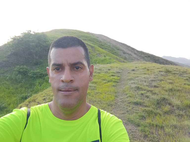
Cabe destacar que me levanté bien temprano para hace este recorrido, realizando mis ejercicios de calentamiento, para salir a la 5:49 am, pasando por todo el centro de la comunidad, para subir por la calle doctor Morales, al llegar al final de esta, se encuentra una redoma y me desvié hacia el sector de El Toquito, para entonces comenzar a subir a la derecha por donde están los edificios de esta comunidad, caminé toda esta calle y la aplicación Strava, registro 19 minutos.
It is worth noting that I got up very early to do this tour, doing my warm-up exercises, to leave at 5:49 am, passing through the center of the community, to go up Doctor Morales Street, when I reached the end of this, there is a roundabout and I deviated towards the El Toquito sector, to then begin to go up to the right where the buildings of this community are, I walked this entire street and the Strava application recorded 19 minutes.

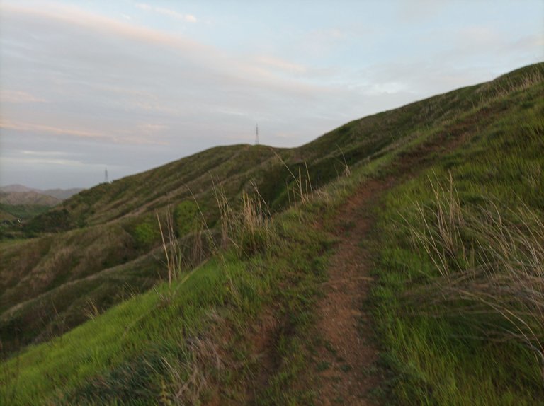

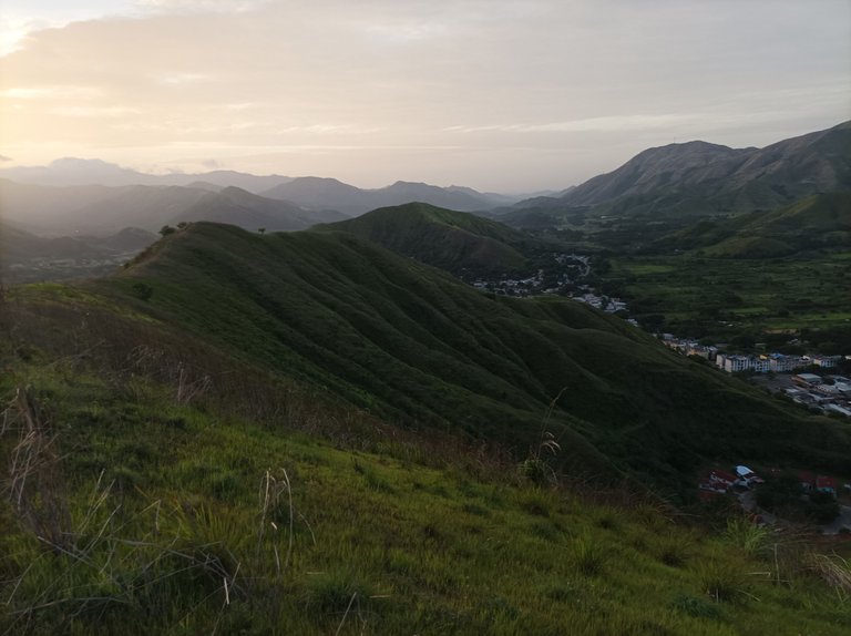
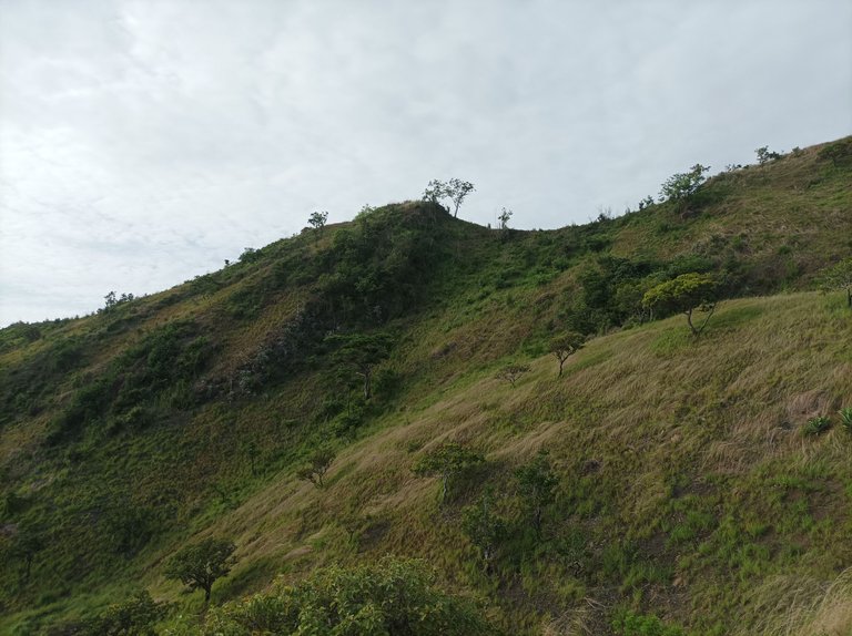
Después, comencé a subir la montaña, la cual ha recuperado completamente su verdor, para adentrarme a este bello paisaje, subiendo la primera pendiente, me detuve unos segundos para tomar algunas fotografías y continúe avanzando para después subir la segunda y la tercera pendiente, que es más exigente. Llegué a la cima con un tiempo de 30 minutos con 35 segundos, desde donde podemos apreciar toda la comunidad de Villa de Cura y por la parte posterior el sector del Toquito.
Afterwards, I began climbing the mountain, which had completely recovered its greenery, to enter this beautiful landscape. Climbing the first slope, I stopped for a few seconds to take some photographs and then continued onward, then climbing the second and third slopes, which were more demanding. I reached the summit in 30 minutes and 35 seconds, from where we can see the entire community of Villa de Cura and, to the rear, the Toquito sector.
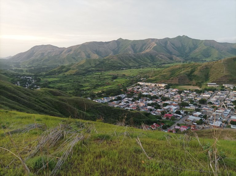
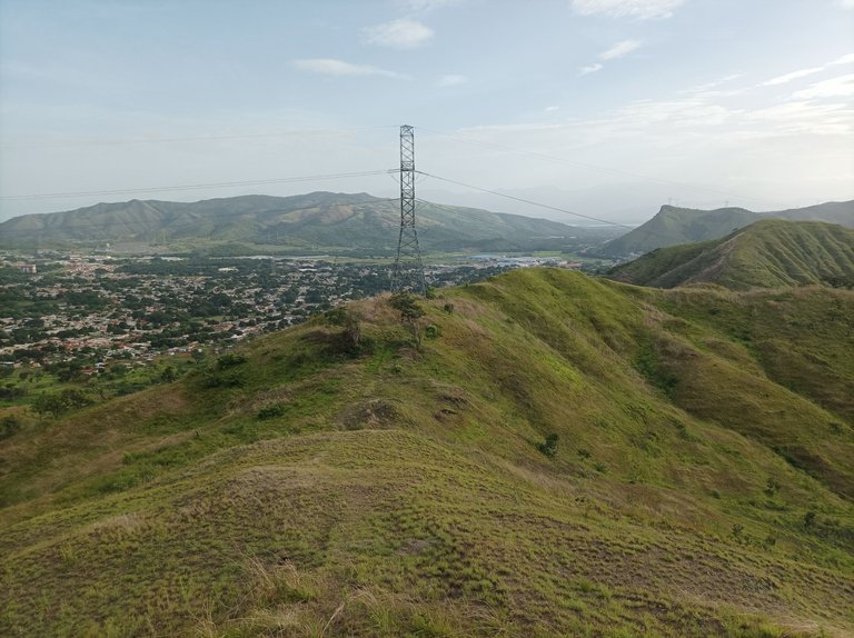
Luego, continúe caminando hasta llegar a la punta de esta montaña y bajar como 400 m, para después retornar, cuya bajada se convierte en una subida bien pronunciada, al llegar nuevamente a la punta nuevamente me hidrate, y seguí avanzando para buscar bajar por detrás de la pista de atletismo. A medida que bajaba, completé la distancia de 5 K, en un tiempo de 1 hora 2 minutos. A llegar cerca de la pista, comencé a subir la otra montaña que yo llamo Toquito II.
Then, I continued walking until I reached the top of this mountain and descended about 400 meters. Then, I returned, the descent becoming a very steep climb. Upon reaching the top again, I hydrated again and continued moving forward, trying to descend behind the athletics track. As I descended, I completed the 5K distance in a time of 1 hour 2 minutes. As I approached the track, I began to climb the other mountain, which I call Toquito II.


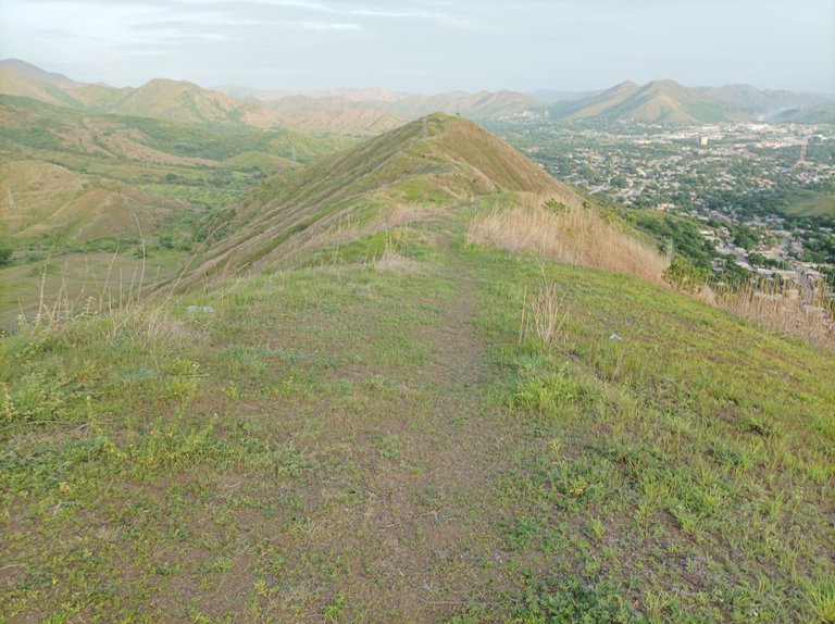
Asimismo, comencé a subir esta otra montaña, a medida que avanzaba pensé que si había muchos arbustos, me regreso, sin embargo el camino estaba despejado y pude nuevamente explorar esta ruta, para llegar a la cima, me encuentro con una pendiente bien empinada, para finalmente llegar a la cima. Traté de buscar continuar para bajar por donde está la universidad, pero había muchos arbustos demasiado alto y entonces decí regresarme.
Likewise, I started climbing this other mountain. As I continued, I thought that if there were too many bushes, I'd turn back. However, the path was clear, and I was able to explore this route again. To reach the top, I encountered a very steep slope, and finally reached the summit. I tried to continue down to where the university is, but there were too many bushes too high, so I decided to turn back.


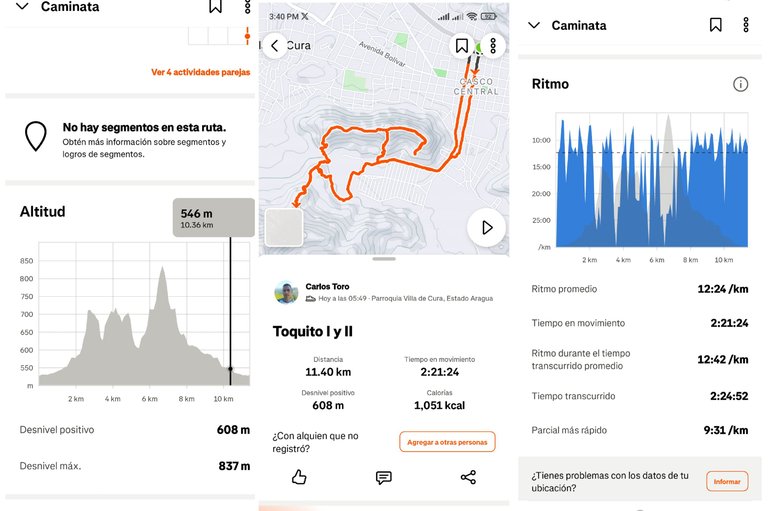
El retorno, es pura bajada, tuve que buscar una rama para apoyarme como si fuese un bastón. Después terminé de bajar toda la montaña, y di la vuelta por la parte que se llama El Country, para hacer una mayor distancia. Llegué de nuevo a la comunidad de El Toquito, para continuar bajando y llegar a la calle Urdaneta, para pasar por el centro de Villa de Cura, finalicé mi entrenamiento con un tiempo de 2 horas 24 minutos, con una distancia de 11.5 K, con un desnivel positivo 608 m y un desnivel maximo de 837 m, registrado en la aplicación Strava.
The return was all downhill, and I had to find a branch to lean on like a walking stick. Then I finished the entire descent and turned around at the section called El Country, to cover a longer distance. I arrived back at the community of El Toquito and continued downhill, reaching Urdaneta Street and passing through the center of Villa de Cura. I finished my training with a time of 2 hours 24 minutes, covering a distance of 11.5 km, with a positive elevation gain of 608 m and a maximum elevation gain of 837 m, recorded on the Strava app.

Echa un vistazo a mi caminata en Strava: https://strava.app.link/7k80hC3geUb
Check out my hike on Strava: https://strava.app.link/7k80hC3geUb
Espero que les haya gustado, nos vemos en una próxima publicación.
I hope you liked it, see you in a next post.
Fotografías: Teléfono Redmi Note 10
Portada realizada en APP GridArt
Logos utilizados de Hive y de @fulldeportes
Traductor utilizado: Traductor de Google
Photos: Redmi Note 10 Phone
Cover made in The APP GridArte
Used logos of Hive and @fulldeportes
Translator used: Translator used: Google Translate

Vote la-colmena for witness By @ylich

Posted Using INLEO
Feliz día del padre profe, bendiciones para tu familia. Que mejor día para celebrar la vida con mucha salud para seguir haciendo lo que más nos gusta, saludos cordiales. Pásela bien.
Saludos amigo gracias, feliz día del padre.