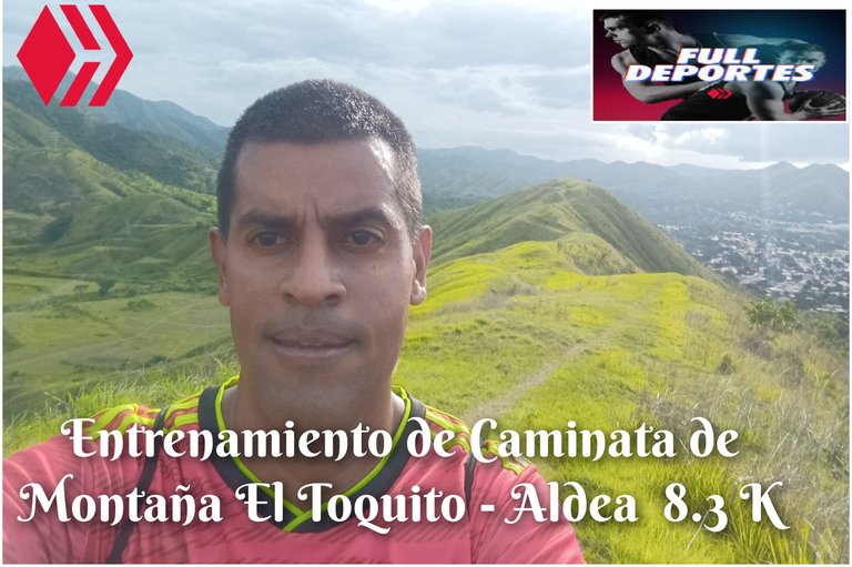
Entrenamiento de Caminata de Montaña El Toquito - Aldea Universitaria 8.3K
Greetings, friends of Hive and @fulldeportes, today I'm going to share with you my mountain hiking training that I did on the El Toquito hill route, in the community of Villa de Cura, Zamora municipality, Aragua state.
Cabe destacar que el día de hoy mi hija tenía práctica en la comunidad del Toquito, entonces tenía que pasarla buscando, entonces ella se fue adelante y yo después, saliendo desde el centro a las 4:19 minutos, activando la aplicación Strava para registrar este entrenamiento, subiendo por la doctor Morales y después llegué al sector del Toquito, para comenzar a subir por donde están los edificios y luego adentrarme a la montaña.
It is worth noting that today my daughter had practice in the Toquito community, so I had to pick her up. So she went ahead and I followed, leaving from the center at 4:19 minutes, activating the Strava application to record this training, going up Doctor Morales and then arriving at the Toquito sector, to begin climbing where the buildings are and then entering the mountain.
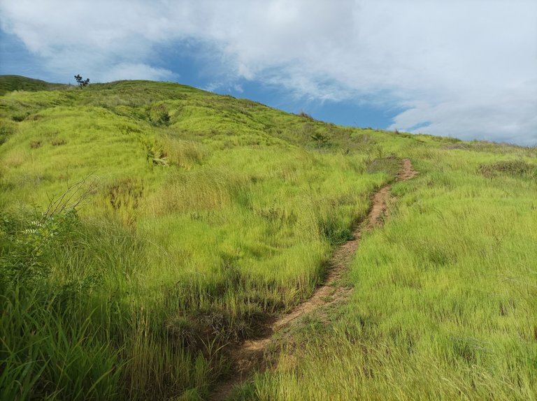
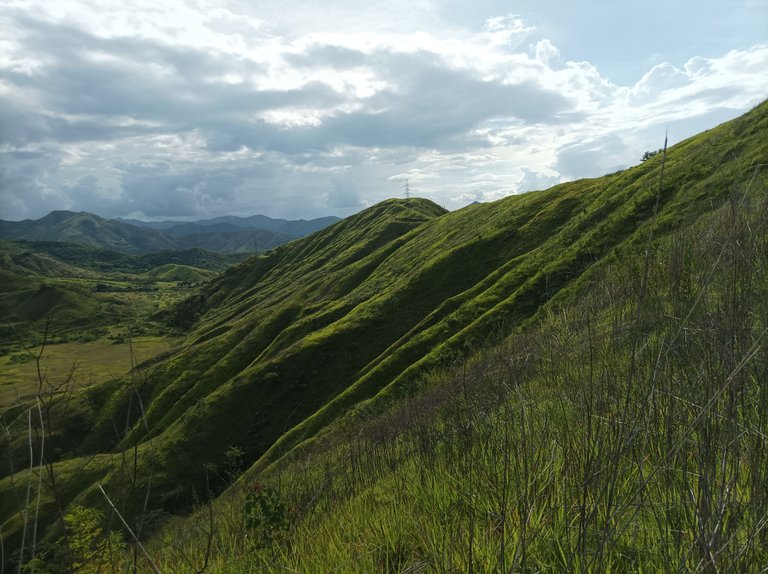
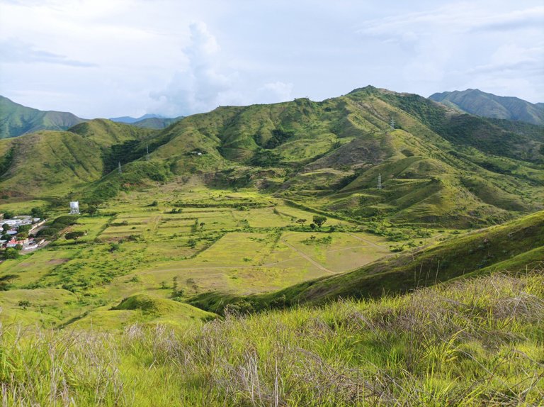
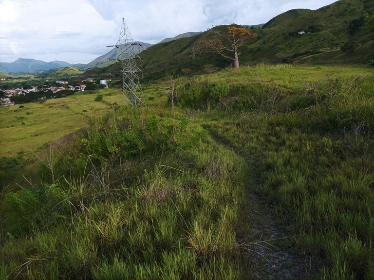
Una vez que comenzó el ascenso al cerro, el estaba intenso, con algo de calor, observando el verdor que cubre toda la montaña, con un ritmo a un 70% de mejor tiempo, esta ruta me gusta hacerlo más en la mañana porque el clima está fresco, sin embargo en bueno cambiar de horario porque esto me ayuda a tener una mayor resistencia y es importante llevar el agua para hidratarnos durante el recorrido. Después alcance la segunda y tercera subida, para llegar a la parte alta con un tiempo de 26 minutos.
Once I began the climb, it was intense, somewhat warm, and I observed the greenery that covers the entire mountain. I was running at a pace that was about 70% of my best time. I prefer to do this route in the morning because the weather is cool. However, it's a good idea to change my schedule because it helps me build stamina, and it's important to carry water to hydrate during the hike. I then reached the second and third climbs, reaching the top in 26 minutes.
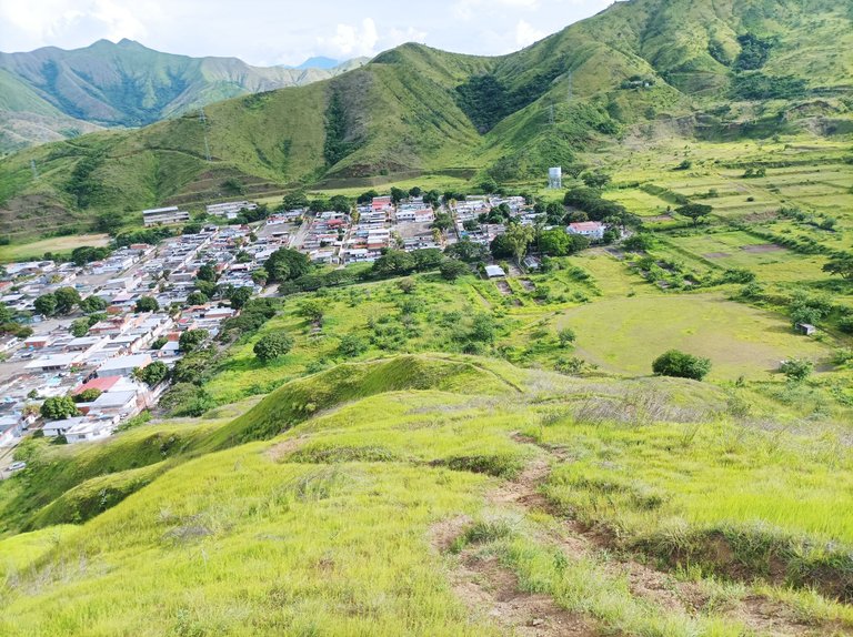
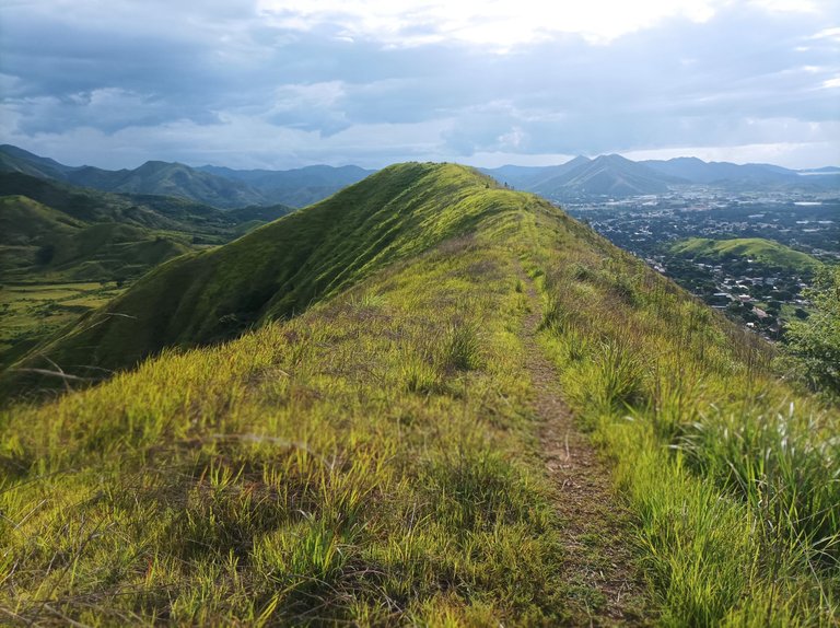
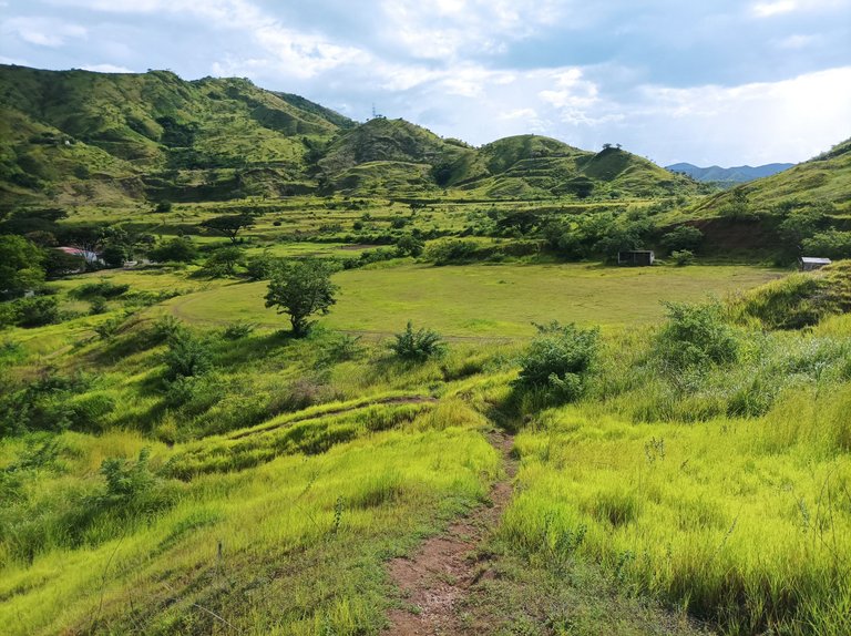
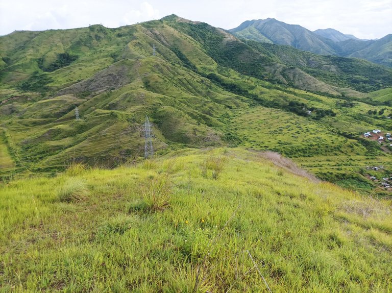
Para los que no conocen esta ruta, en la cima podemos ver todo el centro de Villa de Cura, también la comunidad del Toquito, es una bella vista que podemos apreciar. Luego camine a la parte derecha de la montaña, para descender como 300 metros, con una bajada y de regreso está se convierte en una fuerte subida, la idea es tener una mayor resistencia en este trayecto.
For those unfamiliar with this route, at the top we can see the entire center of Villa de Cura, including the community of Toquito. It's a beautiful view to appreciate. Then, walk to the right side of the mountain, descending about 300 meters, with a steep descent. The return becomes a steep climb. The goal is to build up stamina on this route.
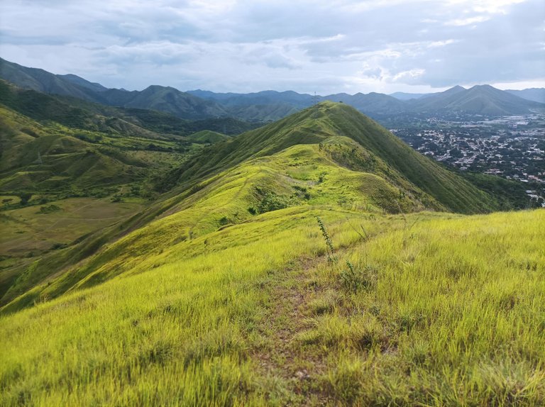
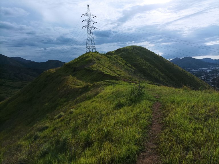
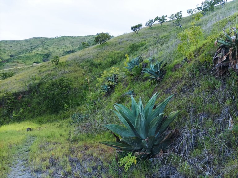
Asimismo, en el retorno, continúe avanzando a la izquierda, para llegar a la torre, llevando una distancia de 5K, terminé de descender para llegar detrás de la pista y subí la montaña que está detrás, para recorrer la parte que llaman El Country.
Likewise, on the way back, I continued moving left to reach the tower, covering a distance of 5K. I finished descending to reach the back of the track and climbed the mountain behind it to walk through the section called El Country.
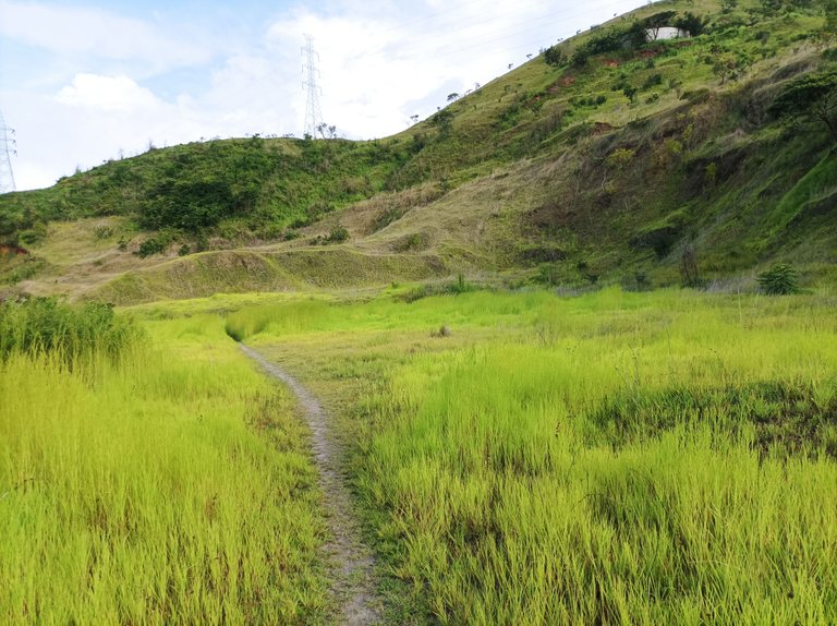
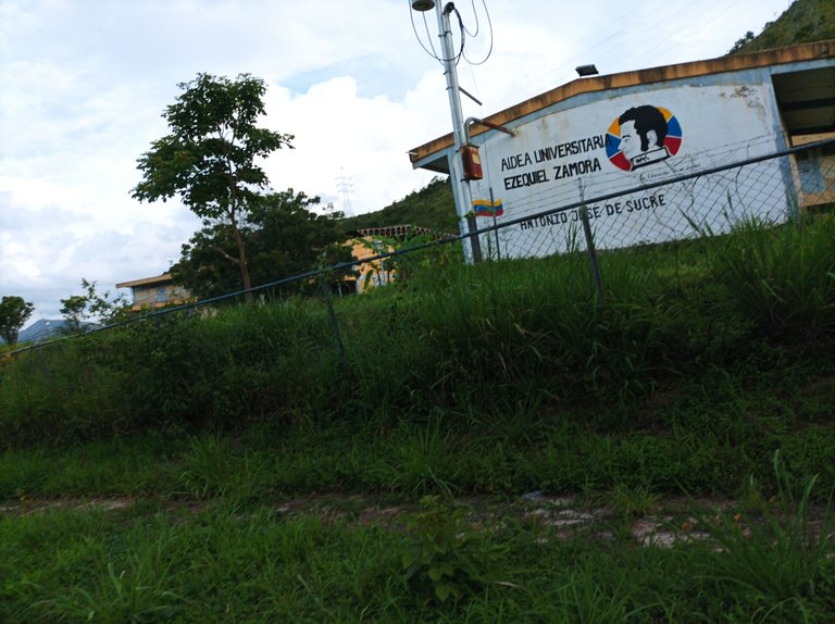
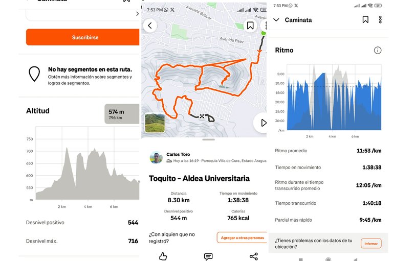
Después llegué a la comunidad del Toquito, al pasar por frente a la Aldea Universitaria, llevaba una distancia de 7.76K, pero decidí completar los 8K, y continúe caminando, para darle una vuelta al estadio y llegar nuevamente a la Aldea Universitaria, con un tiempo final de 1 hora 40 minutos, con una distancia de 8.3K, con un desnivel positivo de 544 m y un desnivel máximo de 716 m, registrado en Strava.
Echa un vistazo a mi caminata en Strava: https://strava.app.link/91jmJIFcrVb
Check out my hike on Strava: https://strava.app.link/91jmJIFcrVb
Espero que les haya gustado, nos vemos en una próxima publicación.
I hope you liked it, see you in a next post.
Fotografías: Teléfono Redmi Note 10
Portada realizada en APP GridArt
Logos utilizados de Hive y de @fulldeportes
Traductor utilizado: Traductor de Google
Photos: Redmi Note 10 Phone
Cover made in The APP GridArte
Used logos of Hive and @fulldeportes
Translator used: Translator used: Google Translate

Vote la-colmena for witness By @ylich

Cambiaste de tlf? se ven las fotos mucho mejor que antes, o quizás porque no esta oscuro?
Saludos amigo, no es el mismo, lo que paso fue que entrené en la tarde, abrazos amigo.