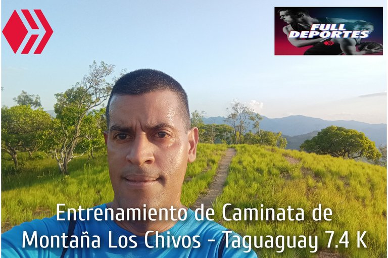
Entrenamiento de Caminata de Montaña Los Chivos - Taguaguay 7.4K
Greetings, friends of Hive and @fulldeportes, today I'm going to share with you my mountain hiking training that I did on the Los Chivos - Taguaguay hill route, in the community of Villa de Cura, Zamora municipality, Aragua state.
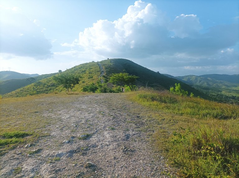
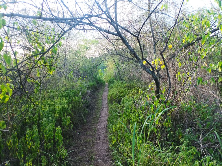
Cabe destacar que este entrenamiento lo comencé un poco tarde porque decidí subir con mi hija y su amiga, activé la aplicación Strava a las 5:13 pm., saliendo desde la avenida Lisandro Hernández, a esta hora todavía el sol estaba intenso, adentrándonos a la montaña por la primera entrada, al comenzar a subir, le dije a mi hija que iba a continuar adelante, para esperarlas cuando venga de regreso en la tercera montaña. A medida que iba subiendo, se fueron quedando rezagadas, al llegar a la cima de la primera subida, hice un tiempo de 11 minutos, a un ritmo suave.
It's worth noting that I started this training a little late because I decided to go up with my daughter and her friend. I activated the Strava app at 5:13 pm, leaving from Lisandro Hernández Avenue. At this time, the sun was still intense. We entered the mountain through the first entrance. As we began to climb, I told my daughter that I was going to continue ahead, to wait for them when I came back on the third mountain. As I was climbing, they fell behind. When I reached the top of the first climb, I made a time of 11 minutes, at an easy pace.
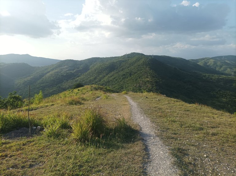
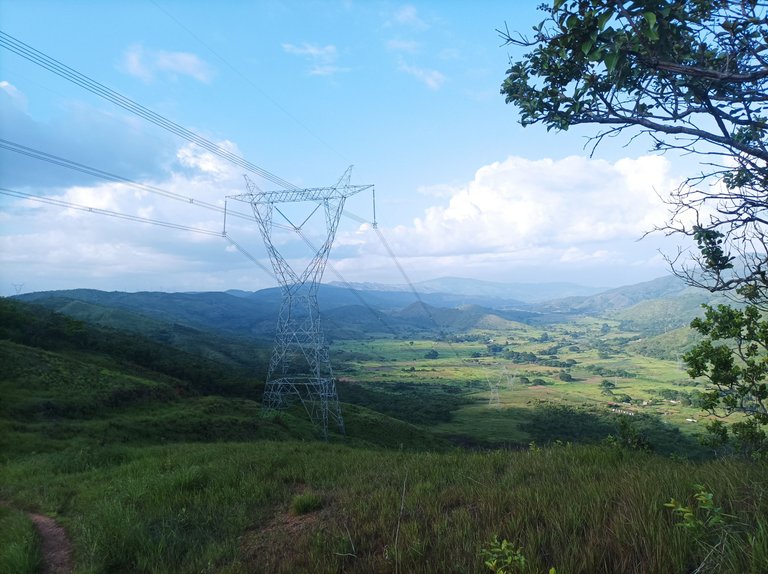
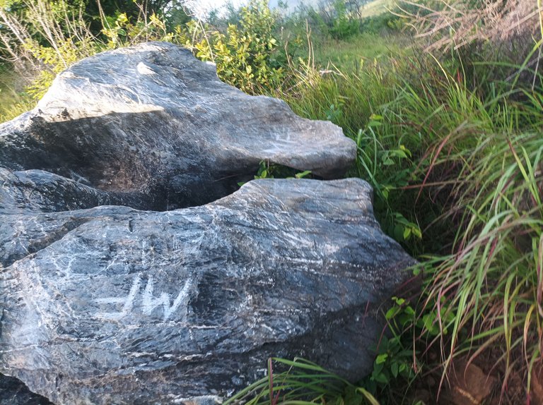
Después aumenté el ritmo de la caminata a un 70%, para pasar por la segunda y llegar a la tercera montaña, donde están las máquinas de ejercicios, realizando un tiempo de 19 minutos. En esta parte, observé hacia bajo para ver si venían cerca las muchachas, pero no porque se quedaron un poco lejos. Entonces pensé llegar hasta acá, pero después decidí continuar avanzando para comenzar a descender, con un tiempo en la parte baja, de 28 minutos. Así me detuve unos segundos para tomar una fotografías de La Piedra Hueca, que está ubicada en plena subida.
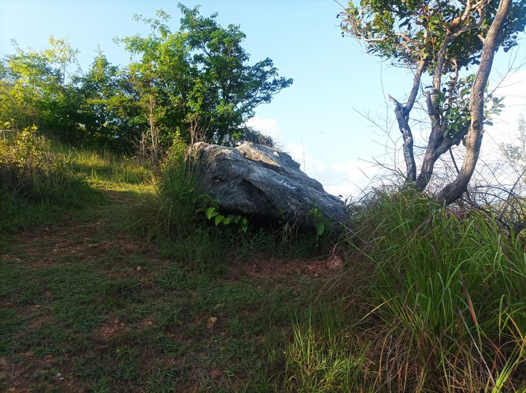
I then increased my walking pace to 70% to cross the second mountain and reach the third mountain, where the exercise machines are located, completing a time of 19 minutes. At this point, I looked down to see if the girls were coming closer, but they didn't because they stayed a bit far behind. I then thought about reaching this point, but then decided to continue moving forward to begin the descent, with a time on the lower part of the mountain of 28 minutes. I then stopped for a few seconds to take a photo of La Piedra Hueca, which is located halfway up the mountain.
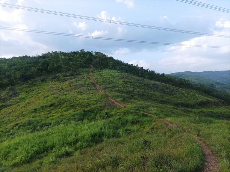
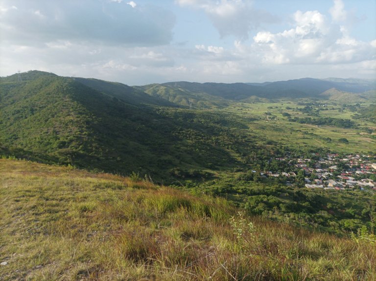
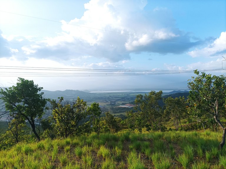
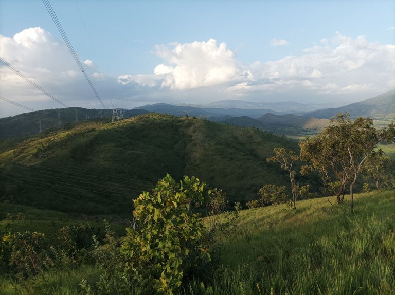
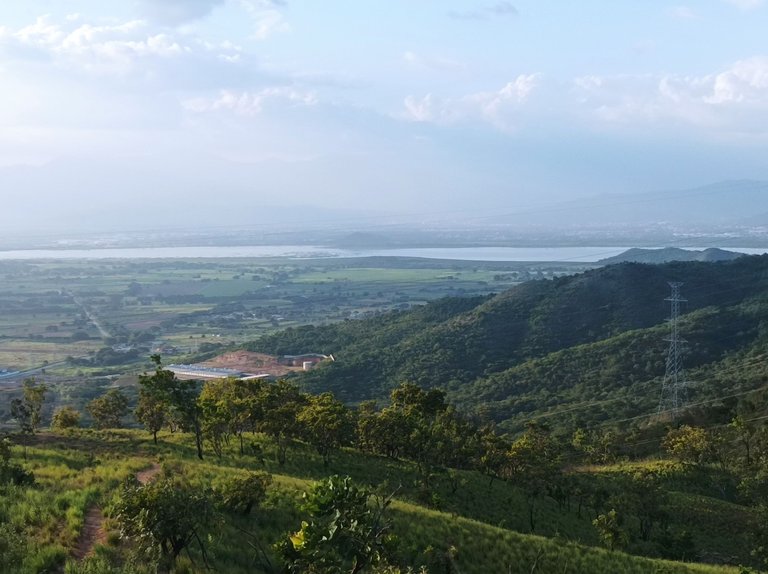
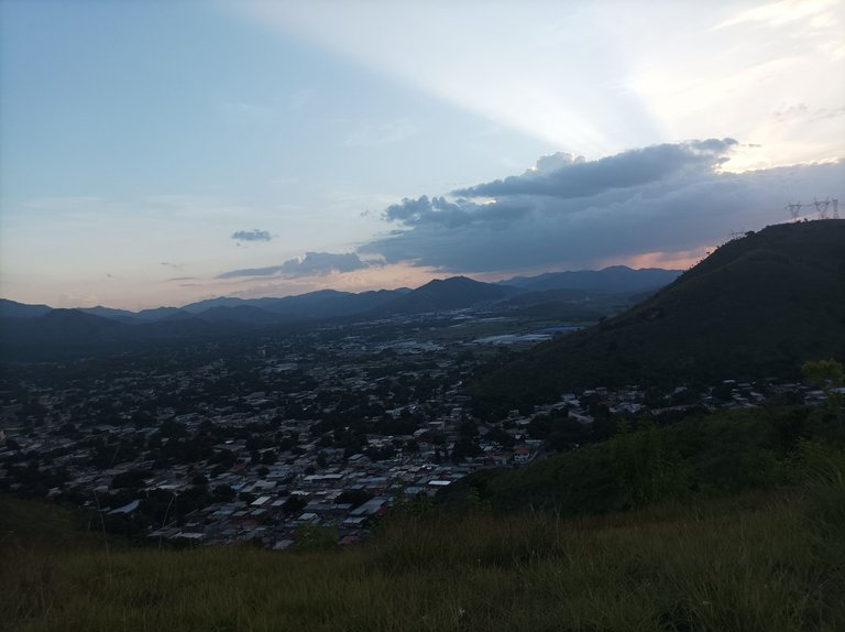
Asimismo, el clima continuaba con algo de calor, pero seguí caminando, cuando se entrena, uno debe adaptarse a todo tipo de clima, porque cuando se participa en una competencia, obtenemos un mayor rendimiento físico y se mejoran las marcas en las diferentes distancias. De esta forma pude pasar por Las Torres, La Piedra, y finalmente llegué a la montaña, para visualizar la laguna de Taguaguay, en un tiempo de 50 minutos, con una distancia de 3.7K.
The weather continued to be a bit warm, but I kept walking. When you're training, you have to adapt to all kinds of weather, because when you compete, you improve your physical performance and improve your times at different distances. This way, I was able to pass through Las Torres, La Piedra, and finally reach the mountain, where I could see Taguaguay Lagoon. I completed a distance of 3.7 km in 50 minutes.
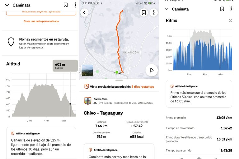
Luego de hidratarme, me regresé, por el mismo camino, caminando a un bueno paso, una vez que llegué a la tercera montaña, mi hija y su amiga me estaban esperando. Después continuamos con el descenso de la montaña, para llegar nuevamente al mismo punto de partida en la Lisandro Hernández, con un tiempo final de 1 hora 43 minutos con 25 segundos, con un desnivel positivo de 515 m y un desnivel máximo de 603 m, que se registró en la aplicación Strava.
After rehydrating, I returned along the same path, walking at a brisk pace. Once I reached the third peak, my daughter and her friend were waiting for me. We then continued down the mountain, arriving back at the same starting point on Lisandro Hernández. I finished with a time of 1 hour 43 minutes, 25 seconds, with a positive elevation gain of 515 m and a maximum elevation gain of 603 m, which was recorded on the Strava app.
Espero que les haya gustado, nos vemos en una próxima publicación.
I hope you liked it, see you in a next post.
Fotografías: Teléfono Redmi Note 10
Portada realizada en APP GridArt
Logos utilizados de Hive y de @fulldeportes
Traductor utilizado: Traductor de Google
Photos: Redmi Note 10 Phone
Cover made in The APP GridArte
Used logos of Hive and @fulldeportes
Translator used: Translator used: Google Translate

Vote la-colmena for witness By @ylich
