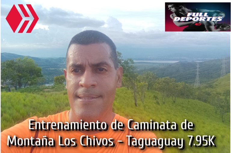
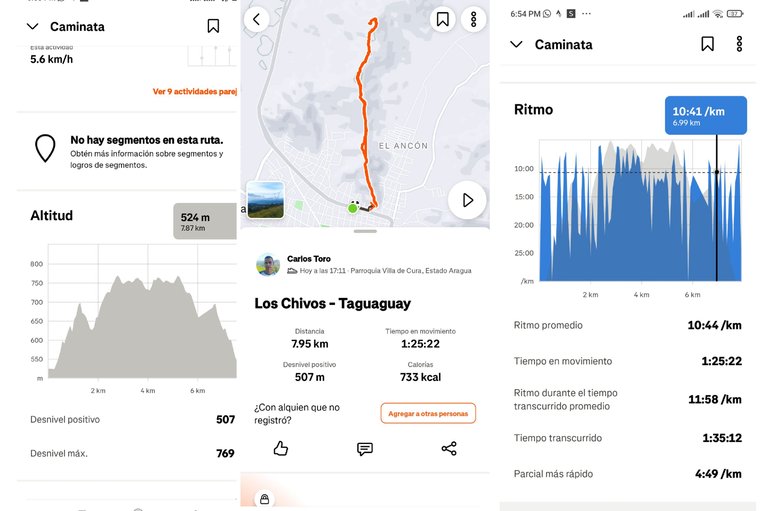
Entrenamiento de Caminata de Montaña Los Chivos - Taguaguay 7.95K
Lo
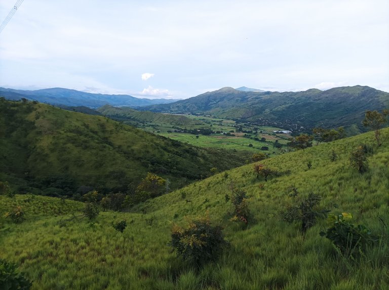
Greetings friends of Hive and @fulldeportes, today Tuesday, August 19, I will be sharing my mountain hiking training that I did on the Los Chivos - Taguaguay hill route, in the community of Villa de Cura, Zamora municipality, Aragua state.
Cabe destacar que tenía nueve días que realizaba entrenamiento de caminata de montaña, ya que el día domingo el recorrido que hice fue plano y como me estoy preparando para la caminata de montaña de El Peñón, tengo que entrenar con rutas similares para estar listo para el mes de septiembre. Generalmente salgo antes de la 5 de la tarde, pero como estuve en la práctica de mi hijo, se me hizo más tarde. Activé la aplicación Strava a las 5:11 pm, saliendo de la avenida Lisandro Hernández, a esta hora el sol se había ocultado pero se sentía algo de calor.
It's worth noting that I'd been training for mountain hikes for nine days, as the route I completed on Sunday was flat, and since I'm preparing for the El Peñón mountain hike, I need to train on similar routes to be ready for September. I usually leave before 5 p.m., but since I was at my son's practice, it felt later. I activated the Strava app at 5:11 p.m., leaving Lisandro Hernández Avenue. By this time, the sun had set, but it felt a bit warm.
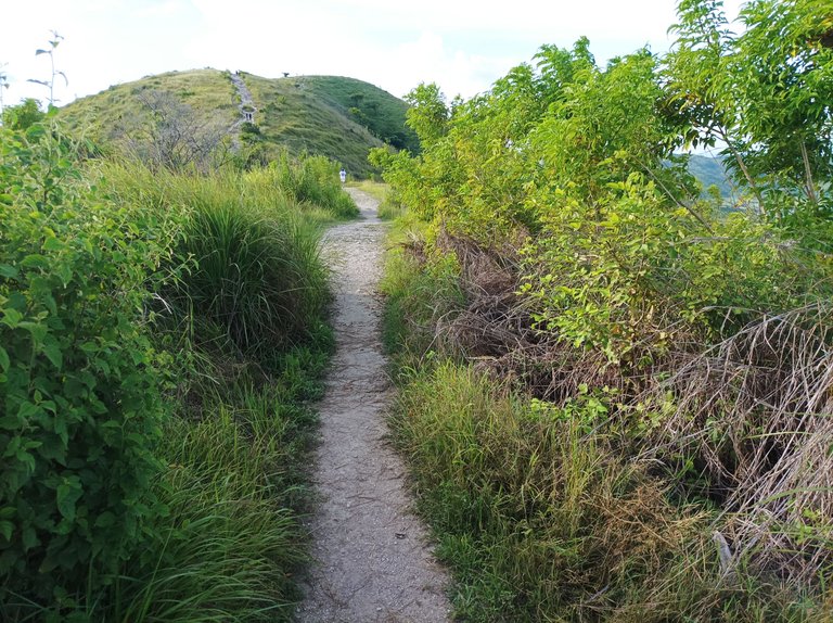
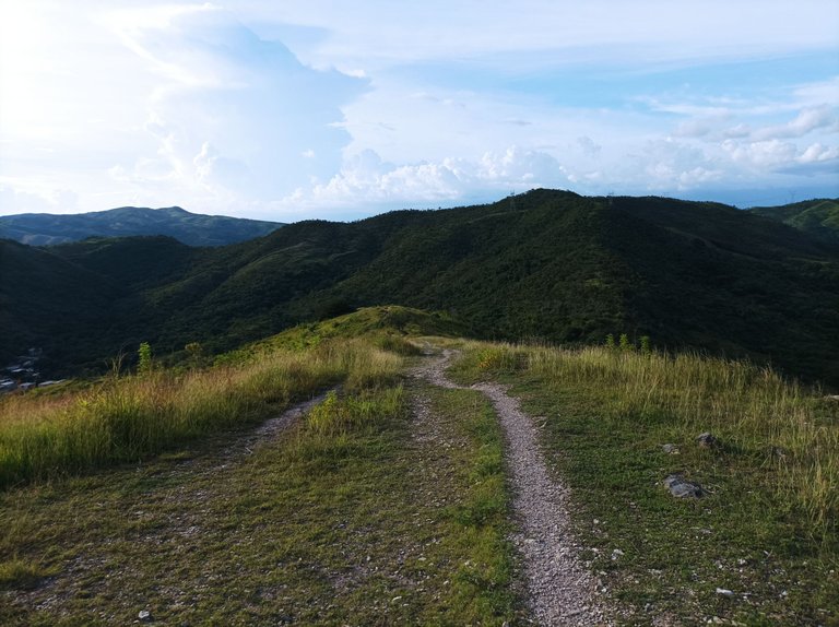
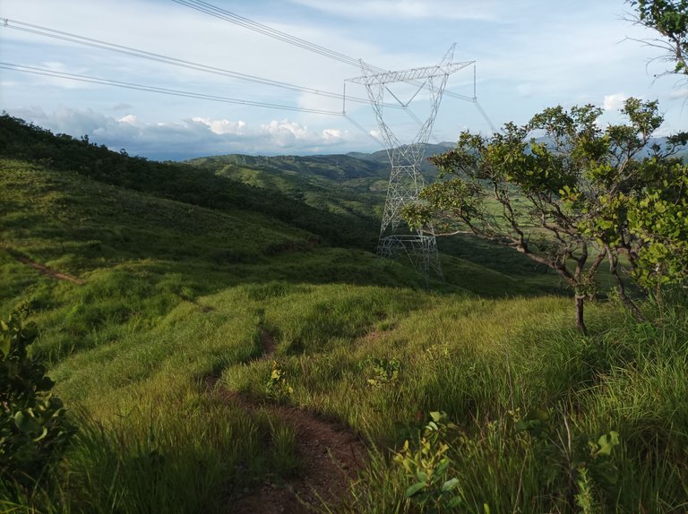
Después continúe adentrándome a la montaña, a esta hora me conseguí varias personas que también estaban subiendo, pero la mayoría no hacen un recorrido largo, sino que llegan hasta la tercera montaña donde están las máquinas de ejercicios. Fui avanzando a un ritmo fuerte, pasando por la cima de la primera subida en un tiempo de 7 minutos con 55 segundos, luego pase por la segunda, donde al alcance a varios niños que estaban subiendo, llegué a la cima de la tercera montaña con un tiempo de 15 minutos con 22 segundos.
I then continued deeper into the mountain. At this point, I met several people who were also climbing, but most didn't do the long route, instead making it to the third mountain where the exercise machines were. I progressed at a strong pace, reaching the top of the first climb in 7 minutes, 55 seconds. Then, I passed the second, where I caught up with several children who were climbing. I reached the top of the third mountain in 15 minutes, 22 seconds.
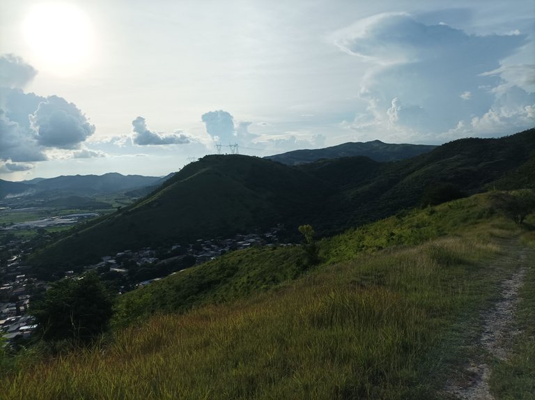
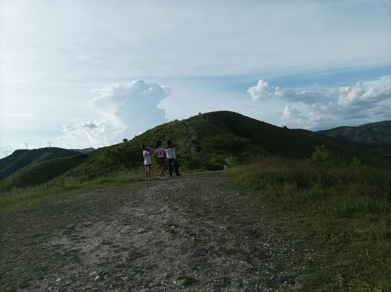
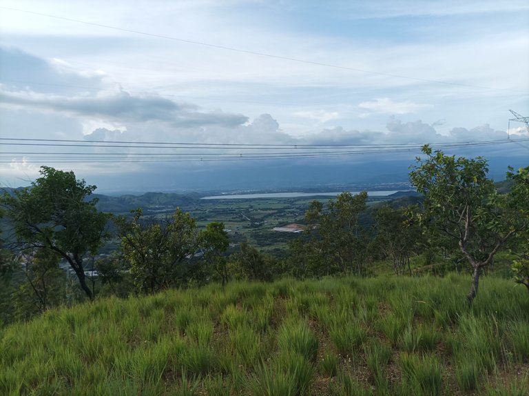
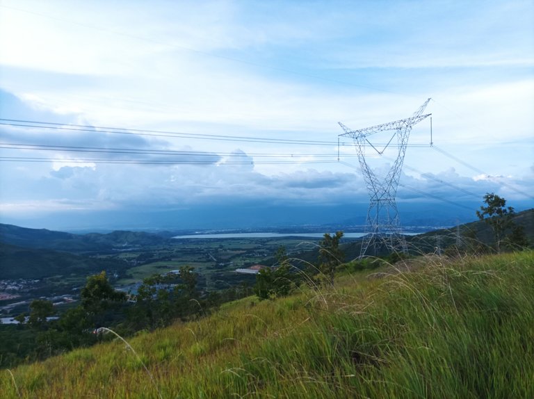
Luego comencé a descender para llegar a la parte baja con un tiempo de 21 minutos. Nuevamente inicié el ascenso con una subida bien pronunciada y larga. A medida que avanzaba sentía que estaba bajando el paso, para entonces marcar en Las Torres un tiempo de 31 minutos y más adelante continúan las subidas para terminar de llega a La Piedra con un tiempo de 35 minutos con 55 segundos, mi mejor tiempo en esta parte es de 33 minutos. Después continúe bajando y caminando en una parte que es plana y llegué a la parte donde podemos ver la laguna de Taguaguay en un tiempo de 46 minutos con una distancia de 3.76K.
I then began the descent to reach the lower part with a time of 21 minutes. Once again, I began the ascent with a very steep and long climb. As I progressed, I felt like I was slowing down. I then clocked a time of 31 minutes at Las Torres, and further up the climbs continued, eventually reaching La Piedra with a time of 35 minutes, 55 seconds. My best time on this section was 33 minutes. I then continued descending and walking on a flat section and reached the section where we can see Taguaguay Lagoon with a time of 46 minutes, covering a distance of 3.76 km.
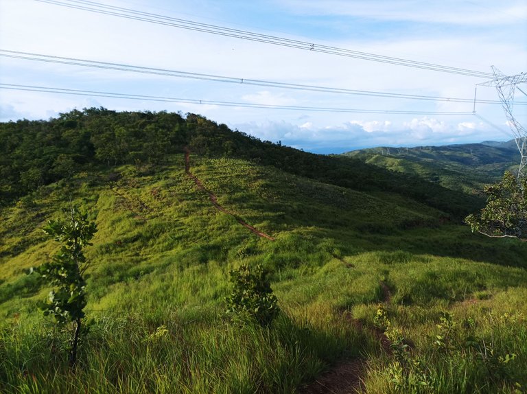
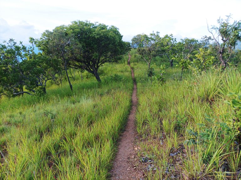
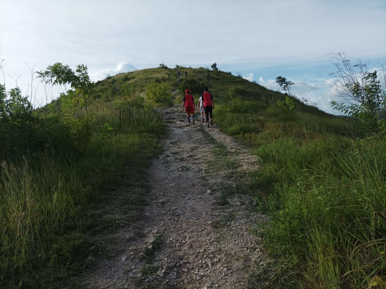
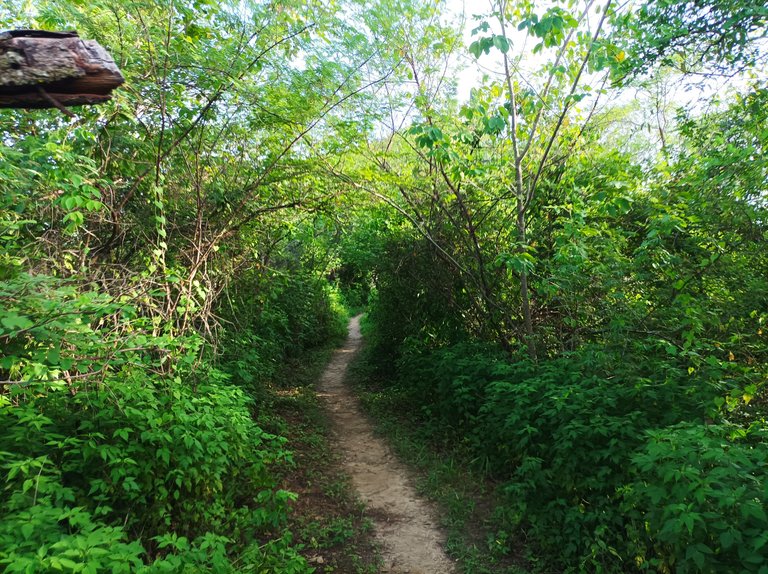
Asimismo, caminé unos metros más para completar los 4K y me regresé por el mismo camino, la parte más fuerte de retorno es donde estar el sector de Las Mercedes, que es una subida para llegar a la tercera montaña y después los demás es pura bajada, que requiere mucho cuidado para no tropezar y caer debido a la cantidad de piedras que hay en el camino. Terminé de salir de esta montaña y llegué de nuevo al mismo punto de salida con un tiempo de 1 hora 35 minutos, una distancia de 7.94K, con un desnivel positivo de 507 m y un desnivel maximo de 769 m, que se registro en la aplicación Strava.
6mf.jpg) I also walked a few more meters to complete the 4K and returned along the same path. The toughest part of the return journey is near the Las Mercedes sector, which is an uphill climb to reach the third mountain. After that, the rest are downhill, requiring great care to avoid tripping and falling due to the number of rocks along the path. I finished leaving this mountain and arrived back at the same starting point with a time of 1 hour 35 minutes, a distance of 7.94K, a gain of 507 m, and a maximum elevation gain of 769 m, which was recorded on the Strava app.
Echa un vistazo a mi caminata en Strava: https://strava.app.link/jfwnLYUmYVb
Check out my hike on Strava: https://strava.app.link/jfwnLYUmYVb
Espero que les haya gustado, nos vemos en una próxima publicación.
I hope you liked it, see you in a next post.
Fotografías: Teléfono Redmi Note 10
Portada realizada en APP GridArt
Logos utilizados de Hive y de @fulldeportes
Traductor utilizado: Traductor de Google
Photos: Redmi Note 10 Phone
Cover made in The APP GridArte
Used logos of Hive and @fulldeportes
Translator used: Translator used: Google Translate

Vote la-colmena for witness By @ylich
