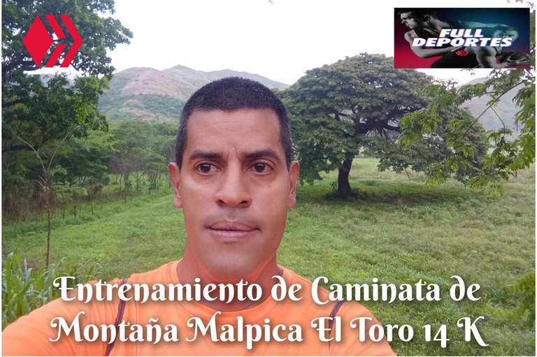
Entrenamiento de Caminata de Montaña Malpica El Toro 14 K
Greetings, friends of Hive and @fulldeportes, today I'm going to share with you my mountain hiking training that I did today, Sunday, on the route of the Malpica El Toro peasant settlement, in the community of Villa de Cura, Zamora municipality, Aragua state.
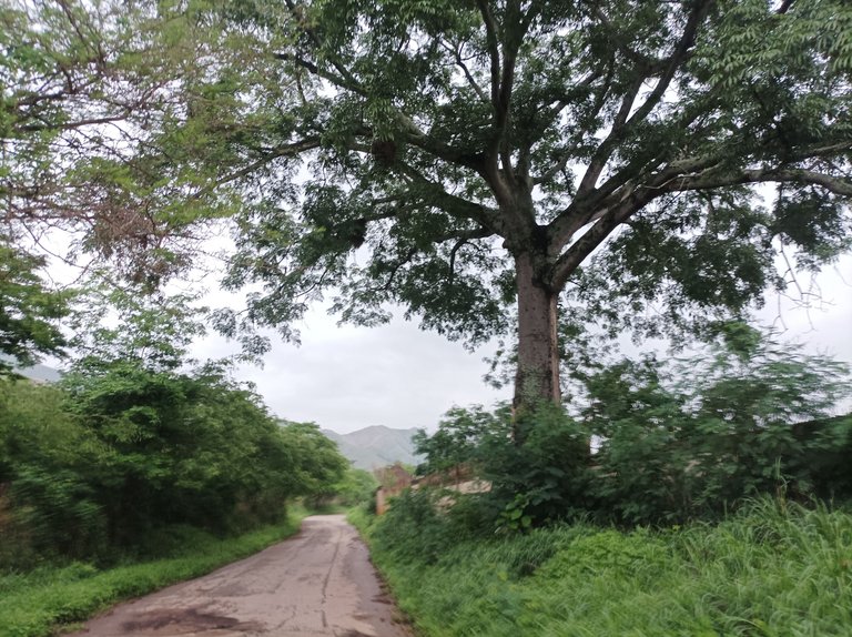
Cabe destacar que tenía cuatro meses que no hacía este recorrido, y el día de hoy me decidí a realizarlo porque como ayer llovió entonces lo más seguro es que el recorrido este húmedo y me vendría mejor otra ruta, por eso me levanté temprano y hice mis ejercicios de calentamiento, para salir exactamente a la 6:00 am, pasando por centro de Villa de Cura, subiendo por toda la calle doctor Morales. Desde que salí pensé llegar hasta 5 K y luego retornar, pero resulta que me gustó ver cómo cambio el paisaje en este recorrido.
It's worth noting that I hadn't done this route in four months, and today I decided to do it because since it rained yesterday, the route would most likely be wet and another route would be better for me. So I got up early and did my warm-up exercises, to leave exactly at 6:00 am, passing through the center of Villa de Cura, going up Doctor Morales Street. From the moment I left, I thought about reaching 5K and then returning, but it turns out I liked seeing how the landscape changes on this route.
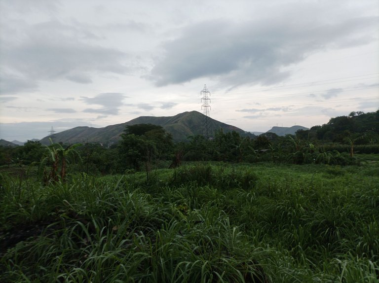
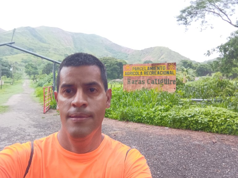
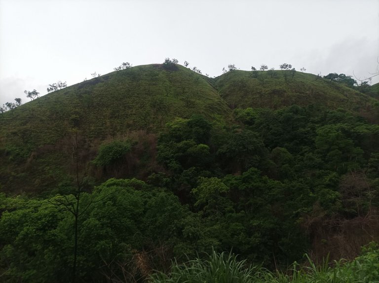
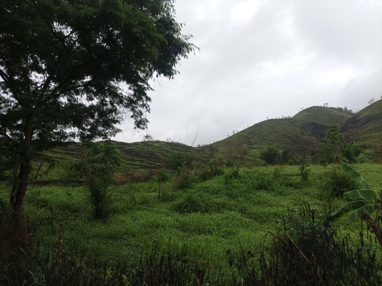
Después comencé a subir, por todo el sector de La Represa, para pasar luego por Santa Eduviges y llegar al desvío que conduce al El Samán y a Malpica El Toro, desde que comencé me sentí bastante bien, a un paso de 9 minutos por kilómetro, pasando los primeros 3 K en un tiempo de 29,con las recientes lluvias en las montañas que están alrededor recuperaron su verdor y las parcelas tambien se observa que los agricultores están preparando la tierra para la siembra.
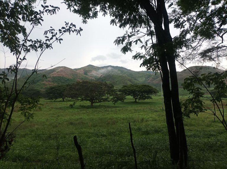
Then I started to climb, through the entire La Represa sector, to then pass through Santa Eduviges and reach the detour that leads to El Samán and Malpica El Toro, from the moment I started I felt quite good, at a pace of 9 minutes per kilometer, passing the first 3 K in a time of 29, with the recent rains in the surrounding mountains they recovered their greenery and the plots also show that the farmers are preparing the land for planting.
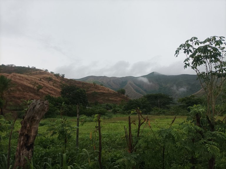
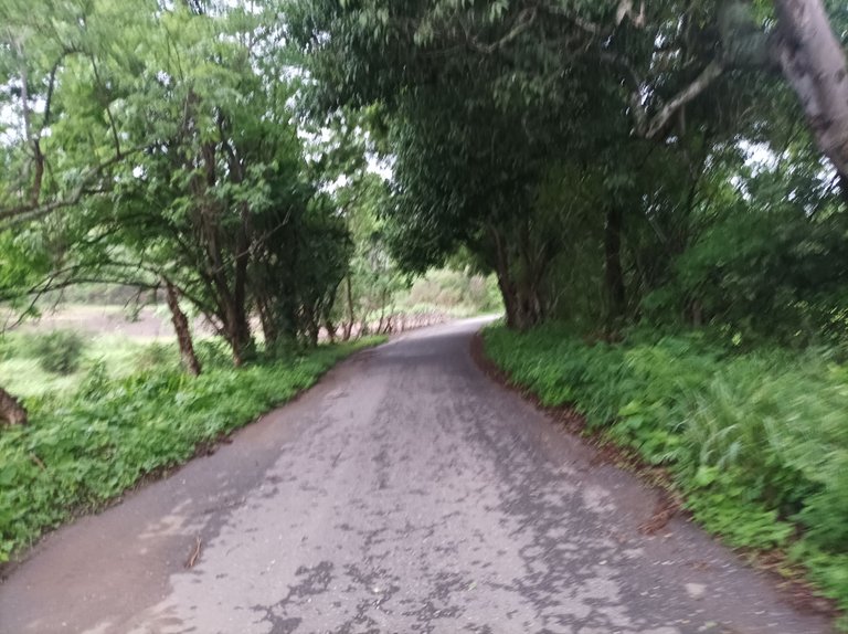
Asimismo, continúe avanzando, el clima estuvo fresco, un poco nublado, parecía que las lluvias continuarán, al acercarme casi a los 5 K, me detuve unos segundos para hidratarme y tomar unas fotografías de todo el bello paisaje de esta asentamiento campesino. Una vez que complete los 5 K con un tiempo de 48 minutos, a partir de aquí las subidas se comienzan a sentir, aumentando el ritmo para tratar de mantener el mismo paso, llegué a la cima con un tiempo de 1 hora 8 minutos, con una distancia de 7 K.
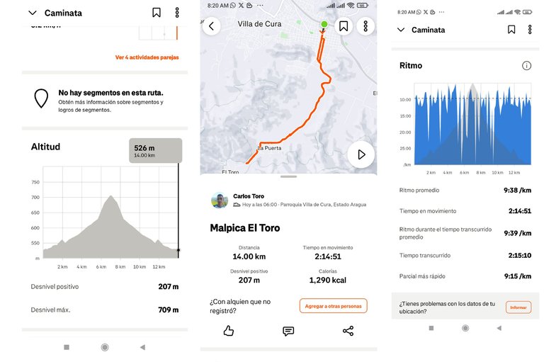
Likewise, I continued moving forward. The weather was cool, a bit cloudy, and it looked like the rain would continue. As I approached the 5K mark, I stopped for a few seconds to hydrate and take some photographs of the beautiful landscape of this rural settlement. Once I completed the 5K with a time of 48 minutes, from here on the climbs began to be felt. I increased my pace to try to maintain the same pace. I reached the summit with a time of 1 hour 8 minutes, covering a distance of 7K.
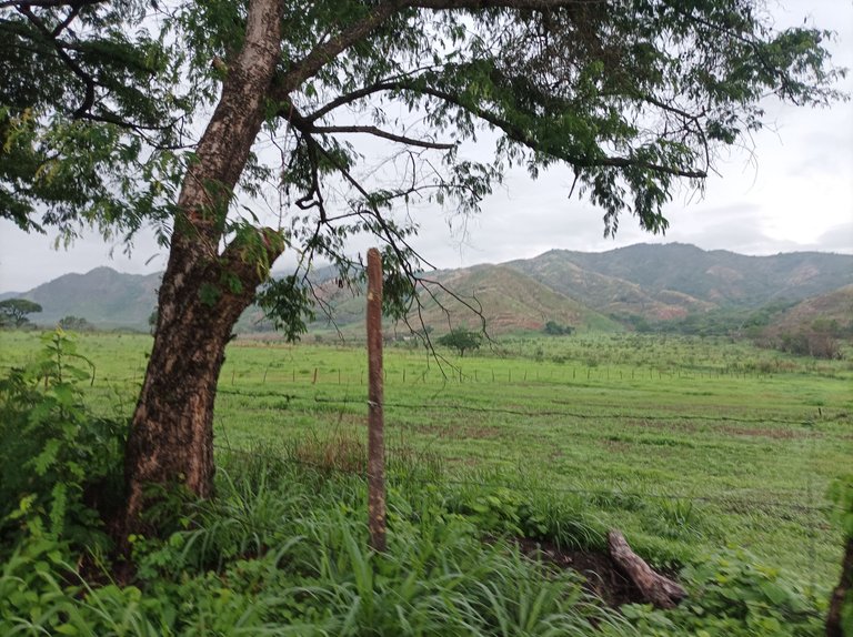
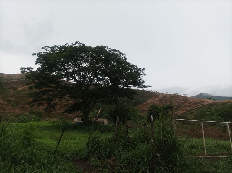
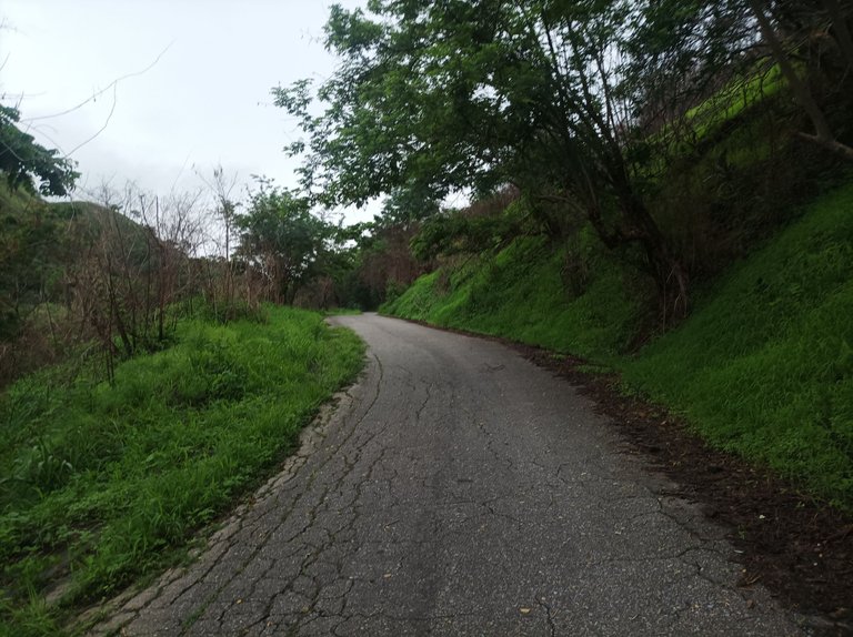
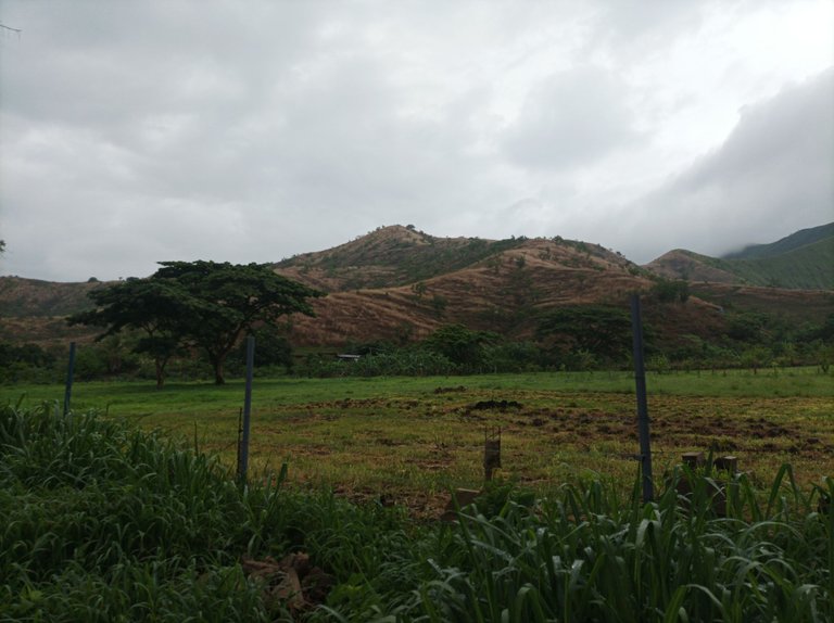
Luego, me hidrate y me devolví, el retorno es más fácil, porque uno viene bajando, encontrándome con varias personas que iba subiendo en bicicleta, me imagino que son trabajadores de las diferentes parcelas que hay en este lugar. Una vez que complete los 10 K, el cual marco 1 hora 37 minutos, en la aplicación Strava. Todavía me faltaban 4 K para terminar este entrenamiento. Al pasar por El Samán, ya tenía una distancia de 11.63 K, casi 12 K, para nuevamente adentrarme al sector de Santa Eduviges.
Then, I hydrated and headed back. The return was easier because I was coming down, meeting several people I was cycling up. I imagine they are workers from the different plots of land in this area. Once I completed the 10K, which I clocked in at 1 hour 37 minutes on the Strava app, I still had 4K left to finish this workout. By the time I passed El Samán, I had already covered 11.63K, almost 12K, before once again entering the Santa Eduviges sector.
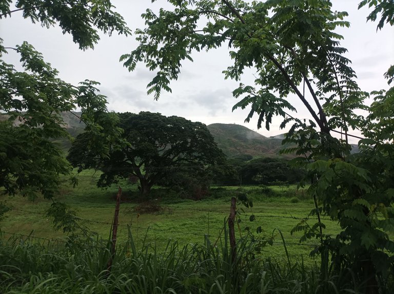
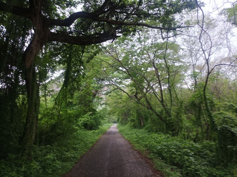
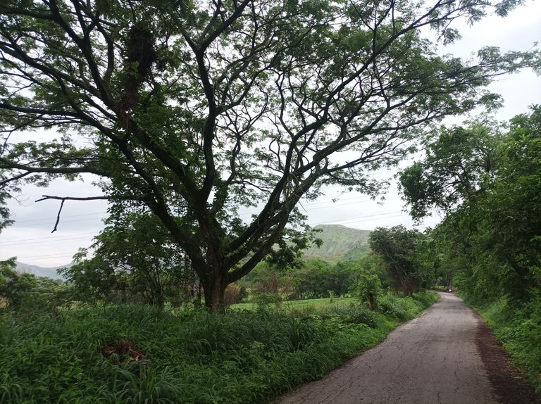
Para finalizar, este entrenamiento, continúe caminando por el sector de La Represa y luego llegué al centro de Villa de Cura. Esta ruta me gusta mucho porque tiene una superficie de asfalto y parte de tierra, con parte plana, subidas y bajas, es un buen recorrido, que finalice con un tiempo de 2 horas 15 minutos, con una distancia de 14 K, con un desnivel positivo 207 m y un desnivel máximo 709 m.
To finish this workout, I continued walking through the La Represa area and then arrived at the center of Villa de Cura. I really like this route because it has an asphalt surface and part dirt, with a flat part, ups and downs. It's a good run, which I finished with a time of 2 hours 15 minutes, with a distance of 14 km, with a positive 207 m gradient and a maximum gradient 709 m.
Espero que les haya gustado, nos vemos en una próxima publicación.
I hope you liked it, see you in a next post.
Fotografías: Teléfono Redmi Note 10
Portada realizada en APP GridArt
Logos utilizados de Hive y de @fulldeportes
Traductor utilizado: Traductor de Google
Photos: Redmi Note 10 Phone
Cover made in The APP GridArte
Used logos of Hive and @fulldeportes
Translator used: Translator used: Google Translate

Vote la-colmena for witness By @ylich

Excelente ese recorrido de 14 kilómetros, el verdor está cada vez más presente y con ese clima es súper agradable caminar por allí. Las lluvias están en su mayor exponente, todos los días llueve y la Tierra lo agradece, saludos 🥰🤗
Hola amiga, se ha recuperado la belleza de la montaña, gracias por tu comentario, feliz semana.
Una buena caminata como siempre, mantenerse en forma es sumamente importante y siempre disfrutamos de esos bellos paisajes
Así es amigo, gracias por pasar y comentar, feliz lunes.
Congratulations @cetb2008! You have completed the following achievement on the Hive blockchain And have been rewarded with New badge(s)
Your next target is to reach 41000 upvotes.
You can view your badges on your board and compare yourself to others in the Ranking
If you no longer want to receive notifications, reply to this comment with the word
STOPQue genial caminata ,realizar este tipo de entrenamientos fortalece cuerpo y mente ,saludos
Saludos amigo, gracias por pasar y comentar, feliz nartes
Saludooss, no se ven araguaney por alli?
Saludos amigo, por estos lados no, feliz martes.