Entrenamiento de Caminata de Montaña ruta Taguaguay - Los Chivos
Greetings, friends of Hive and @fulldeportes, today I'm going to share with you my mountain hiking training that I did on the Los Chivos hill route, in the community of Villa de Cura, Zamora municipality, Aragua state.
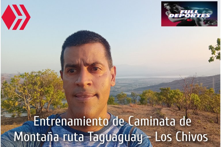
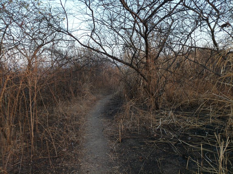
Cabe destacar que este entrenamiento lo realicé hoy miércoles en la mañana porque en la tarde está haciendo mucho calor, salí a las 5:58 am, había pensado llegar hasta ala montaña donde se ve la laguna de Taguaguay, pero después llegué más lejo de lo que había planificado. Inicié desde la avenida Lisandro Hernández Hernández y comencé a subir por la primera entrada, ya estaba aclarando y al llegar a la cima de la primera subida, registre un tiempo de 9 minutos.
It's worth noting that I did this training session today, Wednesday morning, because it was very hot in the afternoon. I left at 5:58 a.m. I had planned to reach the mountain where you can see Taguaguay Lagoon, but I ended up further than I had planned. I started from Lisandro Hernández Hernández Avenue and began climbing through the first entrance. It was already getting light, and when I reached the top of the first climb, I recorded a time of 9 minutes.
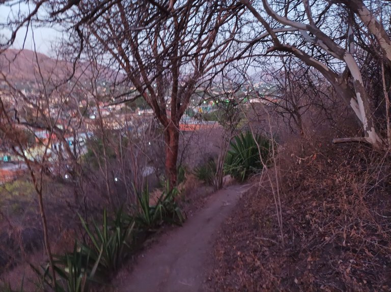
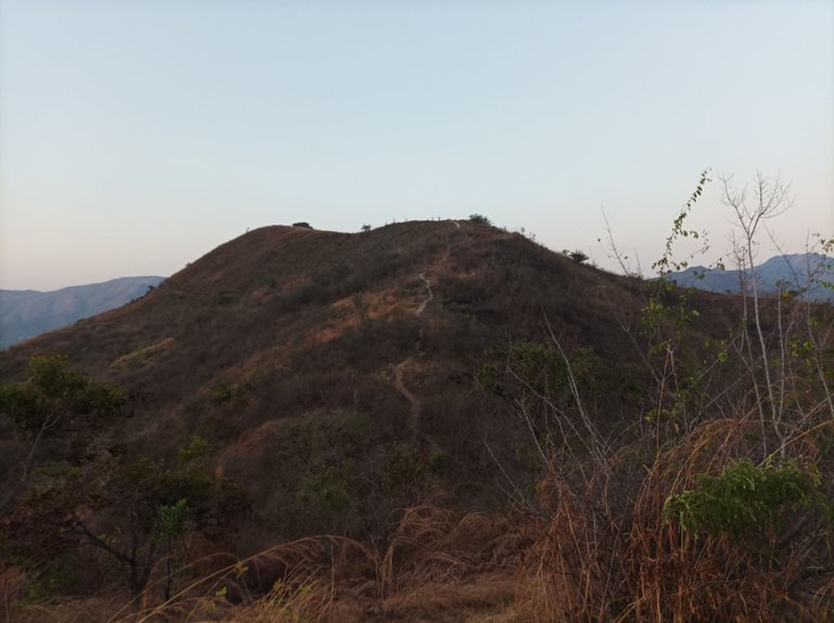
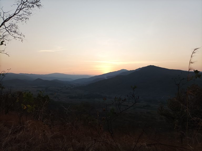
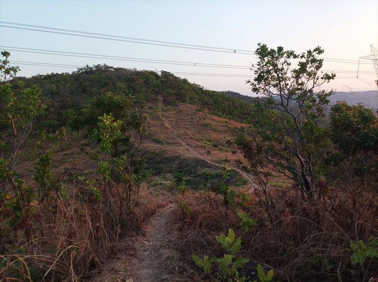
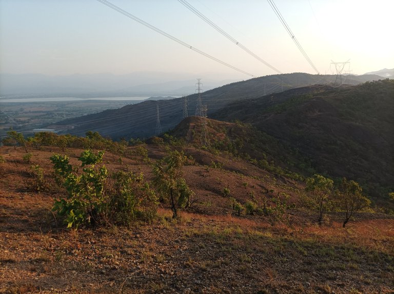
Después continúe avanzando, para pasar la segunda y tercera subida, y llegar a la cima donde están las máquinas de ejercicios, pude apreciar que estaba sólo, en esta parte la aplicación Strava registro un tiempo de 17 minutos, luego comencé a descender para llegar a la parte baja y nuevamente comenzar el ascenso, el clima estaba fresco, pero la montaña continúaba seca, el sol comenzó a salir y pude tomar unas bellas fotografías del amanecer desde esta montaña.
Then I continued moving forward, to pass the second and third climb, and reach the top where the exercise machines are, I could see that I was alone, in this part the Strava application recorded a time of 17 minutes, then I began to descend to reach the lower part and again begin the ascent, the weather was cool, but the mountain remained dry, the sun began to rise and I was able to take some beautiful photographs of the sunrise from this mountain.
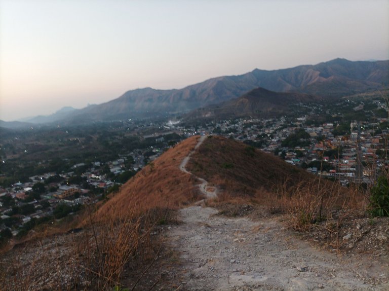
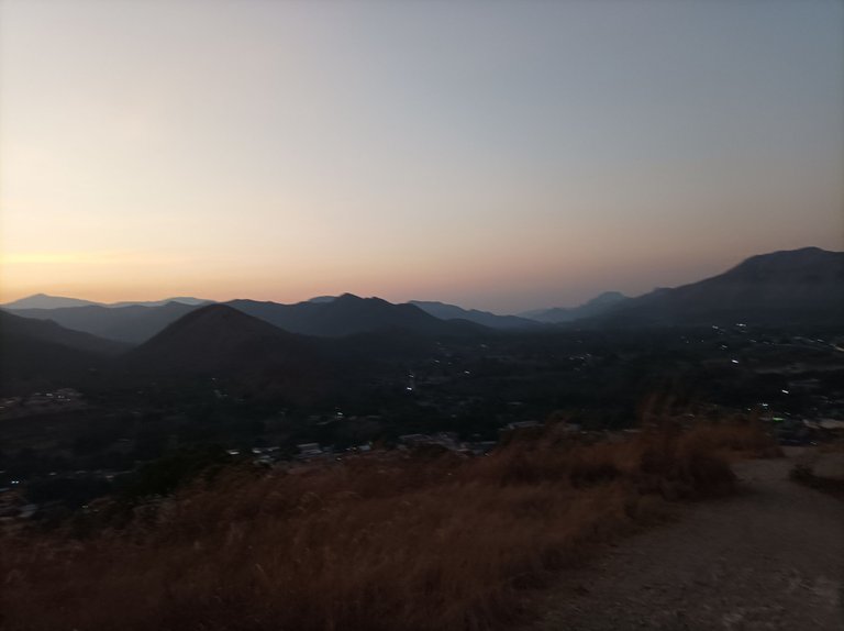
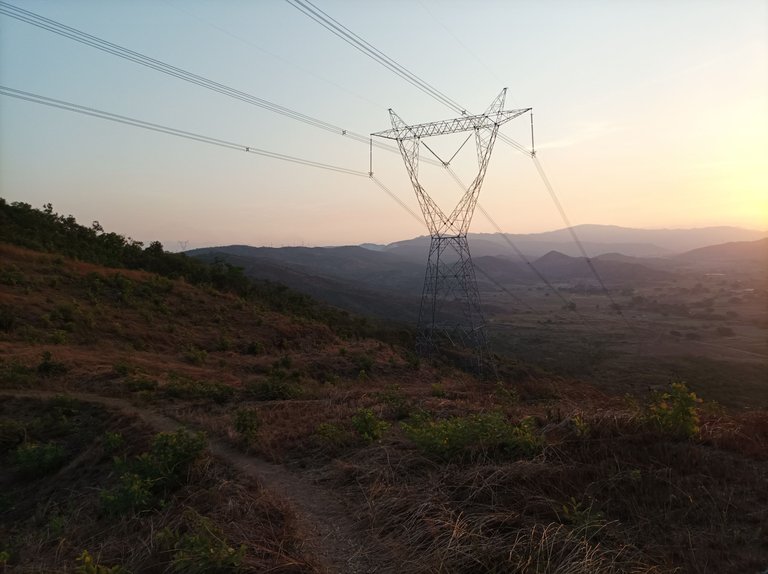
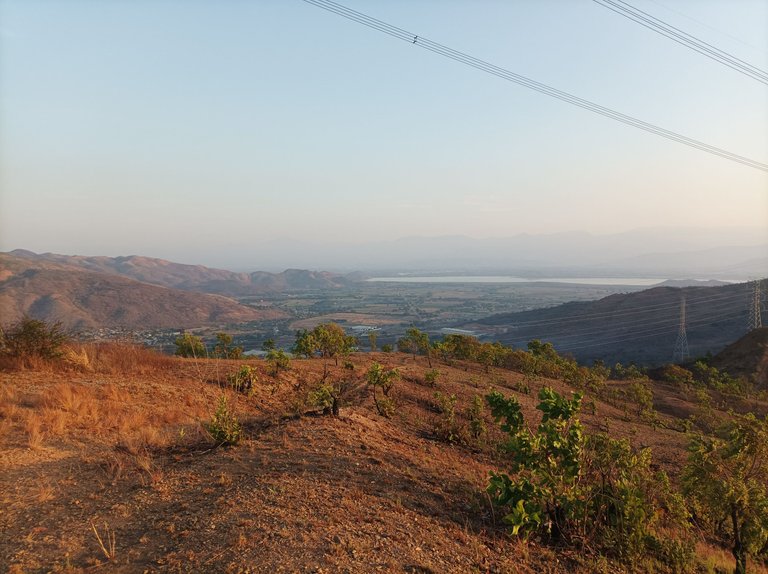
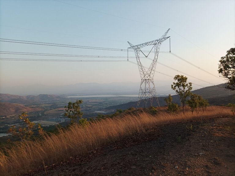
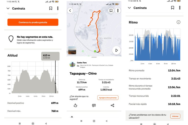
Al continuar subiendo, esta pendiente es larga pero pronunciada, llegando a la cima y pasar por Las Torres, para luego continuar avanzando hasta La Piedra, con un tiempo de 37 minutos, para después bajar y recorrer una parte plana y llegar a la montaña frente de la laguna de Taguaguay, con un tiempo de 47 minutos con 50 segundos, una distancia de 3.74, me detuve para tomar una fotografía y continuar bajando, para tratar de completar 5K y regresarme al llegar a esta distancia.
Continuing to climb, this slope is long but steep, reaching the top and passing through Las Torres, then continuing to La Piedra, with a time of 37 minutes, then going down and covering a flat part and reaching the mountain in front of the Taguaguay lagoon, with a time of 47 minutes and 50 seconds, a distance of 3.74, I stopped to take a picture and continue going down, to try to complete 5K and turn back when reaching this distance.
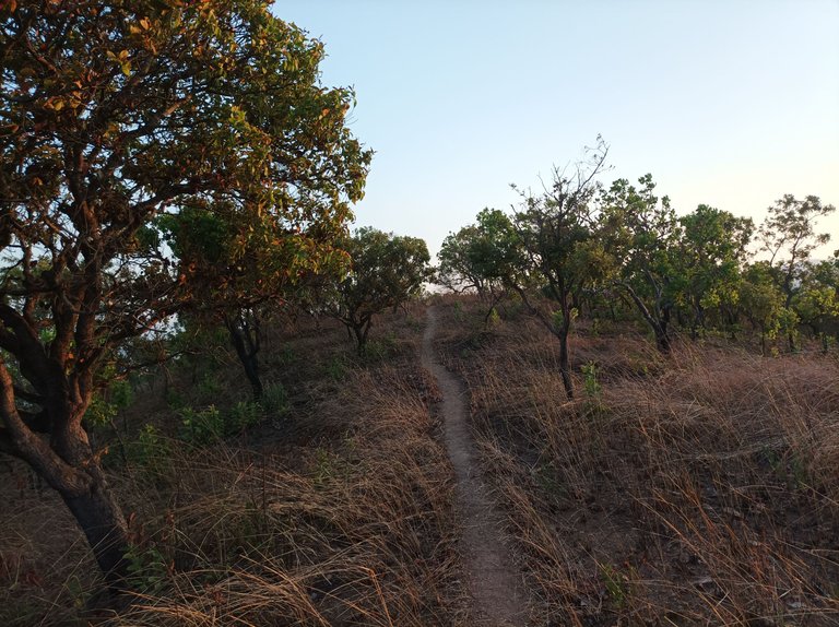
Luego de recorrer este sendero, me encontré con una entrada que está a una distancia de 4.74K , me llamo la atención y decidí explorar para conocer esta parte de la montaña que es otra salida, caminé un 1.26K, y resulta que este camino no me permitió salir a Las Torres, me llevaría a otra montaña detrás de esta, en vista de esto, me regresé de nuevo, retomé el camino que llevará al frente de la laguna de Taguaguay.
After walking this trail, I found an entrance that is at a distance of 4.74K, it caught my attention and I decided to explore to know this part of the mountain that is another exit, I walked 1.26K, and it turns out that this path did not allow me to exit to Las Torres, it would take me to another mountain behind this one, in view of this, I returned again, I took the path that will lead to the front of the Taguaguay lagoon.
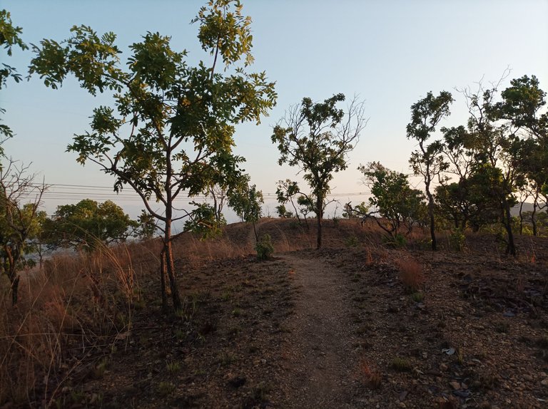
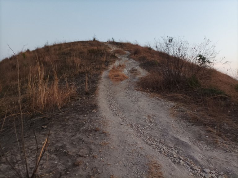
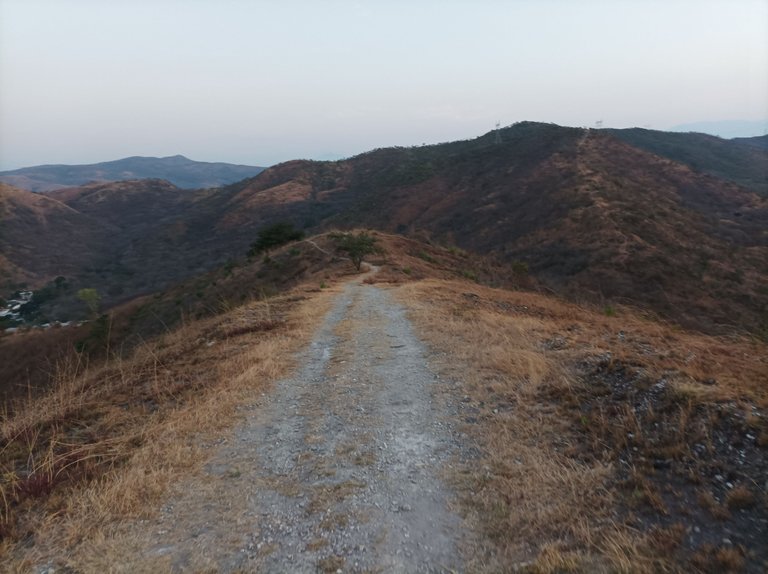
Asimismo, continúe por el mismo camino, ya el sol estaba presente en la montaña, pasando por La Piedra, Las Torres y ya faltaba poco para llegar a la parte baja y comenzar a subir para llegar a la tercera montaña donde están las máquinas de hacer ejercicios, el calor ya se sentía, para después empezar el descenso y pasar por las dos restantes montañas, donde está la cruz, termine de descender, y llegué a la avenida Lisandro Hernández, hasta finalizar mi entrenamiento en el mismo punto de partida con un tiempo de 2 horas 21 minutos, con una distancia de 11.73K, un desnivel positivo de 699 m y un desnivel máximo de 698 m , registrado en Strava.
Likewise, continue along the same path, the sun was already present on the mountain, passing through La Piedra, Las Torres and there was little left to reach the lower part and begin to climb to reach the third mountain where the exercise machines are, the heat was already felt, then begin the descent and pass through the two remaining mountains, where the cross is, finish descending, and arrived at Lisandro Hernández Avenue, until finishing my training at the same starting point with a time of 2 hours 21 minutes, with a distance of 11.73K, a positive slope of 699 m and a maximum slope of 698 m, recorded on Strava.
Espero que les haya gustado, nos vemos en una próxima publicación.
I hope you liked it, see you in a next post.
Fotografías: Teléfono Redmi Note 10
Portada realizada en APP GridArt
Logos utilizados de Hive y de @fulldeportes
Traductor utilizado: Traductor de Google
Photos: Redmi Note 10 Phone
Cover made in The APP GridArte
Used logos of Hive and @fulldeportes
Translator used: Translator used: Google Translate

Vote la-colmena for witness By @ylich

Profe recuerde llevar una buena hidratación en especial en estos días donde claramente se puede observar en las fotos la dureza del clima, el verano y el calor. Saludos cordiales.
Quedo asombrada con lo hermosa que es venezuela, tenemos de todo en este territorio, excelentes fotos
Saludos, muchas gracias por comentar.