Walking the most famous hiking route in Spain - Cares Route (PR-PNPE 3) - (Part 1) ⛰️🇪🇦
For those of you who have followed my blog during the last weeks, you will know that I was on vacation in the north of Spain (1, 2, 3, 4, 5, 6, 7, 8), enjoying its cooler climate, its good food and its forests and mountains.
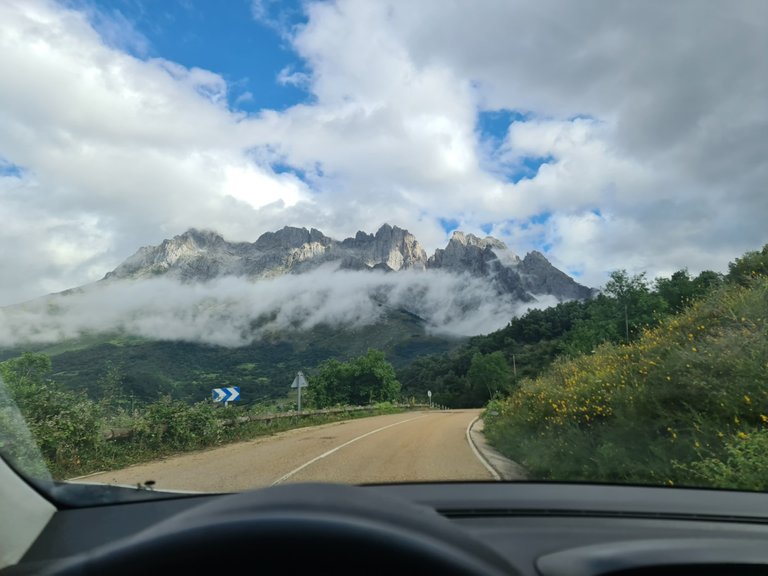
And of course, as a lover of Nature and hiking, I couldn't ignore the fact of having the most famous hiking route in Spain just a few kilometers by car from the inn where I was staying.
YouTube Short of the valley:
https://youtube.com/shorts/Nv7HNOVVETk?feature=share

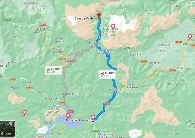
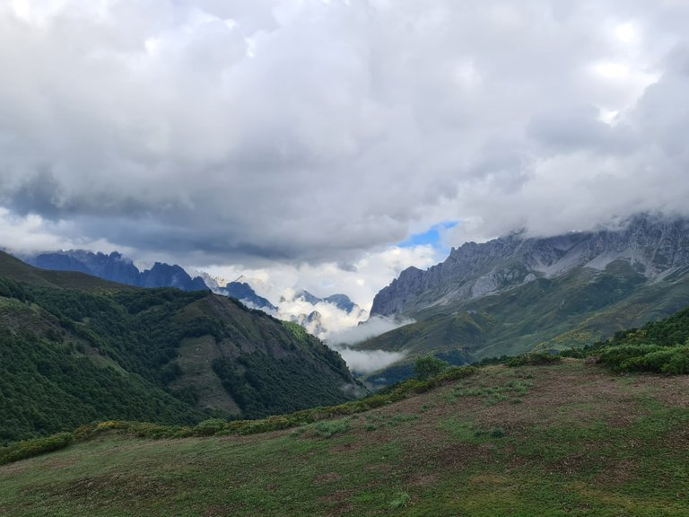
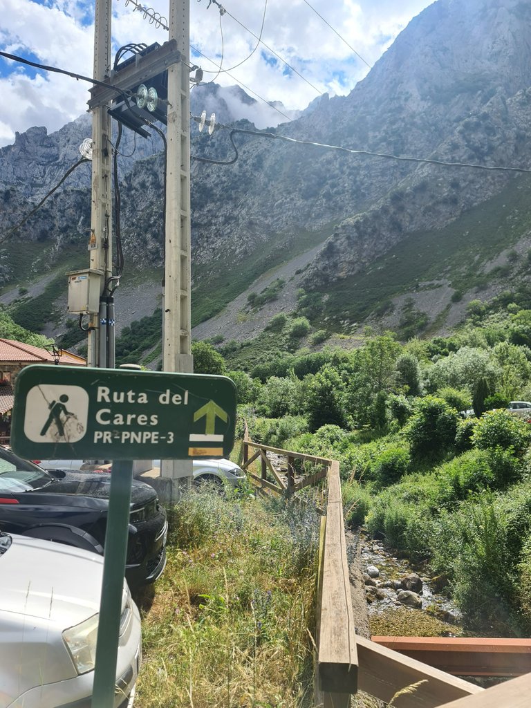
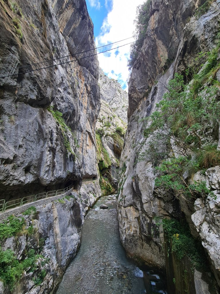
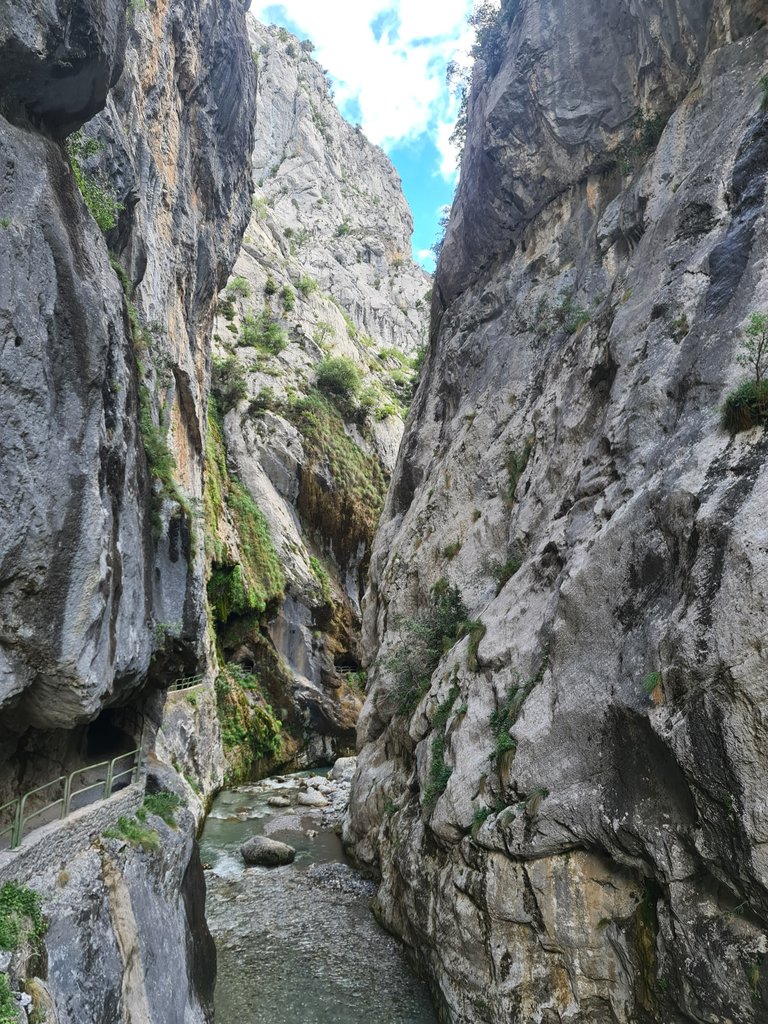
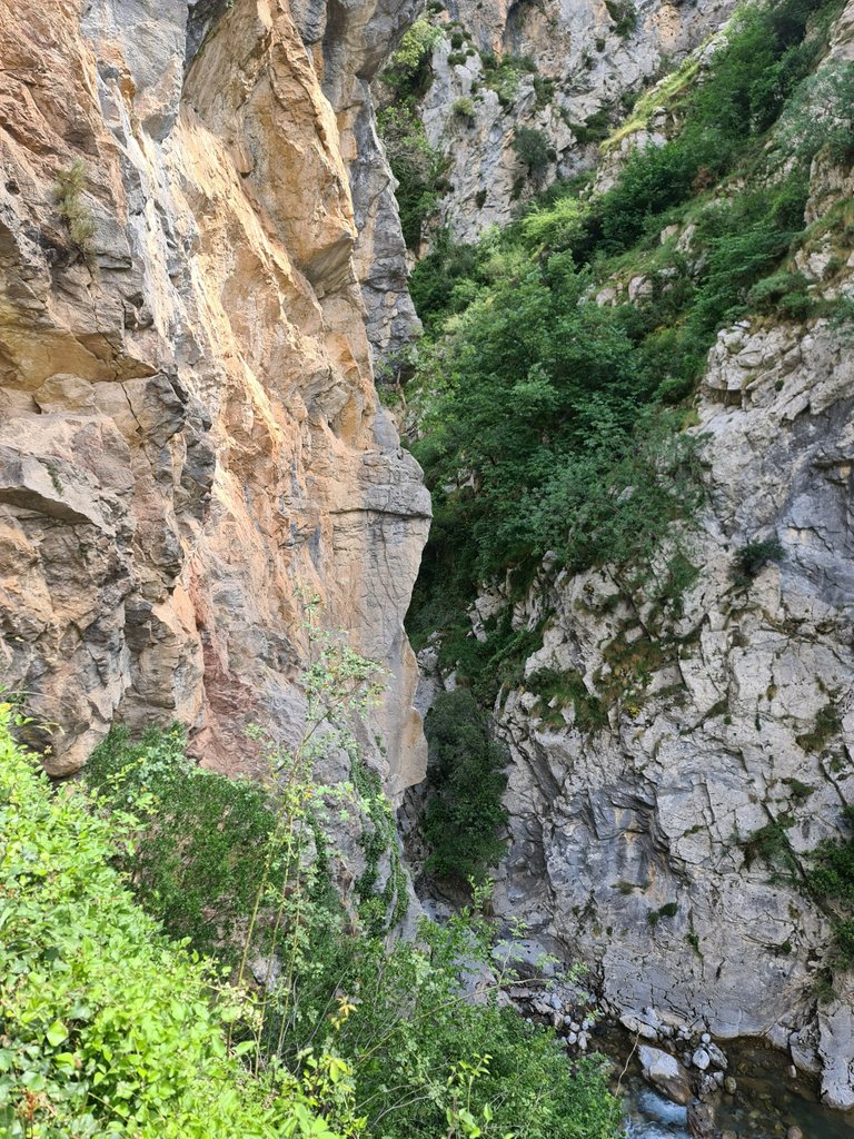
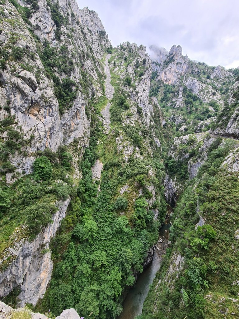
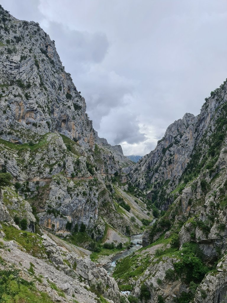
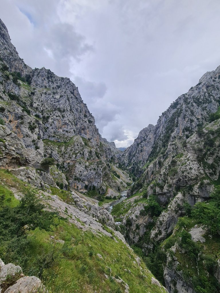
The Cares route is located in Picos de Europa National Park (it extends to three provinces and being not only a national natural park but also the largest limestone formation in Atlantic Europe with important karstic processes, chasms over 1,000 meters and very evident glacial erosion), being a linear route, with a maximum length of 24 kilometers, a medium difficulty (in some sections medium-high) and an approximate duration of 7 hours (depending on your physical condition).
The route starts from Caín de Valdeón, a beautiful hamlet (58 inhabitants) that reminds of the Alpine towns and there are some souvenir shops, small markets and couple of restaurants and hostels.
In principle, the route is for all audiences, but they also recommend that children be over 12 years old or that they always go hand in hand with their parents, not bring dogs, and go well equipped.
YouTube Short of the first bridge of the route:
https://youtube.com/shorts/ApiouVNNxSE?feature=share
YouTube Short running through the tunnel carved into the rock.
https://youtube.com/shorts/rsdVEN_t0DM?feature=share
My personal opinion regarding the recommendation for all audiences is that this route is much more dangerous than it may seem and, of course, it's not recommended for people with vertigo or people somewhat not accustomed to the mountains.
Falls have happened in the past, as does the encounter with wild animals, so common sense it's a must.
YouTube Short appreciating the heights and running towards the next bridge:
https://youtube.com/shorts/Rjh82nnOEgg?feature=share
As you can see in the images and in the YouTube Shorts, there are no guardrails.
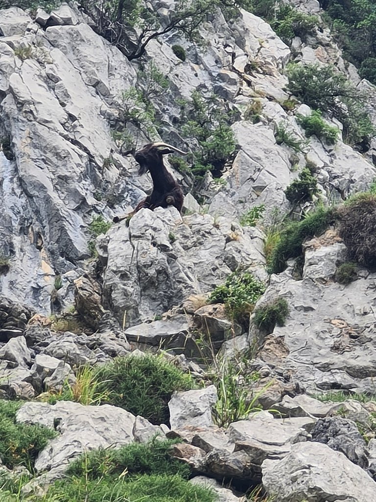
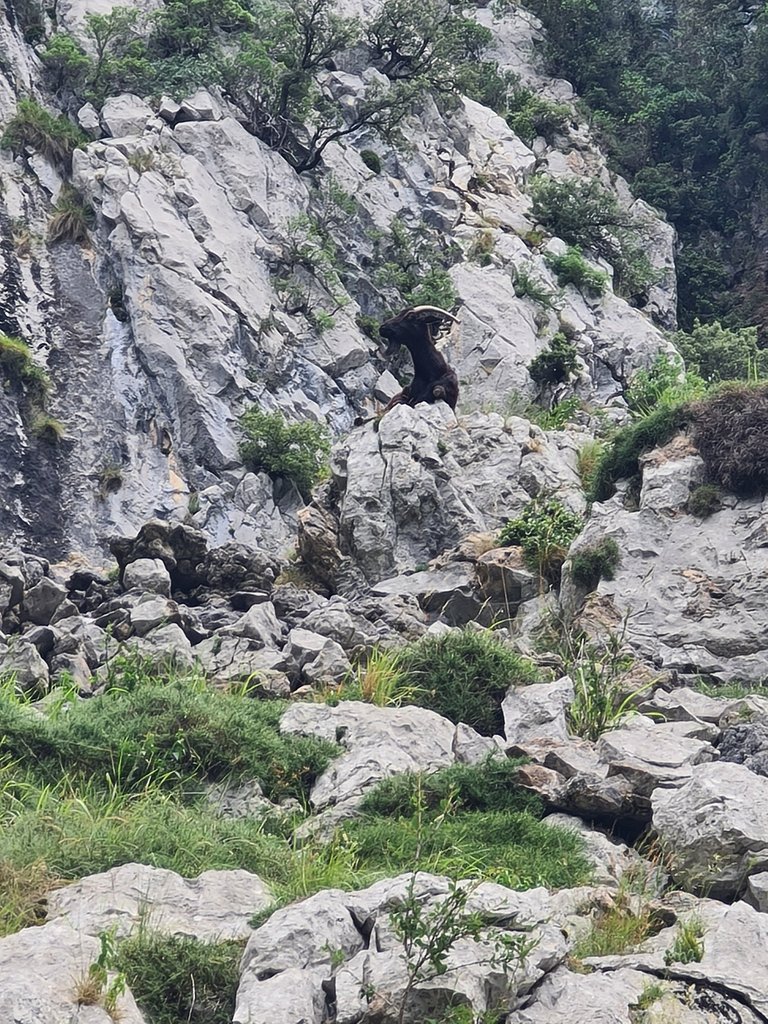
Although the chamois may seem harmless, it's better not to approach them too much in order to avoid bumps that can cause worse accidents, nor to feed them.
YouTube Short appreciating the heights from another point:
https://youtube.com/shorts/NF4PlzyXOCA?feature=share
In my case, I was equipped with Salomon XT Wings 3 mountain shoes, mountain pants, fleece lining, a backpack with 2 liters of water, cereal bars, a raincoat, a wool cap, gloves and a towel.
I will tell you more about this route and my experience in the next episode!
Photographs taken with my Samsung Galaxy S20 Ultra 5G camera.
YouTube shorts recorded with my Samsung Galaxy S20 Ultra 5G camera
Sources on which I relied to give some accurate info about Picos de Europa National park and Cares hiking route: (1), (2)
Congratulations, your post has been added to Pinmapple! 🎉🥳🍍
Did you know you have your own profile map?
And every post has their own map too!
Want to have your post on the map too?
Hiya, @ybanezkim26 here, just swinging by to let you know that this post made it into our Honorable Mentions in Daily Travel Digest #1757.
Your post has been manually curated by the @pinmapple team. If you like what we're doing, please drop by to check out all the rest of today's great posts and consider supporting other authors like yourself and us so we can keep the project going!
Become part of our travel community: