hiking in kintokiyama : June 7 2024
this view of mount fuji was a pleasant surprise. i was part of the research team for this hike and i completely forgot of this beautiful view of mount fuji at the peak of kintokiyama. and this will be submitted to #aroundtheworld contest. let me start at the beginning.
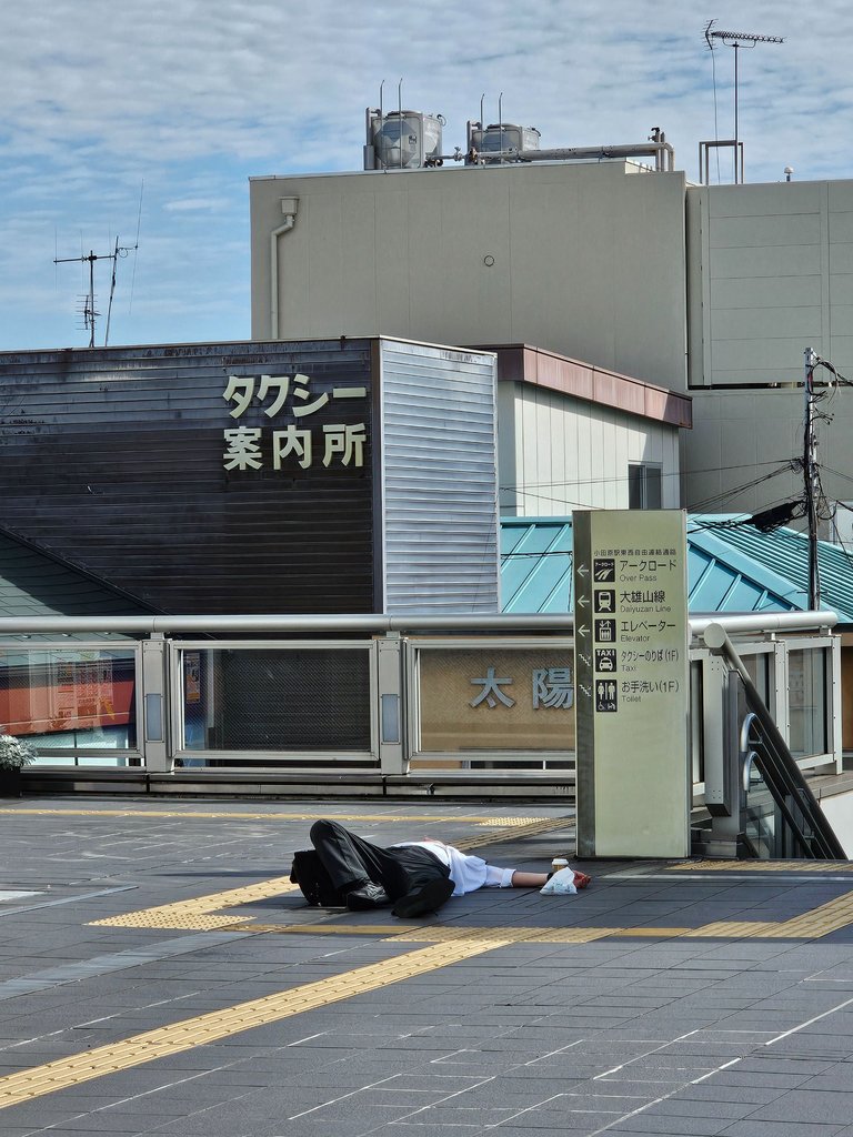
well this greeted us when we got off at odawara station along the very famous hakone tourist area. it was my very first time to be here, all of my friends have already been here in hakone many times and no one wants to go back; thus, i had no chance to be a tourist in this place.
and right away, this drunk man sleeping on the ground was a very pour first impression. this is quite a common sight in central tokyo specially on weekends, never did i know that hakone also have a fair share of this sight.
a housemate and @thinkeringbart with me, this was after an hour and a half of train ride from home and we still have a 42 minute bus ride from this station before reaching the hike trail.
Mount Kintoki (金時山)
according to wikipedia
Mount Ashigara (足柄山), also known as Mount Kintoki (金時山), is the northernmost peak of the Hakone caldera, on the border of Kanagawa and Shizuoka prefectures, in the Fuji-Hakone-Izu National Park in Japan. Ashigara is not a remnant of the collapse of the old Hakone volcano itself, but rather a parasitic cone growing from its flank. source

there was really nothing much i expected in this hike except that this was my first for this year and the first after that hike where i hurt my knees. in fact, this was rather an easy trail according to the difficulty level of our hiking app, with around 600 meters up hill and another 600 meters down.
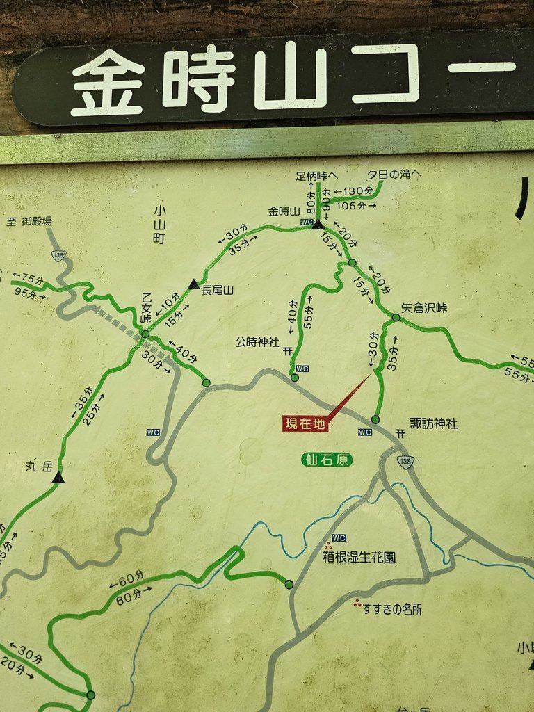
here we finally reached the hiking trail mouth. we were not supposed to start here, but people were gathered at the info map that we decided to just follow these people. the more people on the trail the better for so many reasons.
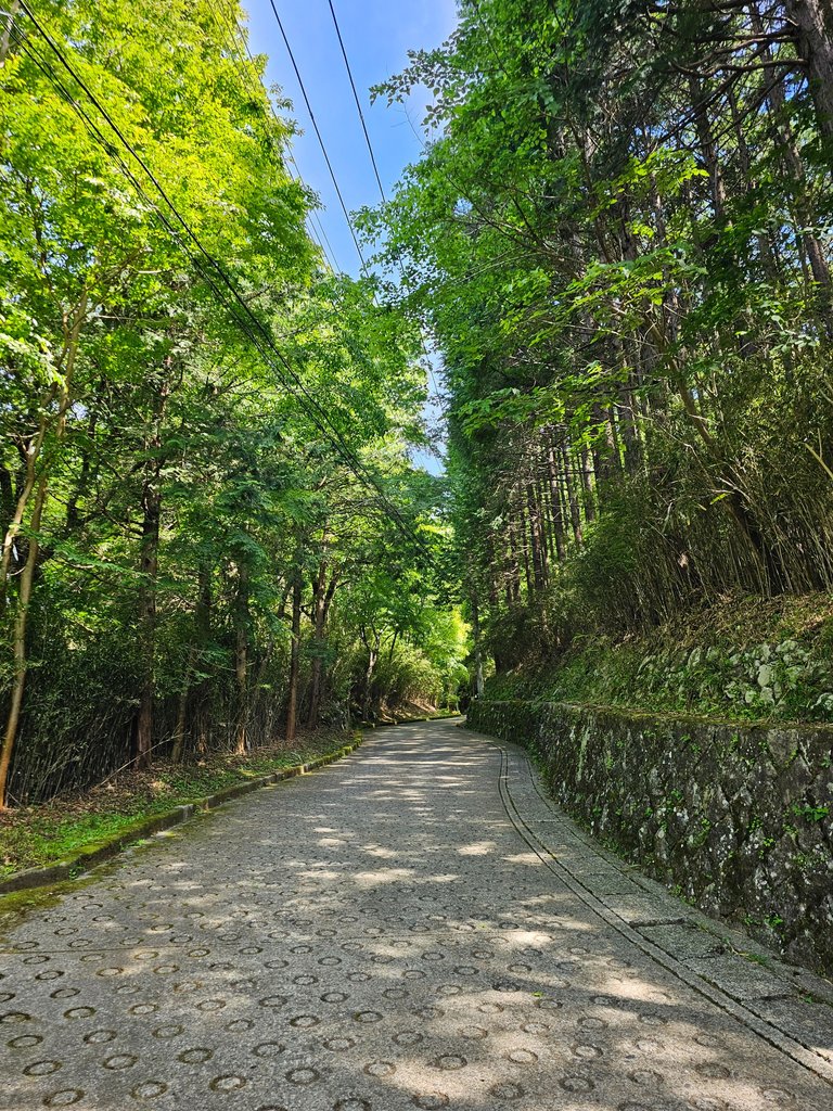
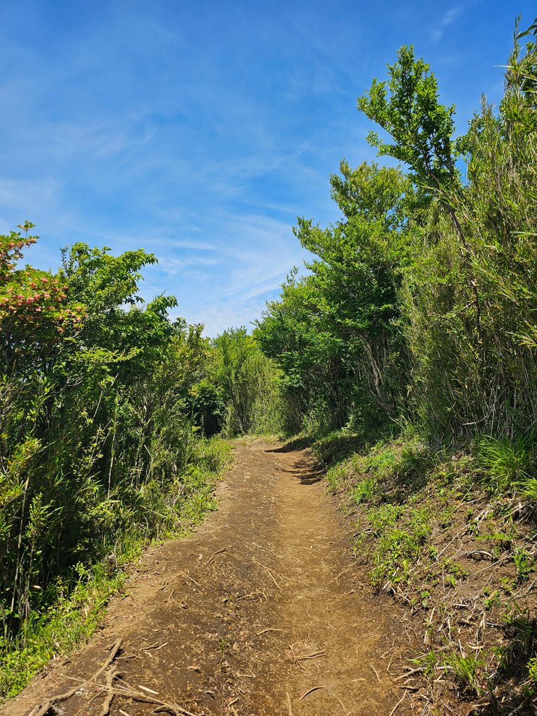
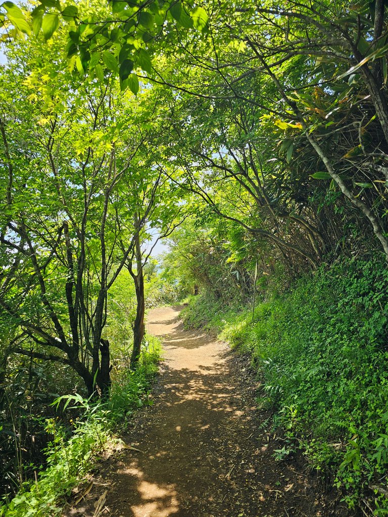
this part was still paved and i was quite wondering how the actual mountain path would look like.
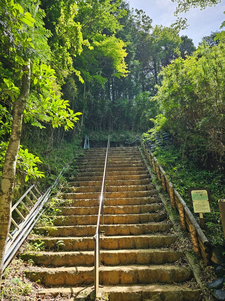
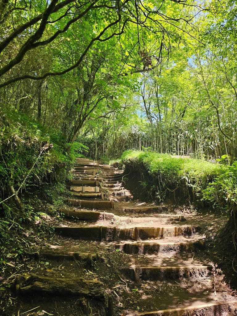
here came the never ending steps uphill. of all things i hate about mountain hiking, stairs top that list. i hated stairs and that never changed even in this hike.
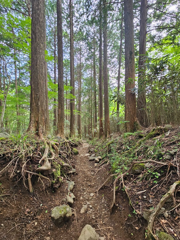
there were occasional elevated stairless paths, but these were very far and in between. but what i appreciated much in here were the tall trees giving so much shade and a cool temperature.
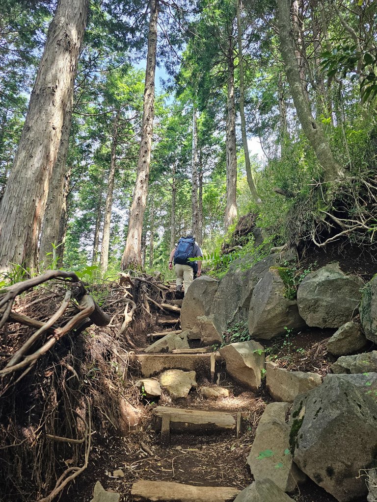

japan loves hiking and it is very evident with the hiking paths created in there mountains. this is much appreciated by hiking neophytes like us.
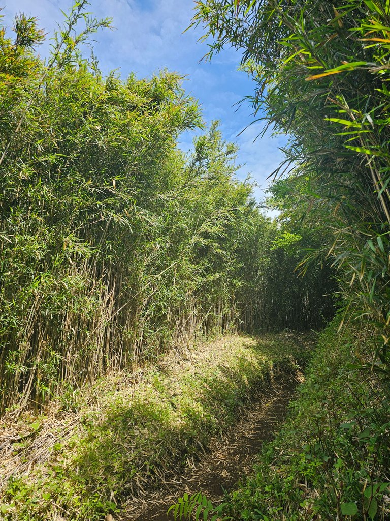

we have now reached the short shrubby area. beside the path this time were mini bamboo like grasses. i don't know what these were called but they do resemble those picket bamboo grown in the gardens of the resorts back home. since these were short, i could feel the sun burning my skin more.
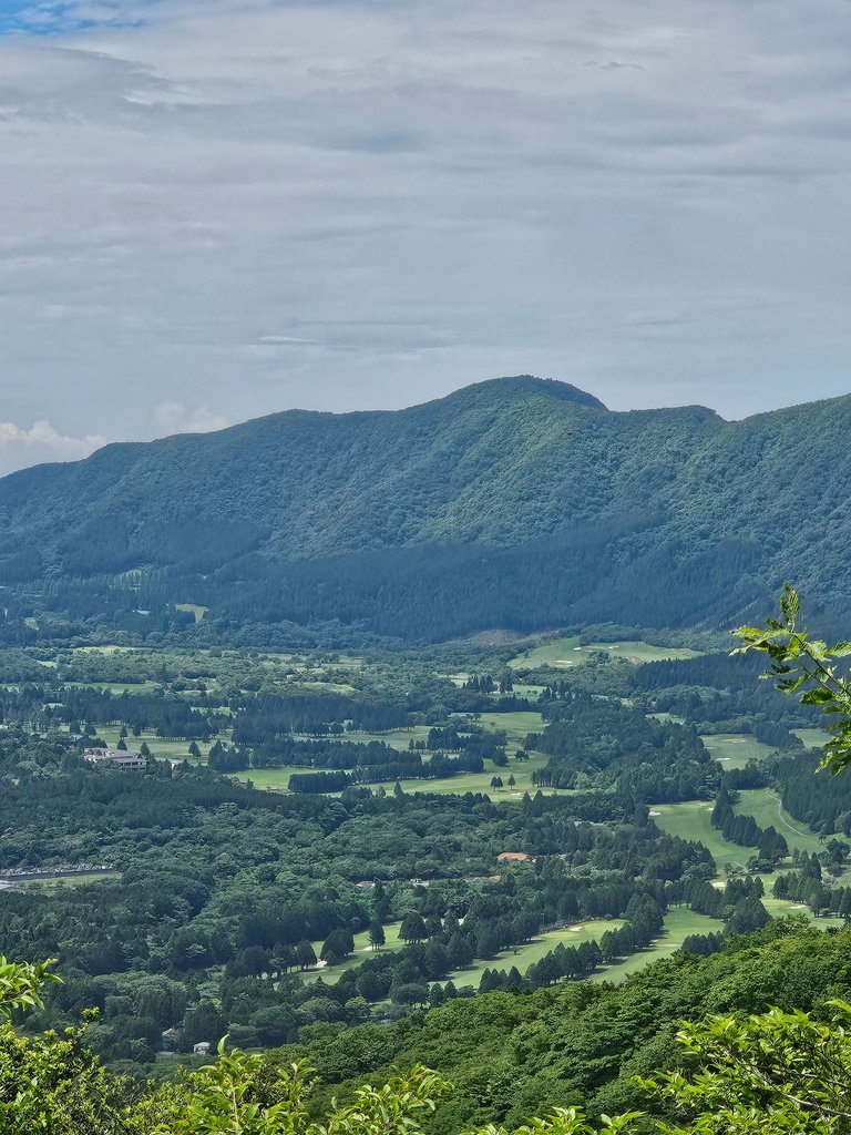
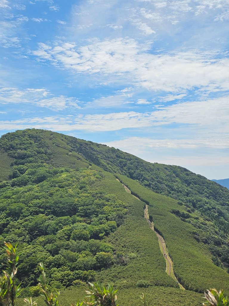
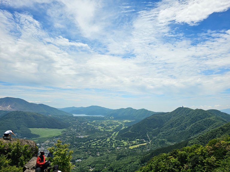
we could see occasional clearings with a view of the surrounding mountains and the plains down below. i could definitely imagine the volcano caldera. the second picture was the path toward another peak. that trail was definitely man made.
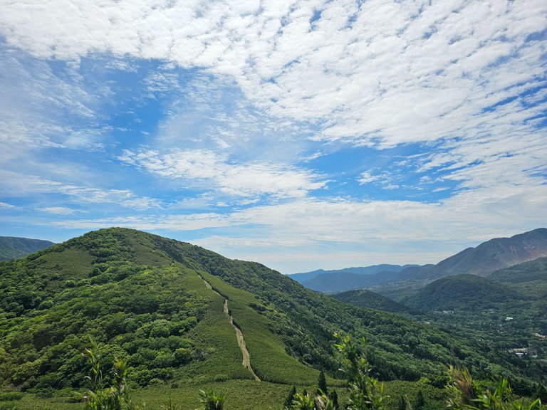
that was how it looked like in landscape.
this path of short bamboo like grasses continued a a good 10 or 20 minutes. this was the hottest part of this hike, no shade at all.
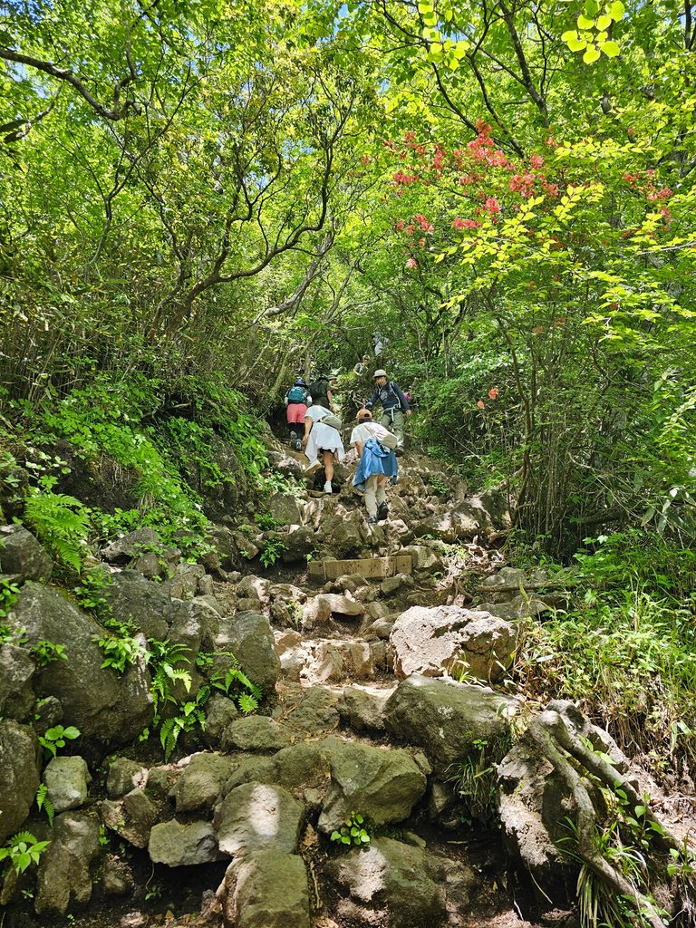
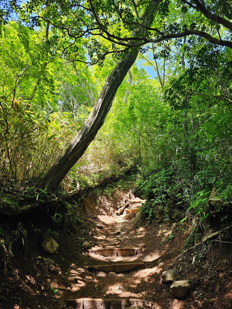
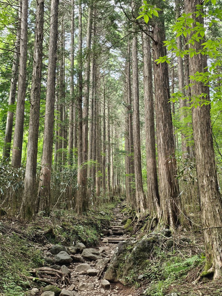
we finally reached some shady part with more steps and more rocks. i loved the part with the rocks, i enjoy stepping on rocks more. we were definitely reaching the peak in a few more meters from here.
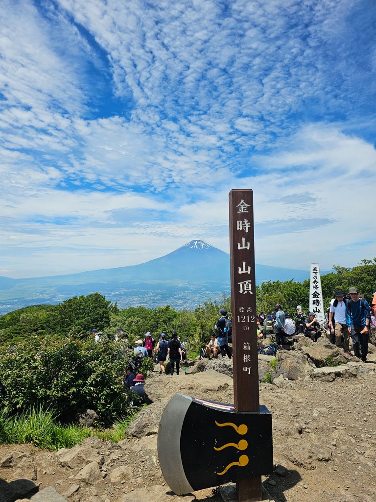

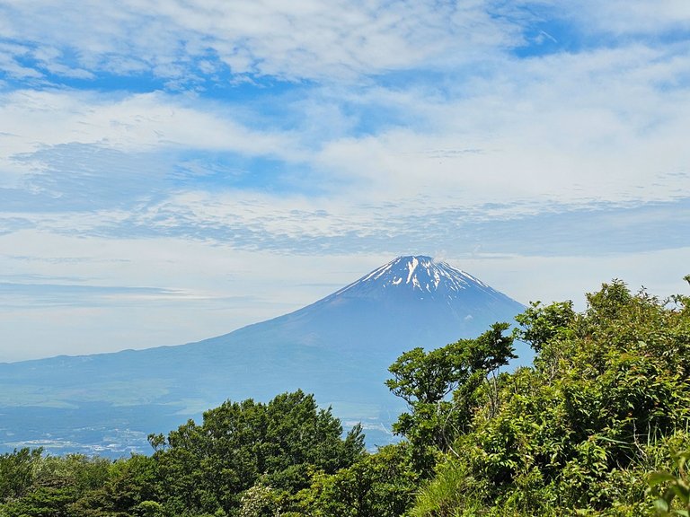
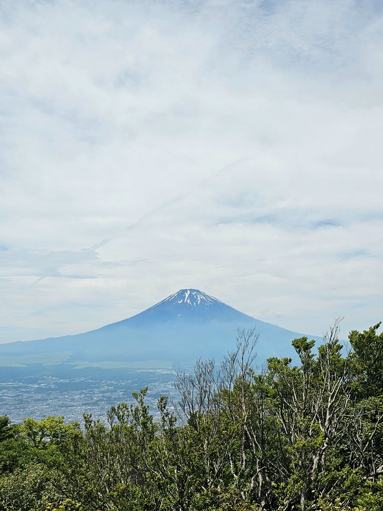
and here she came, THE PEAK! with a beautiful view of mount fuji at the distance, still with some icy peaks. this peak was just a short one, 1212 meters tall. now i was really wondering why this peak featured an axe so i researched. kintokiyama was the legendary birthplace of a folklore hero kintaro, a child of super human strength. and this child is often depicted wielding a giant axe.
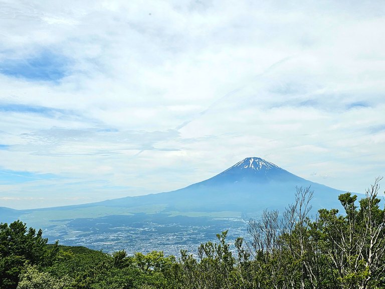
here is another view of mount fuji.
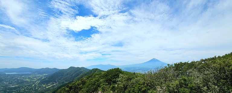
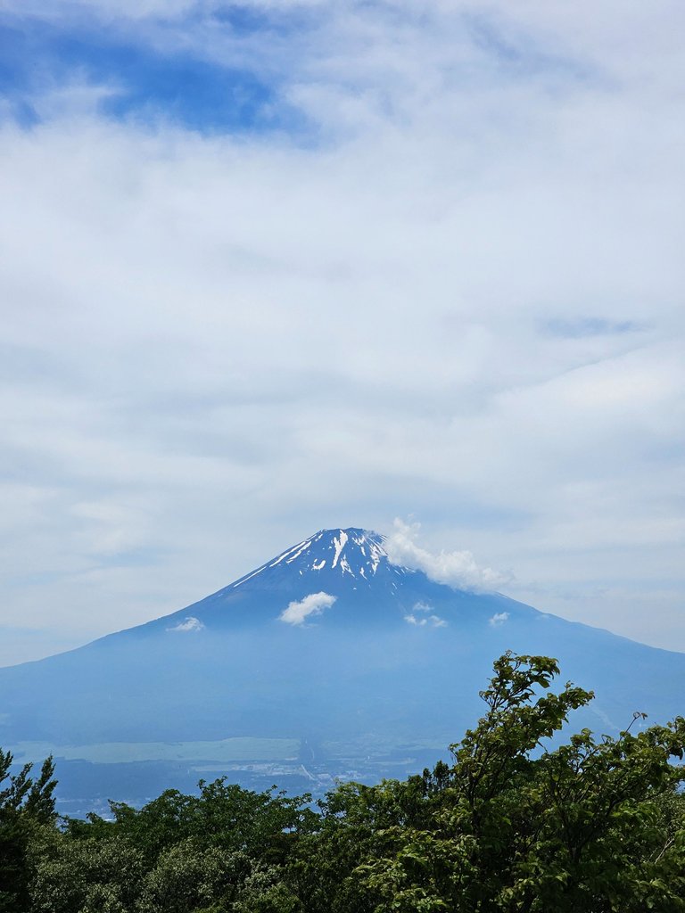
and another one in panorama. i clipped the many people below me on this shot. and the sky was just perfect that time, perfect to view the elusive mount fuji. but not for us who were under direct sun without any shade. we had our lunch in the open while enjoying the view.

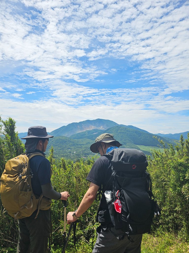
majestic mount fuji yet again. and the many people on this peak. i really wanted to go on top of this rock where these two people got on. it must have been a pretty view despite the trembling knees i would surely have. my acrophobia would surely creep in either on the way up, while on the rock, going down, or in all three stages.
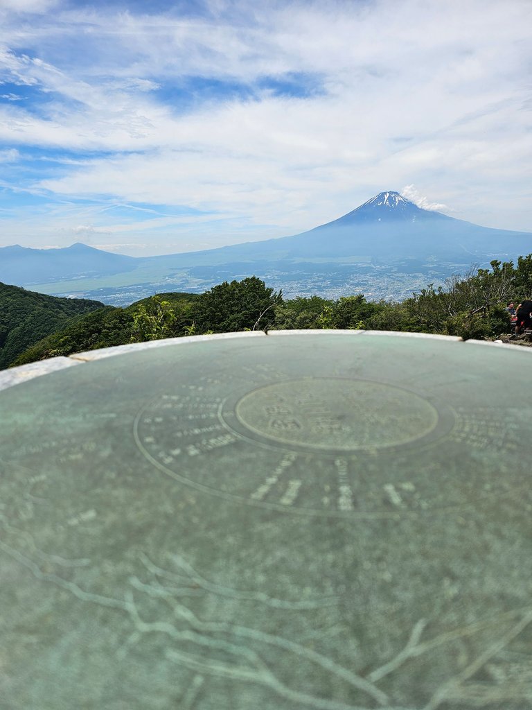
another view of mount fuji, yes she was the star. this first one was on a "metal plate" with the embedded names of the mountains in the vicinity.
and the view of the hakone plains, or caldera, or whatever this is called. it was a long rest at the top and we had to go down.
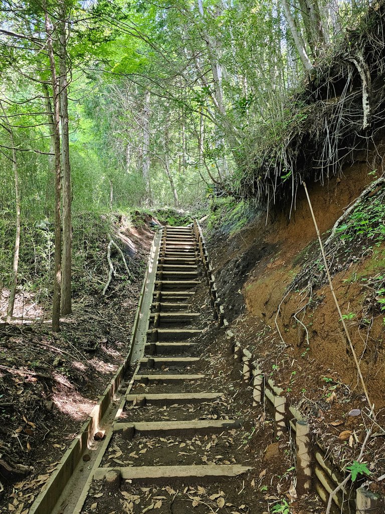
we went down the same trail for a few minutes before diverging on a different trail down hill. like any down hill trip, this one went a lot faster than the climb.
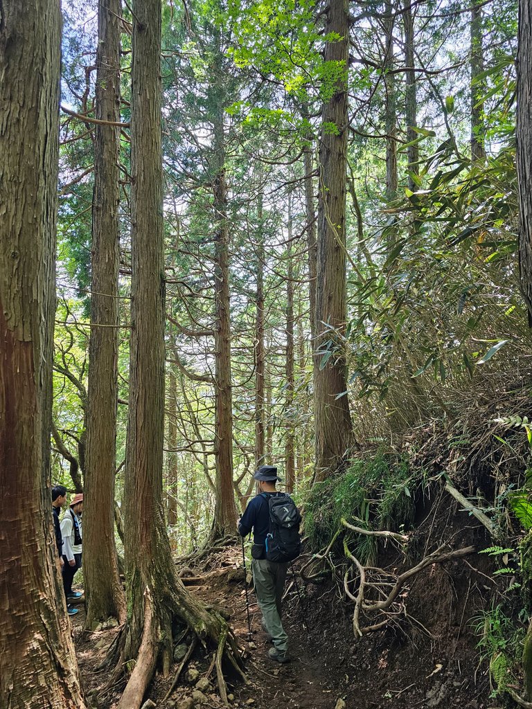
good thing that the trail had the tall trees, but it was a lot more difficult. this was the original up hill trail and we were all glad that we took the other one, this was a lot harder to climb.
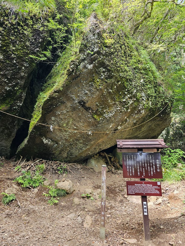
we passed by big rocks which had some connection to the folklore hero kintaro. the first one, about 20 meters wide, seemed to be smashed in half.
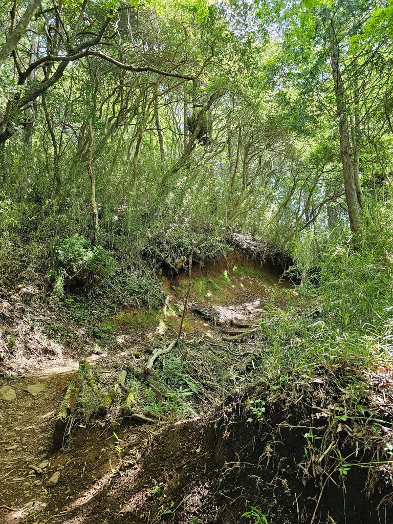
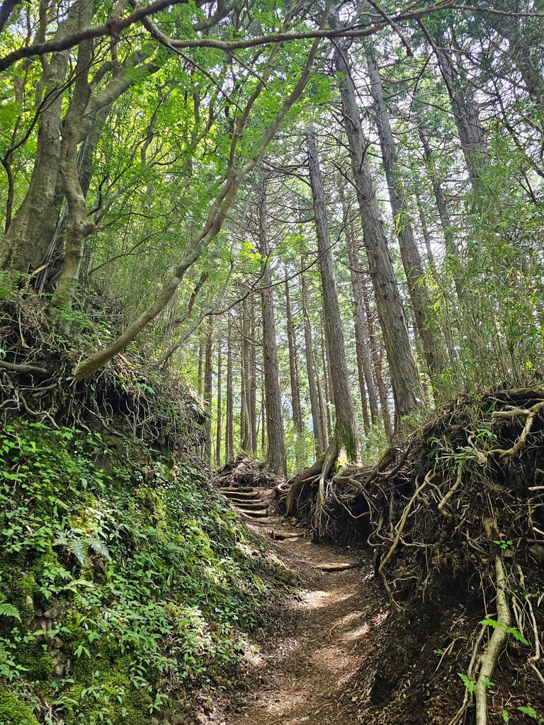
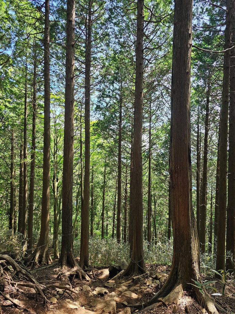
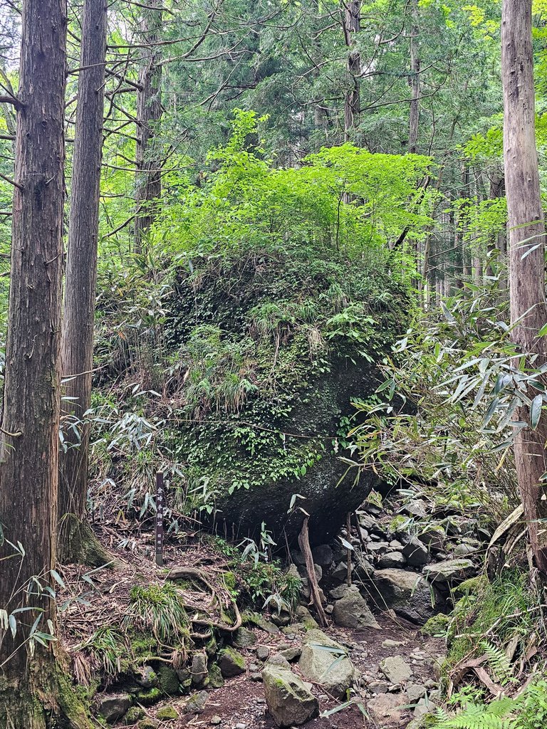
here are more pictures of the down hill trail.
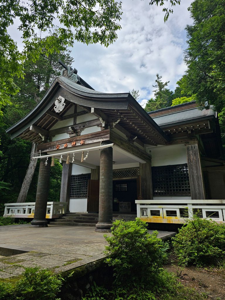
and the kintoki shrine at the foot of the mountain. yes, we completed the hike safely.
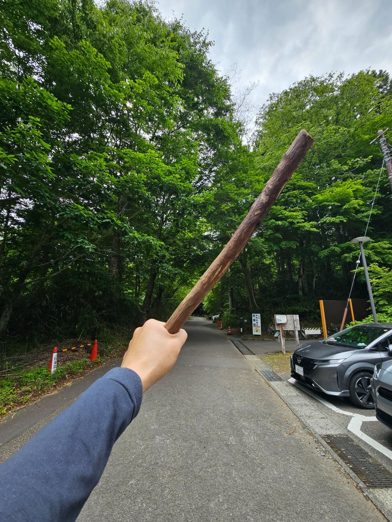
i was very worried of my left knee the whole time and i definitely felt some pain at some point. i was just glad to have picked up this branch and used as a walking stick for this hike. it was a head turner for sure, but i am pretty sure this was how the ancients hiked mountains.
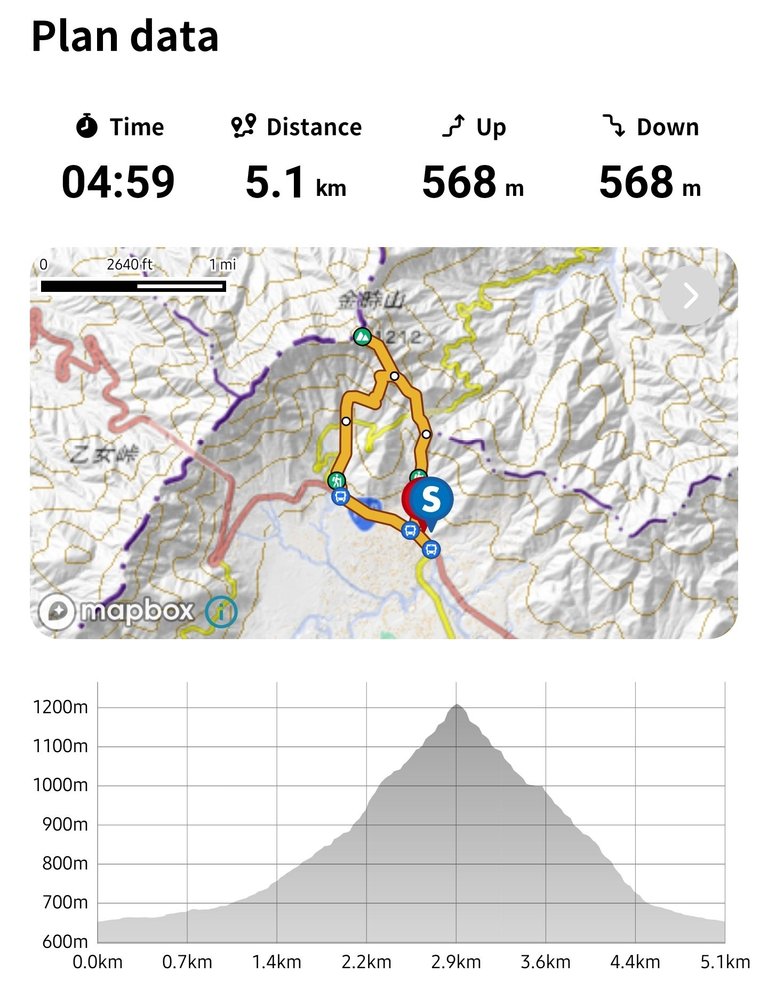

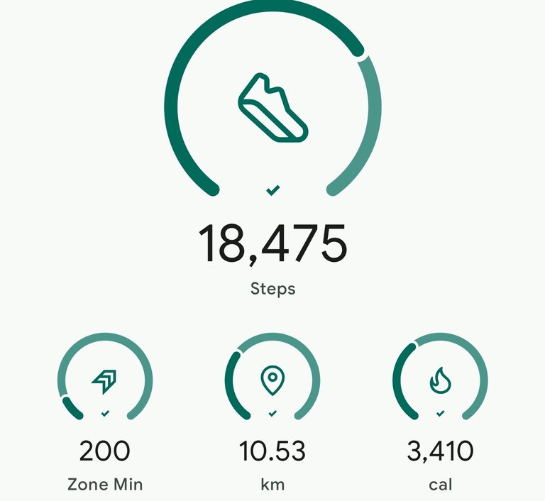
this was the hike plan and the actual hike stats. it took us 6 hours, we were on the slow side and were definitely taking more rests. but better safe than sorry right? we were only competing with ourselves, and the mere fact that we conquered this mountain safely is a win for me.
as always, AMPING KANUNAY!

all content is by yours truly unless otherwise specified
all photos are taken with a galaxy s23 ultra
This report was published via Actifit app (Android | iOS). Check out the original version here on actifit.io


Height168.0 cm |  | Weight72.1 kg |  | Body Fat% |  |
Waistcm |  | Thighscm |  | Chestcm |  |


You can check out this post and your own profile on the map. Be part of the Worldmappin Community and join our Discord Channel to get in touch with other travelers, ask questions or just be updated on our latest features.
Congratulations, your post has been added to the TravelFeed Map! 🎉🥳🌴
Did you know you have your own profile map?
And every post has their own map too!
Want to have your post on the map too?
- Go to TravelFeed Map
- Click the create pin button
- Drag the marker to where your post should be. Zoom in if needed or use the search bar (top right).
- Copy and paste the generated code in your post (any Hive frontend)
- Or login with Hive Keychain or Hivesigner and click "create post" to post to Hive directly from TravelFeed
- Congrats, your post is now on the map!
PS: You can import your previous Pinmapple posts to the TravelFeed map.Opt Out
Hiya, @ybanezkim26 here, just swinging by to let you know that this post made it into our Top 3 in Travel Digest #2585.
Your post has been manually curated by the @worldmappin team. If you like what we're doing, please drop by to check out all the rest of today's great posts and consider supporting other authors like yourself and us so we can keep the project going!
Become part of our travel community:
Congratulations @itz.inno! Your post brought a smile to the TravelFeed team so we have sent you a smiley. Keep up the good job. 🙂
Thanks for using TravelFeed!
@for91days (TravelFeed team)
PS: Did you know that we have our own Hive frontend at TravelFeed.com? For your next travel post, log in to TravelFeed with Hive Keychain or Hivesigner and take advantage of our exclusive features for travel bloggers.
Wonderful place buddy
thanks buddy. i had a great time
Sad to see the drunk man on the sidewalk, unfortunately it’s a common site over here as well!🙄
Fantastic view of Mount Fuji, my friend!🤗
oh drunk sidewalk sleeping is a global thing? shockt
it was a clear day to watch mt fuji. she is very elusive
Sounds like our Mount Rainier volcano down by Seattle….
Very seldom do you get a chance to get a good photograph?🙄
by the way, we have a coffee brand here caled mt rainier. i think it was based on that one in seattle. i'll send you a pic when i go to the groceries
That’s very interesting my friend. Send a pic when you get a chance!👍😊
finally saw some mt rainier
I looked it up online, it’s a very popular brand in Japan!👍😊
i wonder if the mountain in the logo resembles the actual mt rainier
I wish I had a good photo, but yes, actually it does resemble Mount Rainier!👍😊
oh so they did based it on that mountain. cool
I think so my friend!😇
Probably someone came over here on vacation or relocated to Japan!😊
Congrats on providing Proof of Activity via your Actifit report!
As your total AFIT balance across chains is below 5,000 tokens, you are still not eligible for AFIT rewards. You can buy some AFIT tokens on hive-engine, pancakeswap, digifinex or dex-trade.
You received rewards as 0.97% upvote via @actifit account.
Rewards Details
AFIT rewards and upvotes are based on your:
To improve your user rank, delegate more, pile up more AFIT and AFITX tokens, and post more.

To improve your post score, get to the max activity count, work on improving your post content, improve your user rank, engage with the community to get more upvotes and quality comments.
Chat with us on discord | Visit our website
Follow us on Twitter | Join us on Telegram
Download on playstore | Download on app store
Knowledge base:

FAQs | Whitepaper
How to signup | Maximize your rewards
Complete Actifit Tutorial
Support our efforts below by voting for:
Nice one
thanks