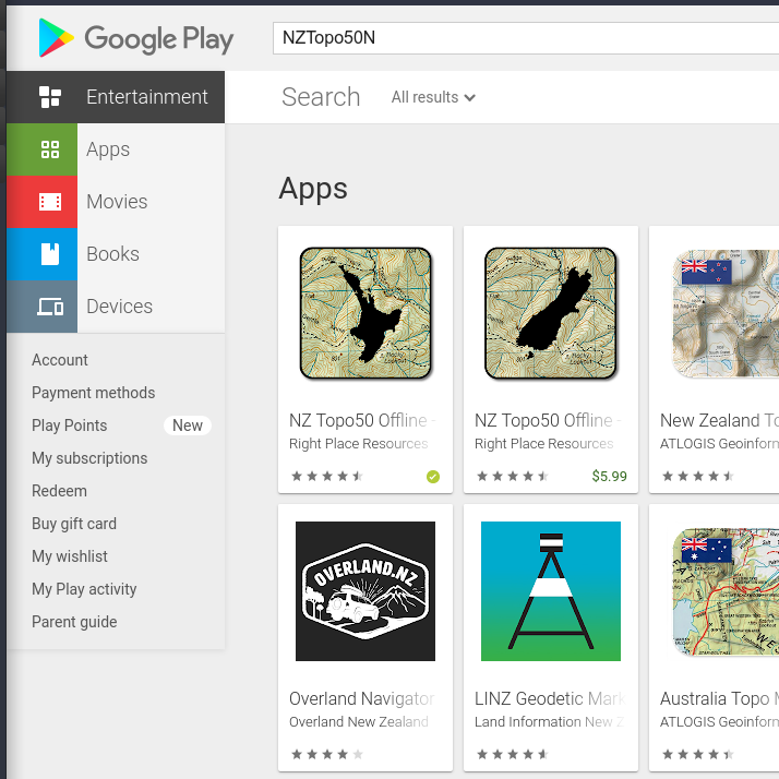
NZTopo50N: GPS Tracking for Android Phones.
I was curious how an Android App like this would work.
After confirming compatibility with my Samsung Galaxy A10, I purchased it from Google Play for $5.99NZ. Note, this is the North Island of New Zealand version only and once all the offline maps had been downloaded to the phone installation was complete.
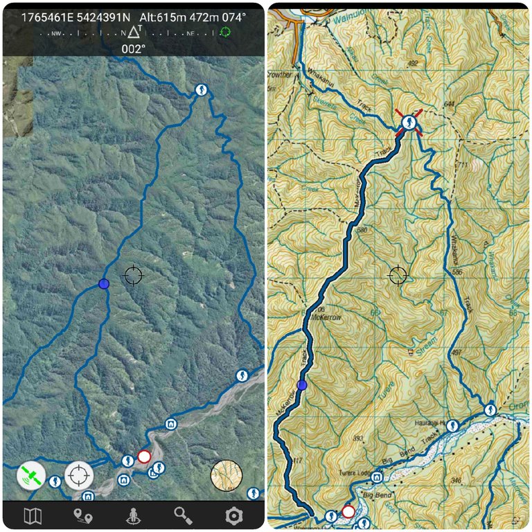
These are the 2 main screen layouts I used.
The settings had some nice features that I turned off eg show campsites, huts etc (shown for this post), I was only interested in the trails. Also, I never used the recording or setting waypoint options for the same reason.
The 2 buttons bottom left of the screen is all I used. 1st button turns on satellite tracking, I was getting up to 5 satellite connections on the trails. The second button places my location on the map as shown by a solid blue dot. I was impressed by how accurate this was when standing at a point where 2 trails converged.
My Thoughts.
I really do like this App and it is fun to use while on a hike. I was looking at it every now and then to see my progress on a particular section of a trail. Planning while on a hike is how I found this to be the most beneficial to me. A map with a compass is no good to me on the trails I hike, I will explain ...
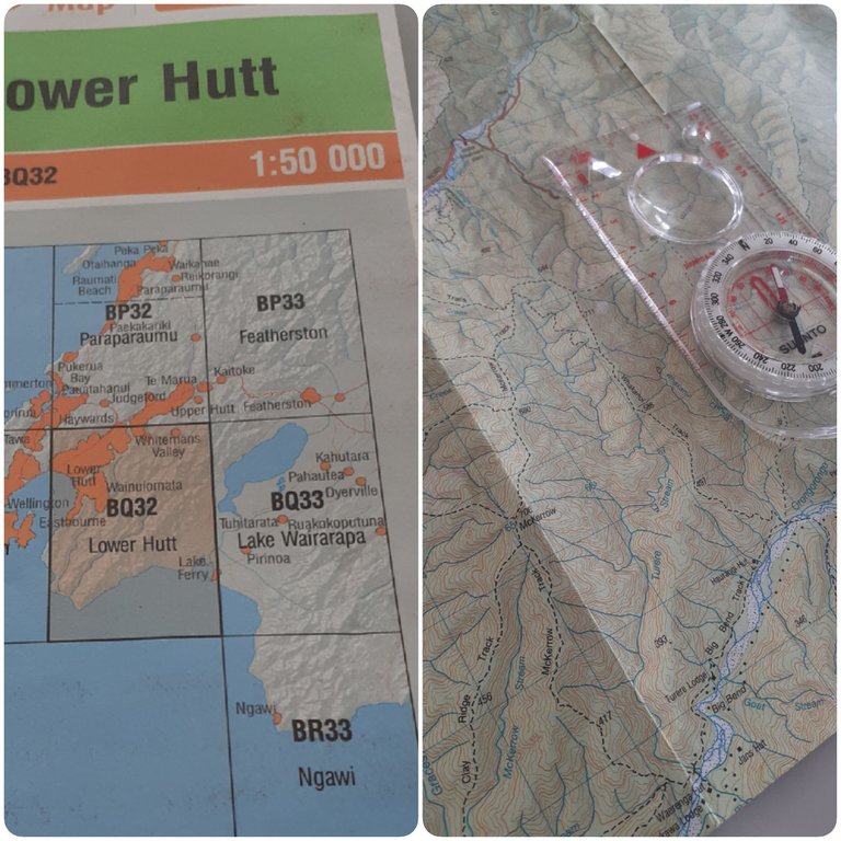
Map and Compass
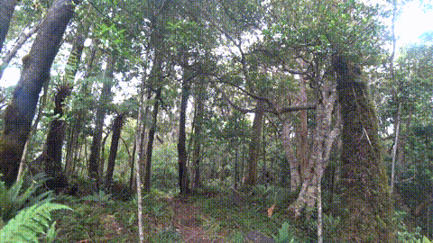
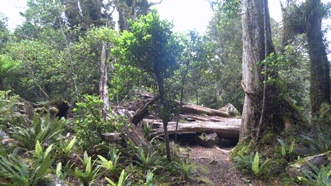
I went to the Orongorongo River on the Whakanui Track, returning on the McKerro Track. Both tracks are 98% under forest and bush canopy, you barely see through to the sky, let alone take a bearing of any significant landmark. The best you can do is read the track and recognize the streams shown on the map to try and pinpoint your location. This is where the App wins hands down.
DOC (Department of Conservation NZ)
Agency charged with conserving New Zealand's natural and historic heritage.
The 2 tracks mentioned above Whakanui & McKerrow are DOC maintained tracks. These tracks are more suited for intermediate/expert hikers/trampers (not family-friendly). There are many tracks in the bush, not all shown on maps. The DOC tracks have orange fluorescent markers which mark the correct path, it's unlikely you get lost. And every year people leave the DOC tracks and get lost, lives have been lost on these tracks.
GPS Tracking and Display produced by the Huawei Band 6 and Samsung Galaxy A10 Phone.
Photos were taken with Samsung Galaxy Phone.

- with every post comes experience, as we all strive to do better.
- curate/up vote, let's encourage/reward and inspire each other.
- as always, thank you for viewing my post.
Congratulations @kiwibloke! You have completed the following achievement on the Hive blockchain and have been rewarded with new badge(s):
Your next target is to reach 13000 upvotes.
You can view your badges on your board and compare yourself to others in the Ranking
If you no longer want to receive notifications, reply to this comment with the word
STOPCheck out the last post from @hivebuzz:
Support the HiveBuzz project. Vote for our proposal!