Cycling & Hiking: What's your favorite navigation app?
Heeeyho Readers! What's your favorite navigation method?
This week's cycling question asks us about our favorite cycling apps or websites. Last time, I wrote about my favorite and most-used app: Strava. It's great for recording our activities and routes, but what if we want to follow new trails? Strava also offers a navigation feature, but there are better options. Let's explore!
Outdoors and more community members may also be interested in this post ^~
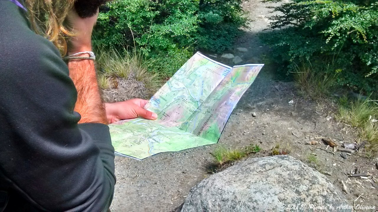
The photo above depicts the best navigation method: a good ole paper map. I didn't have a working cellphone nor a GPS unit during the Patagonian Journey; navigation was purely guided by paper maps. Then, I often got lost for relying on Google Maps while cycling across Europe; low cellphone battery was the main issue. Yes. Electronic devices fail — always when we most need them!
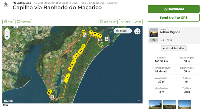
However, since map availability is a pain in the behind round here, I've decided to try Wikiloc as a navigation option to explore new places. Wikiloc works as a social media like Strava, but more focused on sharing trails rather than tracking fitness. It let's us follow routes, upload/create GPX files, record waypoints, and etc. It's essentially a GPS app with fancy social media features.
Most of the cool features (off-line maps, navigation, etc) are premium features, but, considering the price of a Garmin, it's quite a bargain (they don't pay me to advertise the app, don't worry).
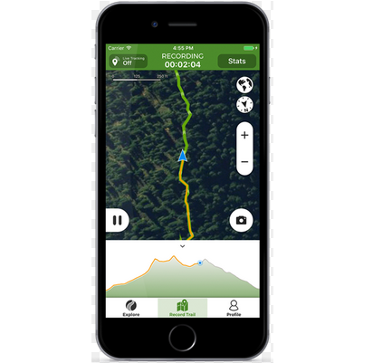
I use Wikiloc mainly to follow previously recorded trails for mountain biking or hiking. It's quite straightforward: upload, hit play and follow. The app will emit alerts if one leaves the route. Well made trails have waypoints showing points of interest — helps a bunch! Another great feature is the Live Streaming, which sends your coordinates to friends and family from time to time.
For me, however, being able to operate off-line is the best option (unfortunately that's a premium service). With off-line mapping I don't risk running low on battery. Super! The app allows us to download just a section of a map, that way also sparing a lot of storage.
Not being a Wikiloc geek, I won't be able to add much more information other than saying that the app is a viable option for those who don't have a Garmin, thus, making Wikiloc my second most-favorite cycling/hiking app.
What's your favorite navigation method?
There are many ways to navigate routes and trails. For me, knowing how to handle a paper map and compass is a crucial skill that everyone should have. However, I'd like to know what the fella Hivers use to avoid getting lost.
Also, what's your favorite cycling apps or websites?
Let me know in the comments.
Peace.
Did you know that I have a book out? Check this!
Access Link: https://www.amazon.com/dp/6500272773?

If you enjoyed this post consider leaving your upvote for a hot coffee.
Find me on Twitter: https://twitter.com/mrprofessor_
~Love ya all,

Disclaimer: The author of this post is a convict broke backpacker, who has travelled more than 10.000 km hitchhiking and more than 5.000 km cycling. Following him may cause severe problems of wanderlust and inquietud. You've been warned.

Congratulations @mrprofessor! You have completed the following achievement on the Hive blockchain And have been rewarded with New badge(s)
Your next target is to reach 600 posts.
You can view your badges on your board and compare yourself to others in the Ranking
If you no longer want to receive notifications, reply to this comment with the word
STOPTo support your work, I also upvoted your post!
Check out our last posts:
That looks like a great app. Good navigation tools are very useful. I didn't know this one. Thanks for sharing!
You can place a link to your post in a reply on the Wat are your favourite cycling apps or websites? blog if you like.
Upvoted by the Cycling Community
Come join the Cycling Community and share your rides, bicycle, maintenance, news or any other cycling related blogs!
You can support the Cycling Community by delegating HP: 25 HP - 50 HP - 100 HP -250 HP - 500 HP
It's really awesome indeed. And its annual fee costs 5% the price of a Garmin, which basically means 20 years of use. I'd still have a real GPS unit though to spare the cellphone's battery.
I would choose paper maps any time, if I had unlimited space to carry like 10 around in my bag😅 (since you would have to change them every few kilometres if you want to keep a detailed map with you)
🤣🤣 I use those road maps still. Funny thing, one day I got mad after my cellphone ran out of battery while cycling in the UK, entered the first convenience store and bought a map. Problem solve to go all the way to Wales.
That's for sure, good old maps you always know what you are at!!😅
This is new to me, haven’t heard of Wikiloc app. I always travel within cities, so google maps are always my means to not get lost. Thank you Arthur for the share.🧭
Google maps is great. Wikiloc is more trail-oriented.