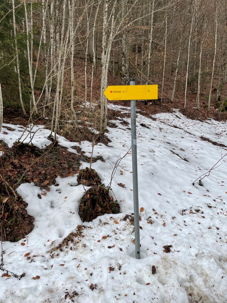
Aufstieg zum Kienbergl
Guten Morgen Steemians, HivePeople und Actifitter,
Auch gestern waren wir wieder unterwegs und haben diesesmal direkt von unserem Ferienhaus aus eine Bergwanderung unternommen.
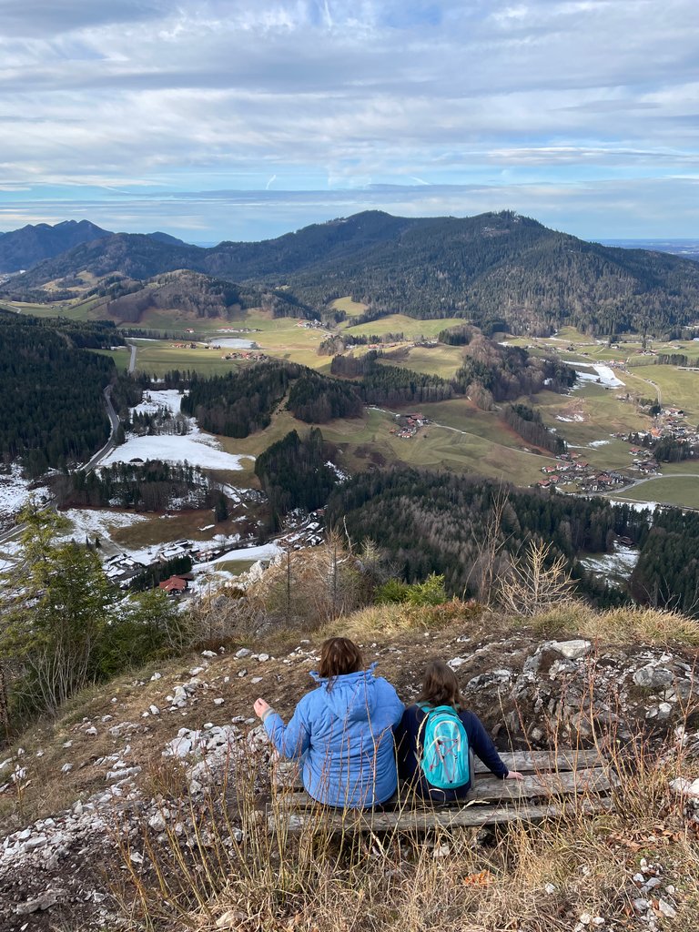
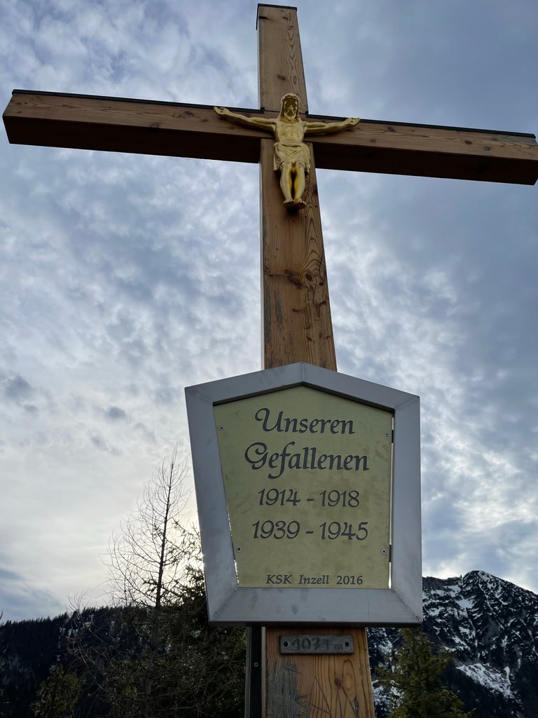
Ziel des Tages war das Gipfelkreuz des Kienberges bei Inzell in einer Höhe von 1071 mNHN. Start war wie gesagt unser Ferienhaus in einer Höhe von ca. 740 mNHN.
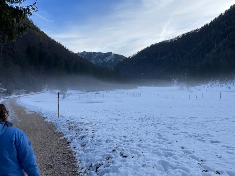
Zu Beginn gab es eine kleine leichte Wanderung über Wanderwege bis zum Spielplatz in Schmelz und dann noch ein Stück um den Kienbergl herum.
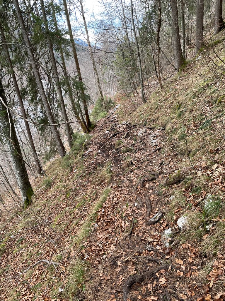
Danach begann der Aufstieg über einen schmalen in Serpentinen verlaufenden Bergpfad über unzählige Wurzeln und Felsstücke. Für den Rund 1,5-stündigen Aufstieg braucht man schon etwas Kondition und vor allem gute Schuhe und Trittsicherheit. Dennoch hat auch unsere 9-jähtige Tochter den kompletten Aufstieg letztendlich geschafft.
Am Gipfelkreuz wird man mit einer tollen Aussicht auf Inzell belohnt.
Überraschenderweise sind wir im Tal bei Temperaturen knapp über 0°C gestartet um am Gipfel dann im T-Shirt herumzuspazieren.
Danke für's lesen, und habt alle noch einen schönen Tag.
Good morning Steemians, HivePeople and Actifitter,
Yesterday we were on the road again and this time we did a mountain hike directly from our vacation home.
The goal of the day was the summit cross of the Kienberg near Inzell at an altitude of 1071 mNHN. Start was as said our vacation home at an altitude of about 740 mNHN.
At the beginning there was a small easy hike over hiking trails to the playground in Schmelz and then a bit around the Kienbergl.
Then began the ascent over a narrow mountain path running in serpentines over countless roots and pieces of rock. For the approximately 1.5-hour climb, you need some stamina and, above all, good shoes and surefootedness. Nevertheless, even our 9-year-old daughter has finally managed the complete ascent.
At the summit cross you are rewarded with a great view of Inzell.
Surprisingly, we started in the valley at temperatures just above 0 ° C to then walk around at the summit in a T-shirt.
Thanks for reading, and have all a nice day.
Translated with www.DeepL.com/Translator (free version)
This report was published via Actifit app (Android | iOS). Check out the original version here on actifit.io


Congrats on providing Proof of Activity via your Actifit report!
You have been rewarded 60.4025 AFIT tokens for your effort in reaching 12446 activity, as well as your user rank and report quality!
You also received a 0.89% upvote via @actifit account.
Actifit rewards and upvotes are based on your:
To improve your user rank, delegate more, pile up more AFIT and AFITX tokens, and post more.
To improve your post score, get to the max activity count, work on improving your post content, improve your user rank, engage with the community to get more upvotes and quality comments.
Actifit is a Hive Witness. If you believe in our project, consider voting for us
Chat with us on discord | Visit our website
Download on playstore | Download on app store
FAQs | Text Tutorial | Video Tutorial
Sieht nach einer schönen Wander Tour aus.
Dear @ynwa.andree,
Your support for our previous proposal has been much appreciated but it expired end of December!
Do you mind renewing your vote to our proposal for 2022 so our team can continue its work!
You can do it on Peakd, ecency, Hive.blog or using HiveSigner.
https://peakd.com/me/proposals/199
We wish you a Happy New Year!