PicsOnBike Day: Passo delle Prade (ENG)
(Edited)
Hello Guys!
Last Saturday I decided to venture into a new PicsOnBike Day, this time to Passo delle Prade. I started from home in the morning, I followed the Via Aurelia to Dogana di Ortonovo. Here I entered more inside, always in Sarzana direction.
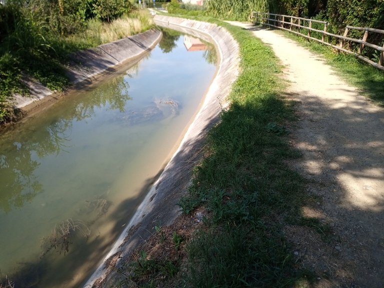
At the height of Canalie I came across a dirt path that I discovered to be a bike lane; it skirts a narrow ditch where the rather low water level has not scared the fishes, on the contrary quite numerous. I followed this route for a few hundred meters: in some points was really not larger than a mountain path and it is located between the reeds in addition to regularly stretches of asphalt where it crosses the city streets.
I took the Via Aurelia near Caniparola and followed it to the entrance of the municipal area of Sarzana; here it is necessary to cycle the outer perimeter of Sarzana, moving upstream and entering a road from which it will be impossible to go wrong.
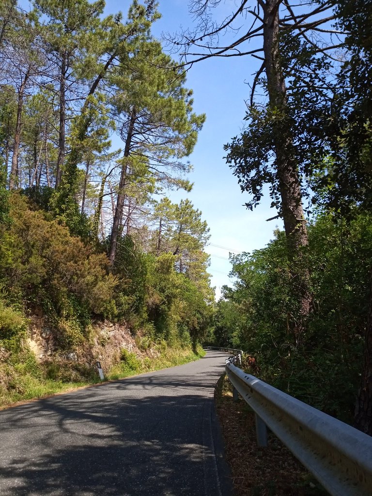
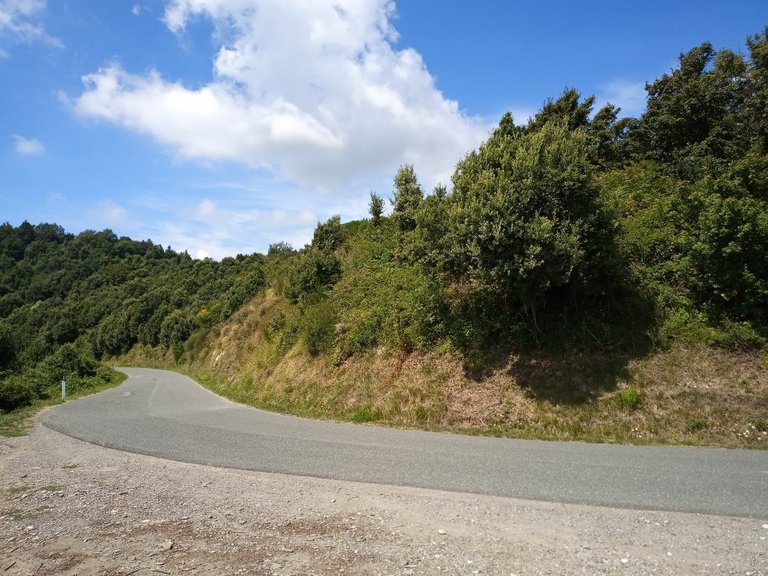
Now: here the climb begins, about 9 kilometers with an average gradient of 6-7% and peaks never again 10.
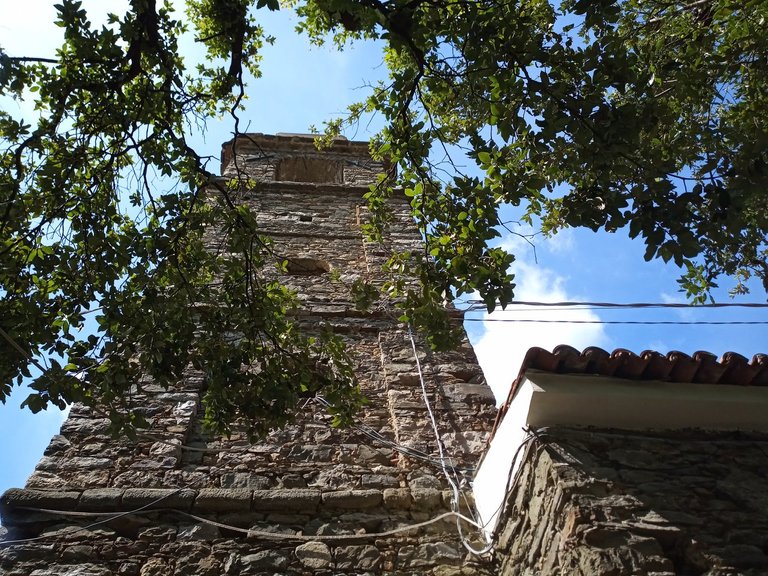
The first town that I met is Carignano: I took in a shot the village church.
2 kilometers further on I met Canepari, the name by which the old cyclists renamed the entire climb.
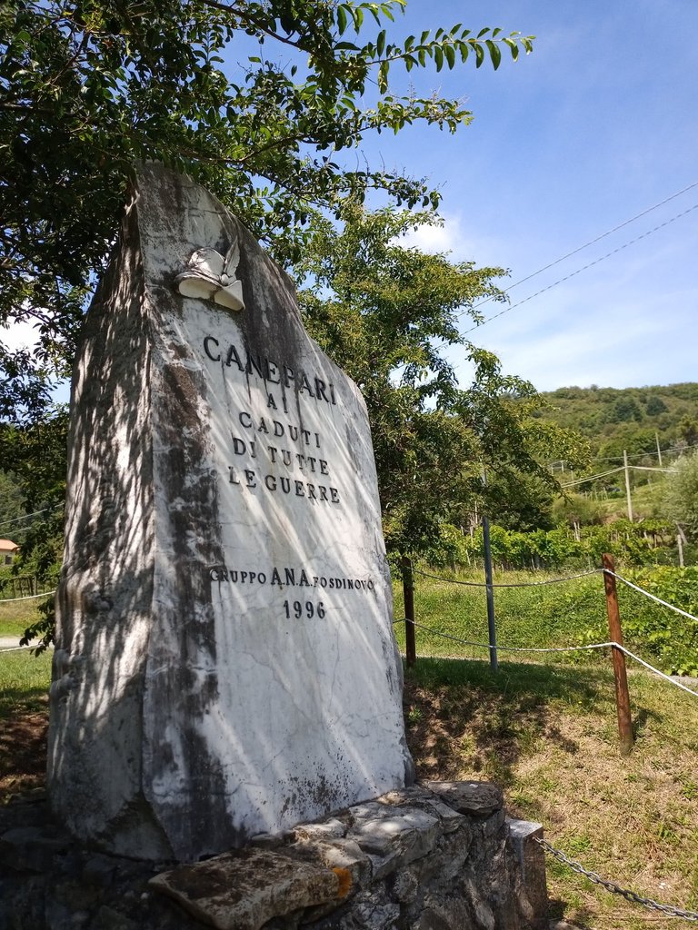
I stopped to take a drink of water and I immortalized the War Memorial Monument located right next to the church. I discovered that in this town some 2-3 days fests are organized, such as the Festa della Torta (Cake Festival) or the Chestnuts Days - the latter programmed for the october month.
I started again with the hope that the hill had reached the finish line: in reality there was still a pedaled section and four curves with slopes at 6-7%, then the road finally became flatter. From here begins a stretch of slight slope and plan that will last for a few kilometers; on the left I saw a dirt road that I decided to follow. I got off the bike because in more than one point the road was impractical, especially at the speed with which I made the ascent.
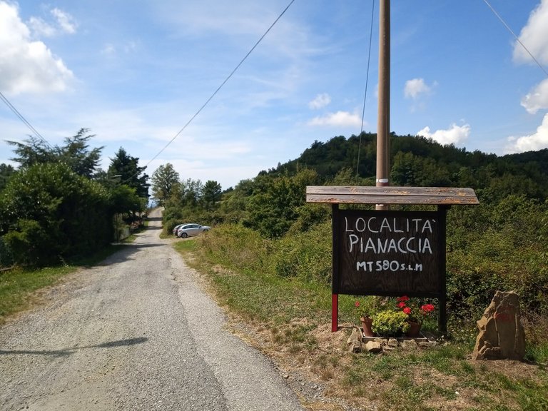
From the dirt road I reached Pianaccia, in 580 mslm, where the road continues towards Aulla, crossing first Vecchietto's quarries zone and then reaching Bibola.
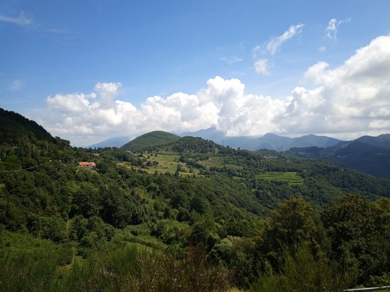
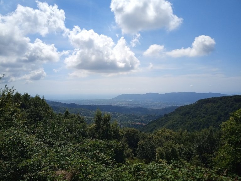
I resumed my steps, I followed the first part of the false-plan I was talking about. The landscape before rich in trees here has become more agricultural, with some lawns and open spaces, although the altitude still had nothing to do with the Apennines and Alps around.
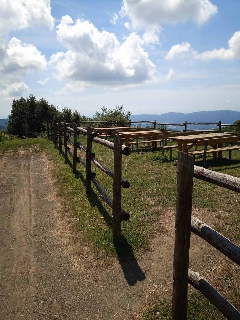
Thank you to European Funds, in the last years a rest area was created composed of wood tables and wooden benches: here I stopped to have lunch.
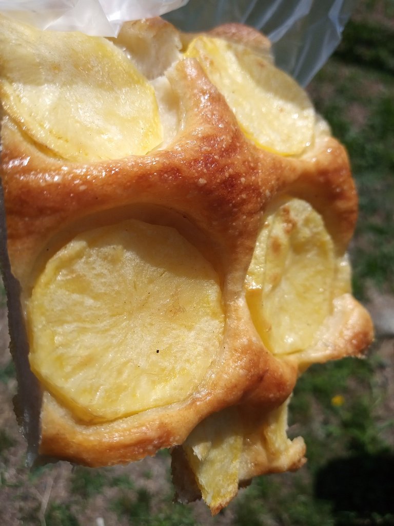
Focaccia with potatoes purchased from a bakery in my area ... delicacy.
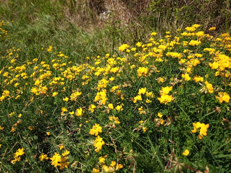
I walked for a few meters taking some pictures of the place..
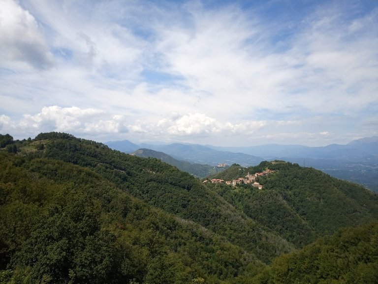
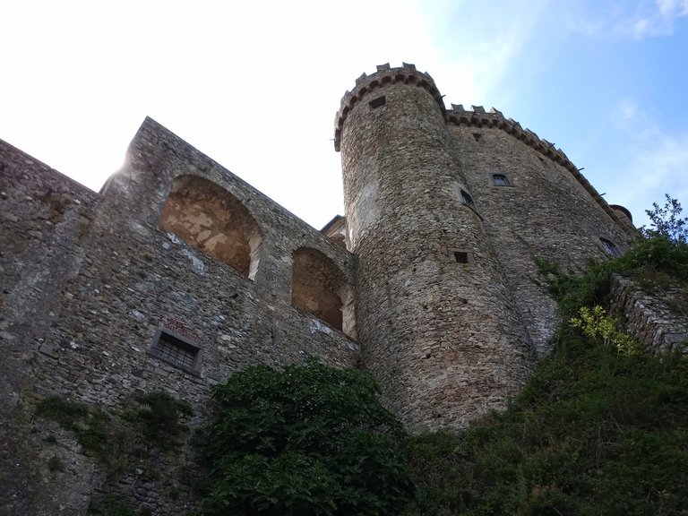
The Passo delle Prade link Sarzana - from which I arrived -, the Passo del Cucco - of which I will say something soon - and Pallerone; going down towards Pallerone it is possible to meet Ponzanello, a village famous for the ruins of the XII century castle where the Lords of Luni lived; the Ruins of Castrum Ponzanello rise from the hill and are clearly visible from the Passo delle Prade.
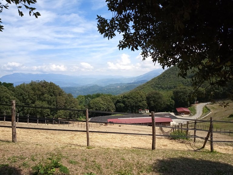
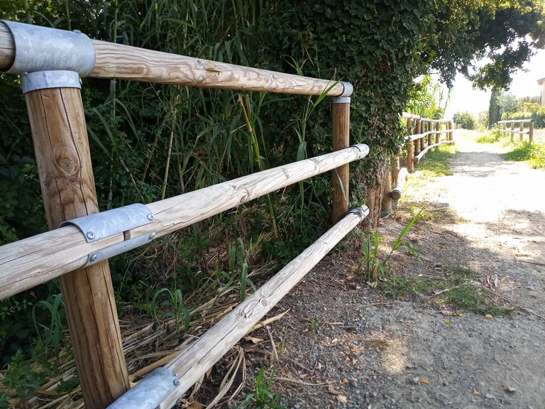
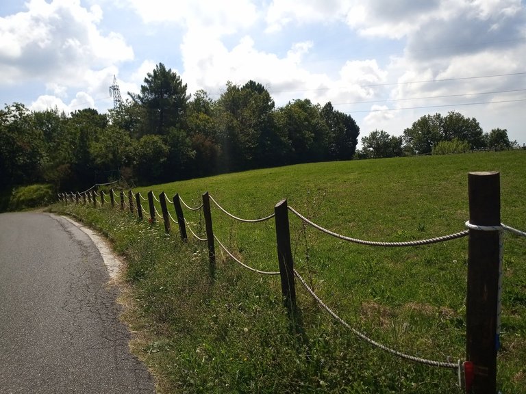
A little further on I met a big series of fences discovering an area dedicated to horses and various activities connected to them: horse riding, adventure park, trekking and various others.
The only bad thing about this Passo is water; from what I've seen, here is scarce; lucky that I met a fountain on the parts of Tendola. I then reached the Passo del Cucco which connects Fosdinovo and the Sarzana area - on one side - S.Terenzo, Canova and the Lunigiana area - on the other. Tendola is the first town that descends towards S. Terenzo and immediately before arriving there is a fountain of running water hidden under the road. Then I went back towards Fosdinovo and stopped for a few minutes away from the sun.
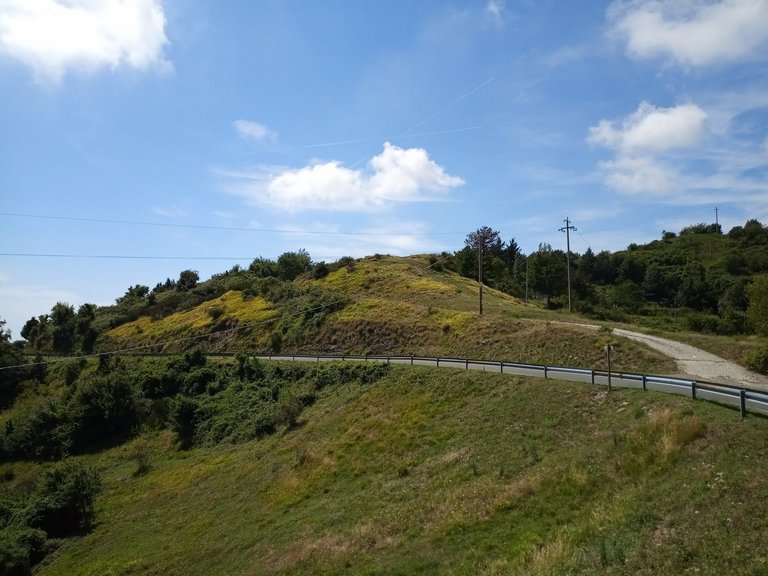
The heat was felt, specially because it was 14.30 about. Just last Saturday was organized to junior category cycling race but, thanks to the warm and the 1.30 am abundant time and that I would have to wait before the arrive, I decided to back to home, going down from the side of Carrara instead of Sarzana : above Fosdinovo is in fact the road to Spolverina locality that the cyclists indicated such a Passo because after having climbed at 690 meters above the sea level it is possible to reach Carrara - towards which I continued -, Vallecchia and Castelnuovo Magra or Fosdinovo - from where I arrived.
I returned home with a distance of 65 kilometers for 6 hours in total; one day, when I cycled better, I usually spent about 2.30 hours of training, but 2 would be enough for cyclists who want to push a little.
In short, this is a route that is definitely recommended for cyclists and bycicle-tourist looking for a day of leisure.
Next Time!
This article was entirely made using photos taken with my smartphone.
View this post on TravelFeed for the best experience.
0
0
0.000
Congratulations, Your Post Has Been Added To The Steemit Worldmap!
Author link: http://steemitworldmap.com?author=davidesimoncini
Post link: http://steemitworldmap.com?post=picsonbike-day-passo-delle-prade-eng
Want to have your post on the map too?
Congratulations! Your high-quality travel content was selected by @travelfeed curator @for91days and earned you a partial upvote. We love your hard work and hope to encourage you to continue to publish strong travel-related content.
Thank you for being part of the TravelFeed community!
Thanks for posting through TravelFeed.io! You have received a larger upvote from us. We hope to see you soon on TravelFeed.io!
Posting through TravelFeed.io also makes your post eligible to participate in the travel writing contest by @invisusmundi where you can earn up to 100 STEEM! Read the contest announcement for more information on how to participate.
We are continuously working on improving TravelFeed, recently we relaunched our map and reinvented the profile introducing collectible badges and a scratch-off-map of your visited countries and posts.
Learn more about TravelFeed by clicking on the banner above and join our community on Discord.
Your post has been curated by

PhotoStreem!!DISCORD
Hiya, @LivingUKTaiwan here, just swinging by to let you know that this post made into our Honorable Mentions in Daily Travel Digest #605.

Your post has been manually curated by the @steemitworldmap team. If you like what we're doing, please drop by to check out all the rest of today's great posts and consider upvoting and supporting us.
Thank you for your contribution to the crowd. We are the Steem community project dedicated to empowering The Wisdom of Crowds. You can find more about us on our official website or whitepaper and you can support us by voting for our witness and joining our curation trail on Steemauto . We are also inviting you to join Crowdmind Discord server. Don't forget to use the #crowdmind hashtag and happy crowdsourcing!
Manually curated by PhotoStreem: The Photography Tribe
Join Photostreem DISCORD
Follow the Trail