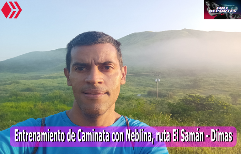
Entrenamiento de Caminata con Neblina , ruta El Samán [ESP/ENG]
Greetings friends of Hive and the community @fulldeportes, today I will share with you my training walk that I did today Friday, on the route El Samán - Dimas, in the community of Villa de Cura, Zamora municipality, Aragua state, Venezuela.
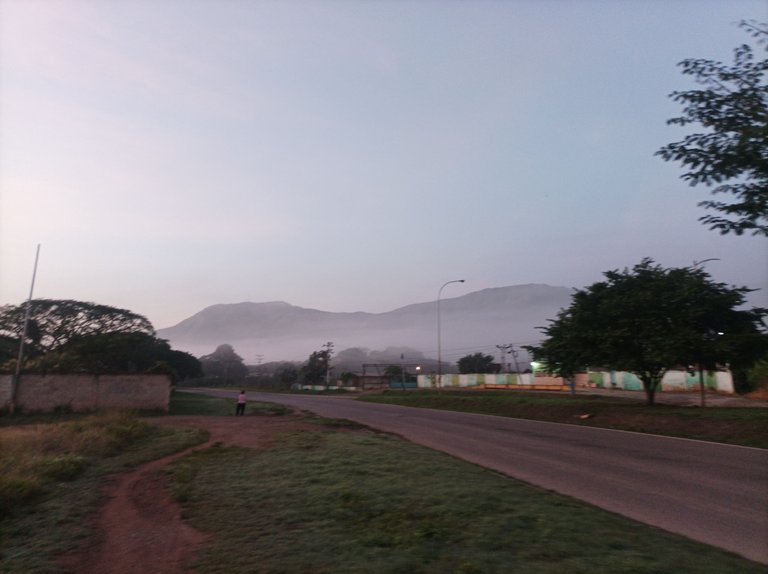
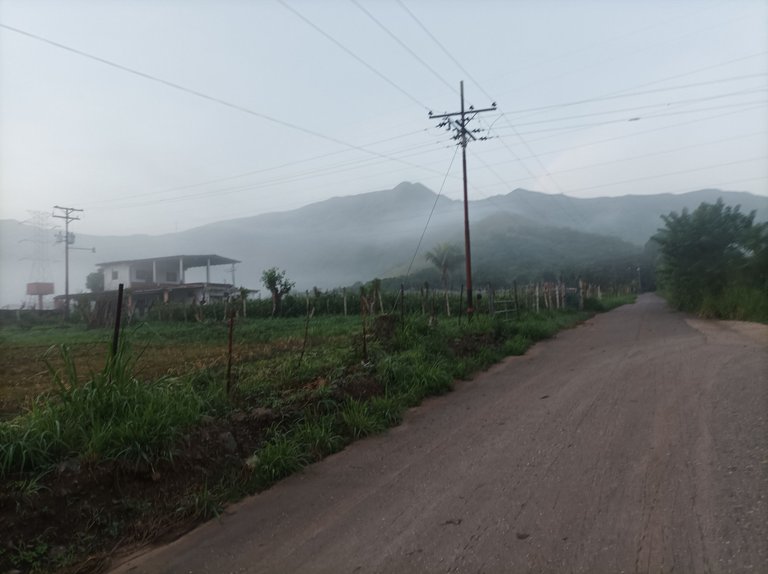
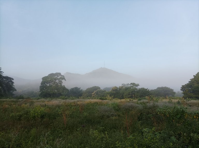
En este entrenamiento la temperatura estuvo a 21 grados, con un poco de frio y neblina en la montaña, saliendo a la 6:00 am, a esta hora estaba un poco oscuro, y pensé subir el cerro, pero entonces decidí mejor realizar el recorrido del EL Samán – Dimas. Activando la aplicación Adidas Running, cuando pase el primer kilómetro, la aplicación me indico con un sonido de voz que había alcanzado el kilómetro 1, cada vez que voy pasando por cada kilometro me indica el tiempo, el kilometraje, la velocidad por kilómetros y la cantidad de calorías consumidas en el entrenamiento.
In this training the temperature was 21 degrees, with a little cold and fog in the mountain, leaving at 6:00 am, at this time it was a little dark, and I thought to climb the hill, but then I decided better to make the route of El Samán - Dimas. Activating the Adidas Running application, when I passed the first kilometer, the application indicated me with a voice sound that I had reached kilometer 1, every time I go through each kilometer tells me the time, mileage, speed per kilometer and the amount of calories burned in training.
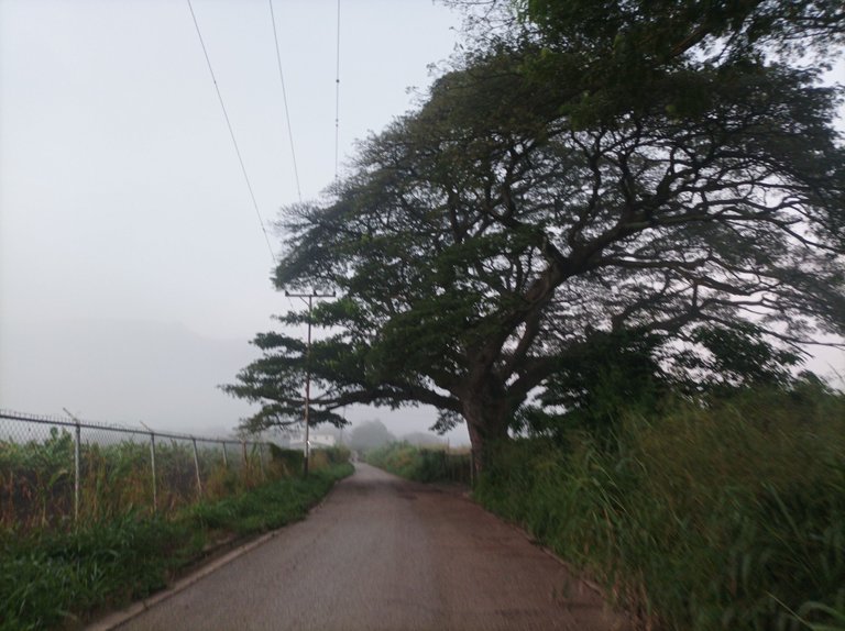

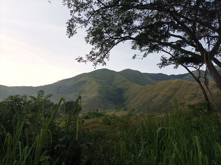
Para llegar a este asentamiento campesino, vamos caminando por toda la avenida Lisandro Hernández, que es la vía principal , cuando llegue al monumento de Ezequiel Zamora, mi reloj marcó 19 minutos, con 2 km, es decir 9 minutos por kilometraje, luego aumento el ritmo para ver si lograba bajar de 9 minutos, cuando llegue a la entrada del asentamiento campesino llevaba 26 minutos con 50 segundos, se veía un poco de neblina en el recorrido, me gusta mucho cuando se siente el frio, por eso es que generalmente hago esta ruta a tempranas horas, para disfrutar de la temperatura.
To reach this peasant settlement, we walk along the entire Lisandro Hernandez Avenue, which is the main road, when I arrived at the monument of Ezequiel Zamora, my watch marked 19 minutes, with 2 km, ie 9 minutes per mile, then increase the pace to see if I managed to get below 9 minutes, When I arrived at the entrance of the peasant settlement I had 26 minutes and 50 seconds, there was a little fog on the route, I really like when you feel the cold, that's why I usually do this route in the early hours, to enjoy the temperature.
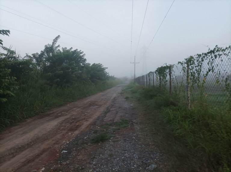
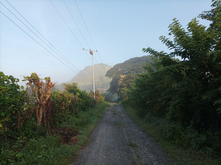
Cabe destacar, que esta ruta, es muy buena para las personas que están iniciando en los entrenamientos, ya que no está fuerte como subir la montaña, luego de pasar la dos primeras rectas, me desvíe la parte donde está el sector Dimas, con una distancia de 3 K, luego continué avanzando hasta el final, donde se encuentra una hacienda, con un tiempo de 48 minutos y una distancia de 5 Km, me detuve unos segundos para hidratarme y tomar algunas fotografías de la montaña que está alrededor de la carretera.
It should be noted that this route is very good for people who are starting in training, as it is not strong as climbing the mountain, after passing the first two straights, I deviated the part where is the Dimas sector, with a distance of 3 K, then continued to move forward until the end, where there is a farm, with a time of 48 minutes and a distance of 5 km, I stopped for a few seconds to hydrate and take some pictures of the mountain that is around the road.
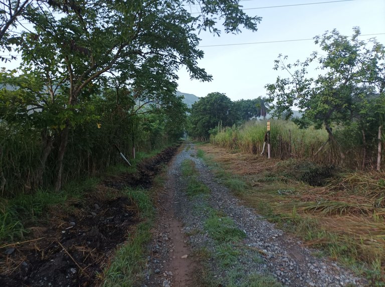

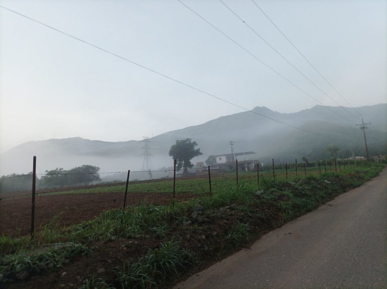
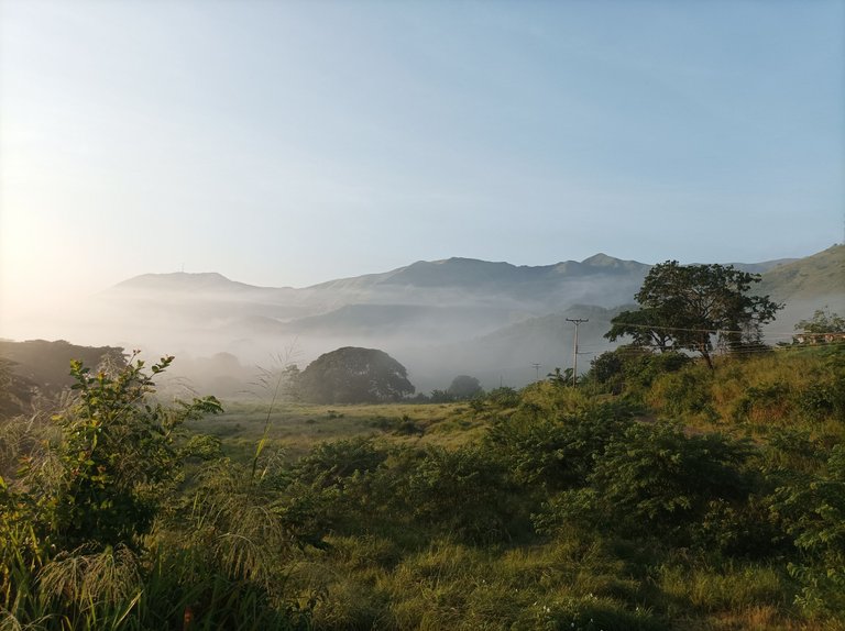
Esta ruta tiene como características que accedemos por la avenida Lisandro Hernández y luego salimos por el sector Santa Eduvigis, para pasar por La Represa y llegar al centro de la comunidad. Es una ruta donde podemos encontrar tres subidas pero que no son muy fuertes, la que es más exigente es la que se encuentra después de llegar al Samán de unos 300 metros. En algunas haciendas podemos observar siembras de maíz que se dan mucho debido a la lluvia que favoreció este tiempo de rubro.
This route has as characteristics that we access through Lisandro Hernández Avenue and then we leave through the Santa Eduvigis sector, to pass through La Represa and reach the center of the community. It is a route where we can find three climbs but they are not very strong, the one that is more demanding is the one that is after arriving to the Samán of about 300 meters. In some farms we can observe corn crops that are given a lot due to the rain that favored this time of the year.
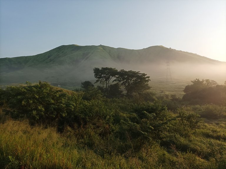
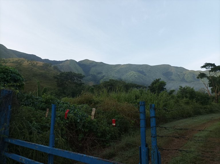
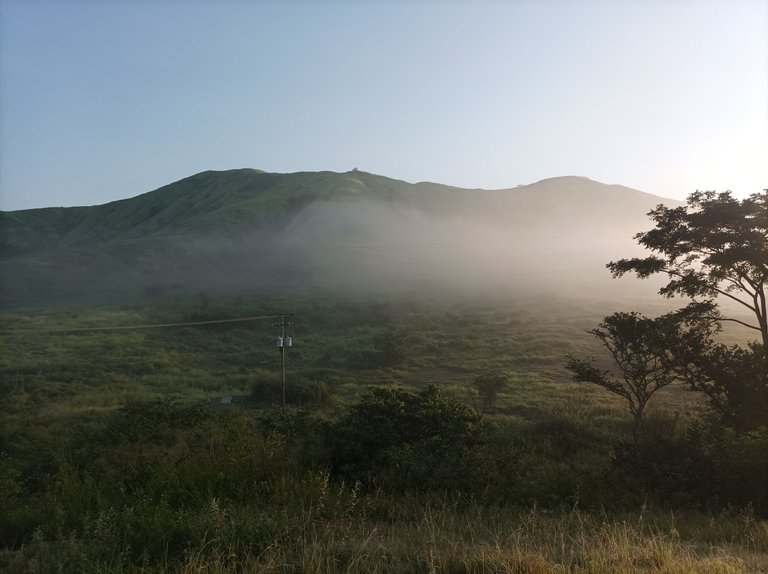
Después de retorne, rumbo al Samán, que son 3 kilómetros de distancia, con un tiempo de 1 hora 4 minutos, la neblina se sintió más que todo en la parte baja, cuando llegue a la parte alta, había solamente en la montaña. Luego pase frente a la montaña cubierta de Neblina, al llegar al Samán, comienzo a ascender en esta pequeña subida, luego lo que viene es pura bajada, en este recorrió me conseguí con un amigo corredor que también estaba entrenando.
After returning, heading to the Samán, which are 3 kilometers away, with a time of 1 hour 4 minutes, the fog was felt mostly in the lower part, when I reached the top, there was only on the mountain. Then I passed in front of the mountain covered with fog, when I arrived to the Samán, I begin to ascend in this small climb, then what comes is pure downhill, in this tour I got with a friend runner who was also training.
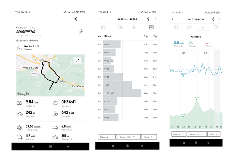
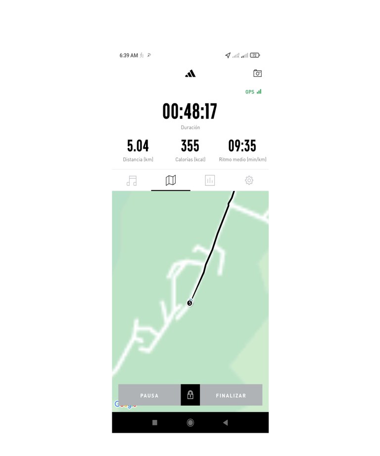
Finalice mi entrenamiento con un tiempo de 1 hora con 34 minutos, 41 segundos, 9 km y 540 metros, gastando 642 calorías, a un ritmo promedio de 9 minutos con 55 segundos, registro tomado de la aplicación Adidas Running.
I finished my training with a time of 1 hour 34 minutes, 41 seconds, 9 km and 540 meters, spending 642 calories, at an average pace of 9 minutes and 55 seconds, record taken from the Adidas Running app.
Fotografías: Teléfono Redmi Note 10
Portada realizada en Inkscape
Logos utilizados de Hive y @fulldeportes
Traductor utilizado: https://www.deepl.com
Aplicación Utilizada: adidas Running
Photos: Redmi Note 10 Phone
Cover made in Inkscape
Logos used: Hive and @fulldeportes
Used Translator: https://www.deepl.com
Used Application: adidas Running

Me encantó cómo has detallado bien la ruta amigo, y que explicaras que es excelente para empezar a entrenar en trekking y caminatas. Qué hermoso que tengas esta constancia!!
Que bueno amiga, muchas gracias por tu comentario, saludos y un abrazo.
Que espectáculo hacer ejercicios no solo rodeado de ese bello paisaje mi hermano, si no de esa neblina, no imagino el frío y luego saliendo el sol, guao todo un espectáculo sin lugar a dudas @cetb2008 🙌🙌🙌
Saludos, se siente un poco de frío y rindes mucho más al hacer ejercicios, gracias por tu comentario.
https://leofinance.io/threads/cetb2008/re-leothreads-2nnkpmap5
The rewards earned on this comment will go directly to the people ( cetb2008 ) sharing the post on LeoThreads,LikeTu,dBuzz.
Tu constancia y entrenamiento por estos caminos mostrando el paisaje son espectaculares, te felicito por la voluntad y dedicación a esta practica deportiva, un abrazo!
Hola, muchas gracias.