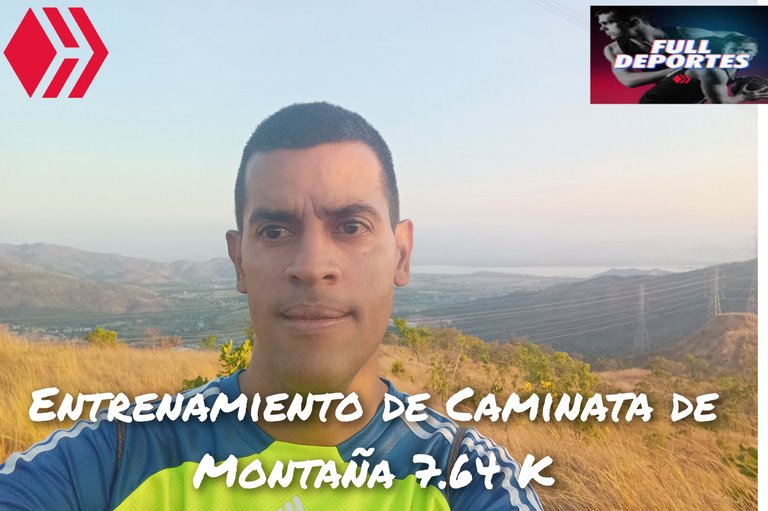
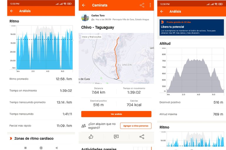
Entrenamiento de Caminata de Montaña 7.64 K
Greetings friends of Hive and @fulldeportes, today I am going to share with you my mountain walking training from today, Wednesday, on the Los Chivos - Taguaguay Samán route, in the community of Villa de Cura, Aragua state, Venezuela.
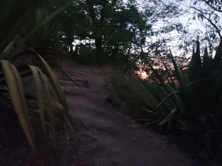
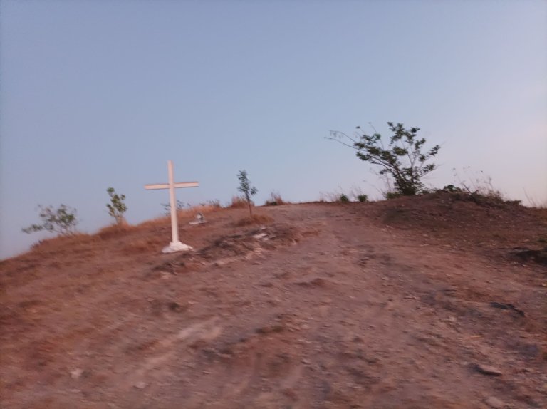
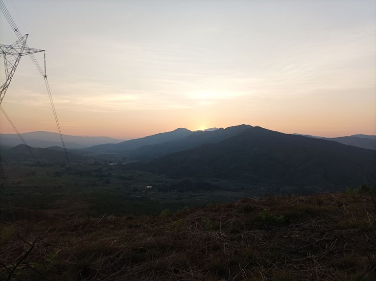
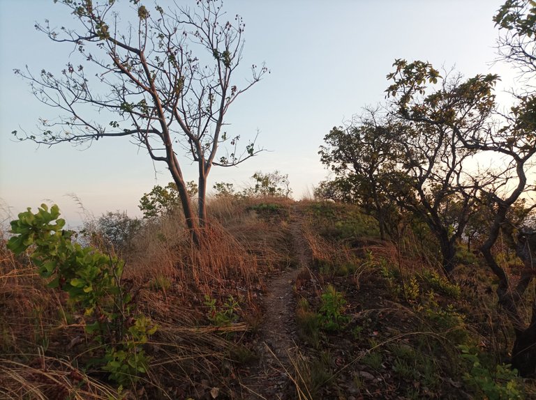
Cabe destacar que no entrenaba desde el día domingo, es decir descanse dos días, y ahora lo estoy realizando generalmente en la mañana porque en las tardes el calor está un poco fuerte. Este entrenamiento lo inicie a la 6:09 am porque más temprano está demasiado oscuro, activando la aplicación Strava para registrar el entrenamiento, salí a un ritmo suave, por toda la avenida Lisandro Hernández y comencé a subir la montaña, llevando un tiempo de 10 minutos en la primera pendiente dónde está la cruz.
It should be noted that I had not trained since Sunday, that is, I rested for two days, and now I am generally doing it in the morning because in the afternoons the heat is a bit strong. I started this training at 6:09 am because earlier it is too dark, activating the Strava application to record the training, I left at an easy pace, along Lisandro Hernández Avenue and began to climb the mountain, taking a time of 10 minutes on the first slope where the cross is.
Después seguí avanzando pasando la segunda subida y pude ver cuatro personas que iba adelante caminando, aumente ritmo en la segunda subida y logré alcanzar a una pareja en la parte baja de la tercera pendiente, los saludé y continúe mi recorrido, pero no pude alcanzar a los otros dos, porque me llevaban mucha ventaja, luego llegué a dónde están las máquinas y mi reloj registro un tiempo de 20 minutos.
Afterwards I continued advancing past the second climb and I could see four people walking ahead, I increased my pace on the second climb and managed to catch up with a couple at the bottom of the third slope, I greeted them and continued my journey, but I couldn't catch up with them. the other two, because they were so far ahead of me, then I got to where the machines are and my watch recorded a time of 20 minutes.
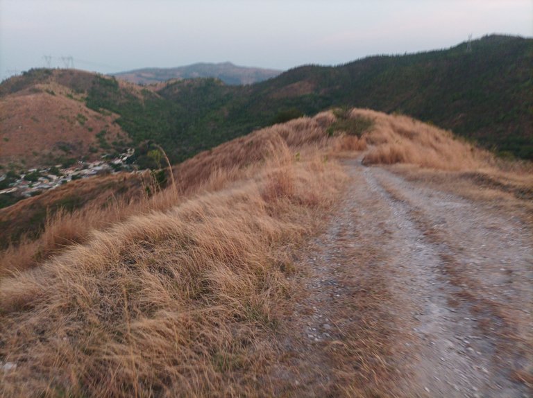
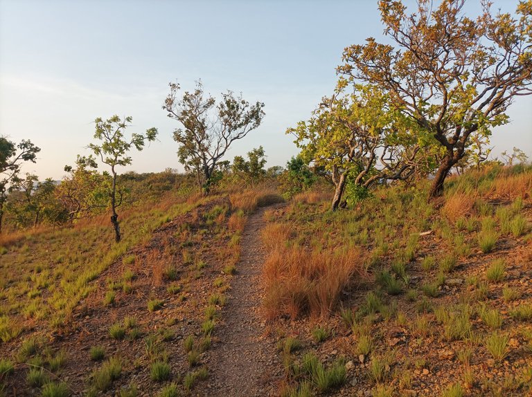
Asimismo saludé a los dos jóvenes que estaban haciendo ejercicios, después comencé a descender para llegar al sector Las Mercedes, con un tiempo de 26 minutos, y nuevamente mantengo el ritmo para subir nuevamente, esta es más larga pero menos empinada, llegando a la cima de esta cuarta subida con un tiempo de 34 minutos.
I also greeted the two young people who were doing exercises, then I began to descend to reach the Las Mercedes sector, with a time of 26 minutes, and again I maintain the pace to climb again, this is longer but less steep, reaching the top of this fourth climb with a time of 34 minutes.
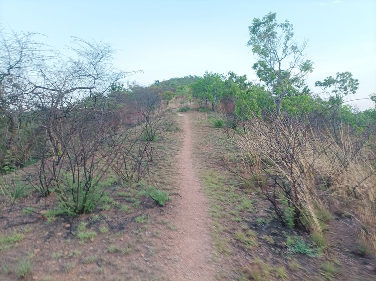
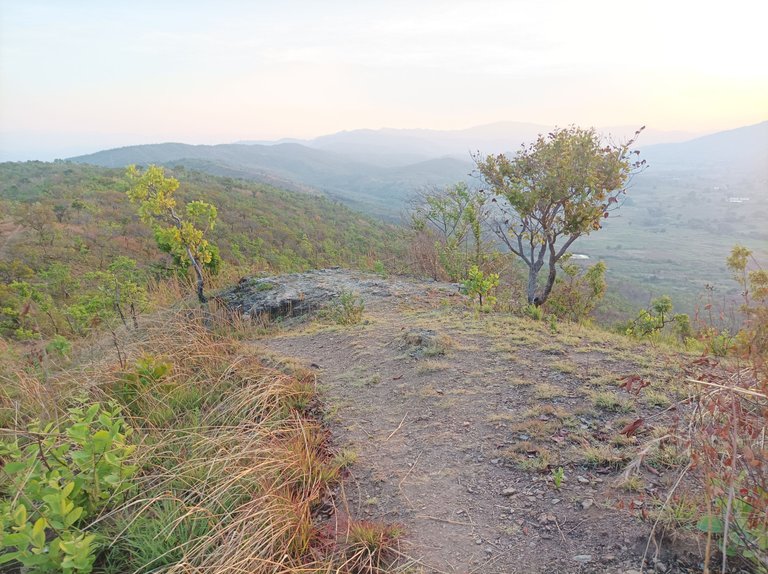
Luego seguí caminando, algunos arbustos están verdes y otros secos, con un clima fresco, pasando por Las Torres y después llegué La Piedra con un tiempo de 40 minutos, en este entrenamiento estuve pensando hacer una nueva ruta pasando por la hacienda El Ancon, tengo que explorar para ver por donde está el camino, porque recuerdo que lo hice una vez en una competencia.
Then I continued walking, some bushes are green and others are dry, with a cool climate, passing through Las Torres and then I arrived at La Piedra with a time of 40 minutes, in this training I was thinking about doing a new route passing through the El Ancon hacienda, I have I have to explore to see where the path is, because I remember I did it once in a competition.
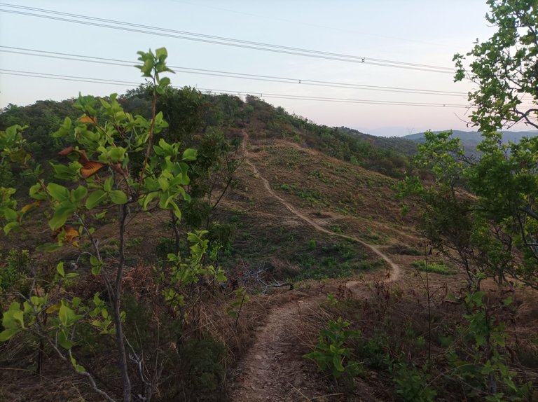
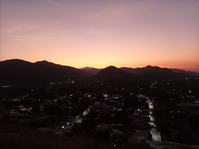
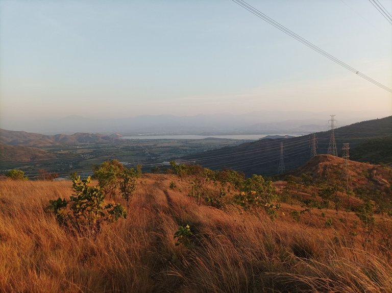
Al llegar al frente donde podemos ver la laguna de Taguaguay, que pertenece al municipio Sucre, con una distancia de 3.86 K y un tiempo de 52 minutos, me detuve para tomar una fotografía y también para hidratarme. Aquí se encuentra un torre eléctrica que se siente como fluye la corriente eléctrica, después me devolví a un ritmo suave.
Upon reaching the front where we can see the Taguaguay lagoon, which belongs to the Sucre municipality, with a distance of 3.86 K and a time of 52 minutes, I stopped to take a photograph and also to hydrate. Here is an electric tower that feels like the electric current flows, then I returned to a gentle rhythm.
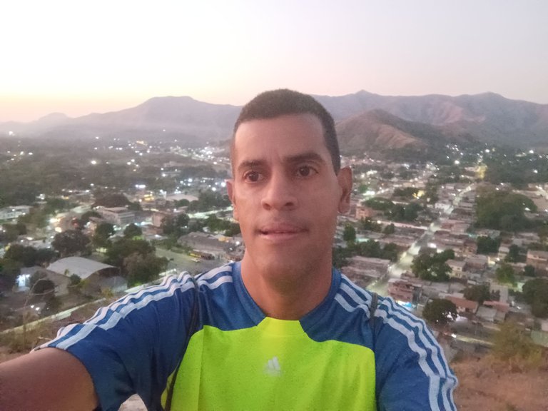
De regreso es prácticamente pura bajada, pero cuando llego al sector de Las Mercedes, se encuentra una pendiente de 200 metros para entonces continuar el recorrido a donde están las máquinas de hacer ejercicios con un tiempo de 1 hora 25 minutos y una distancia de 6.43K, seguí bajando hasta finalmente salir totalmente de la montaña y llegar a la avenida Lisandro Hernández con un tiempo final de 1 hora 41 minutos y una distancia de 7.64 K registrado en la aplicación Strava.
On the way back it is practically a pure descent, but when I arrive at the Las Mercedes sector, there is a slope of 200 meters and then I continue the route to where the exercise machines are with a time of 1 hour 25 minutes and a distance of 6.43K , I continued going down until finally leaving the mountain completely and reaching Lisandro Hernández Avenue with a final time of 1 hour 41 minutes and a distance of 7.64 K recorded in the Strava application.
Espero que le haya gustado este entrenamiento, nos vemos en el próximo.
I hope you liked this training, see you in the next one.
Fotografías: Teléfono Redmi Note 10
Portada realizada en APP GridArt
Logos utilizados de Hive y de fulldeportes
Traductor utilizado: Traductor de Google
Photos: Redmi Note 10 Phone
Cover made in The APP GridArte
Used logos of Hive and fulldeportes
Translator used: Translator used: Google Translate

Vote la-colmena for witness By @ylich

Fabulosas esas caminatas de montañas que siempre nos muestras por acá en la comunidad.
Saludos amigo, gracias por tu comentario.
Excelente recorrido de montaña, sigamos sumando más kilómetros de vida con estos recorridos geniales, junto a la naturaleza, saludos 🤗😘
Muy buen recorrido, con una hermoda vidta que te motiva en cada paso que das. Sin dudas el horario de la mañana es el mejor para realizar caminatas 🤗
Amigo, 7,64 kilómetros! Pero qué maravilla! Encima súper el tiempo! La verdad que para ser en montaña, te digo que re linda velocidad!
Siempre la bajada es el alivio para todos los trekkings, jeje
Muy buen recorrido mi amigo, de verdad que tu condición ya es de pasada. Seguramente en plano unos 10km sería pan comido para ti.